Using Probability of Severe to help issue Warnings

mrms with prob severe warnings

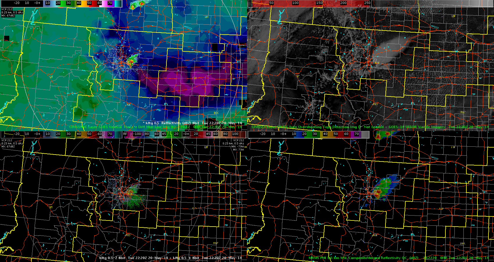
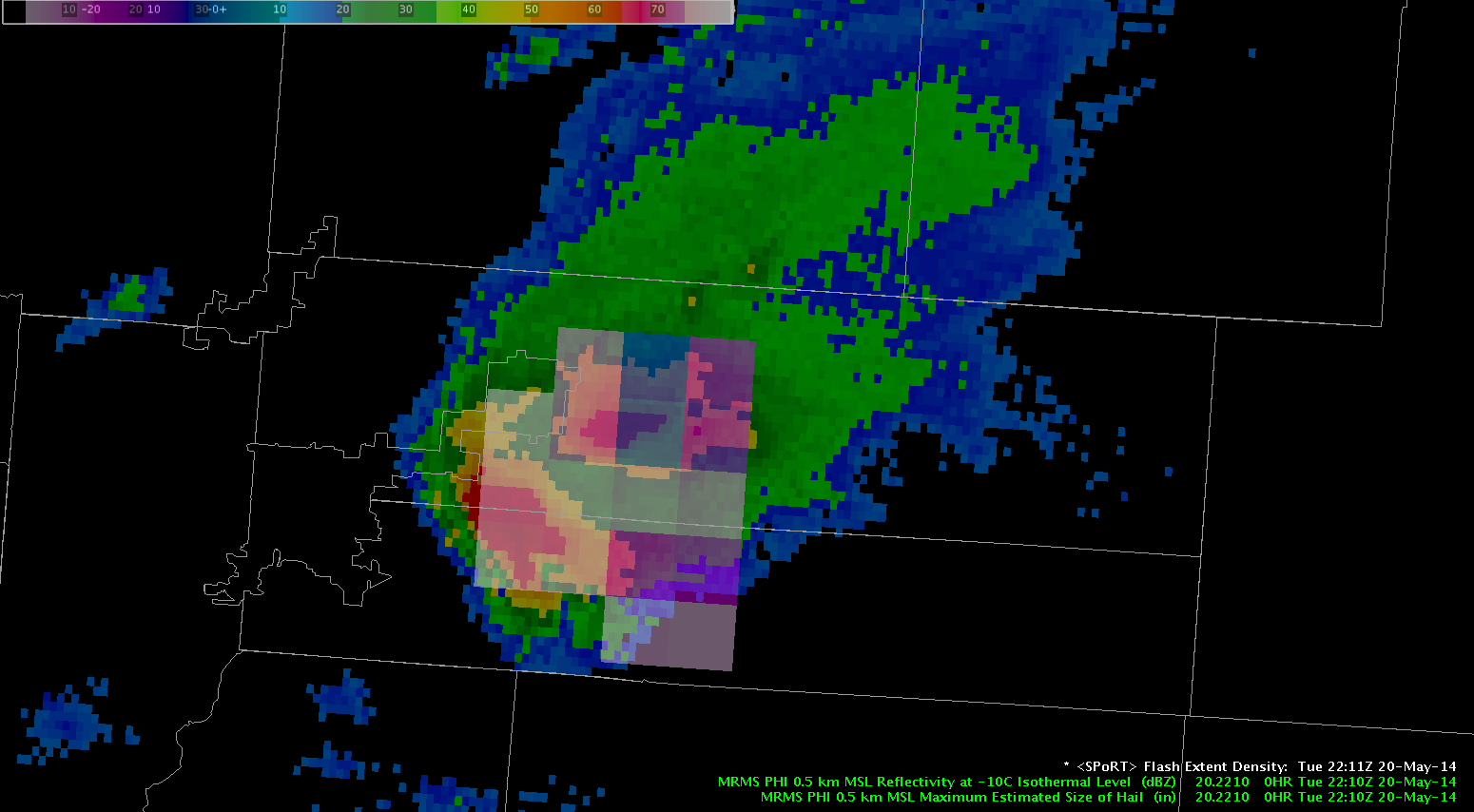
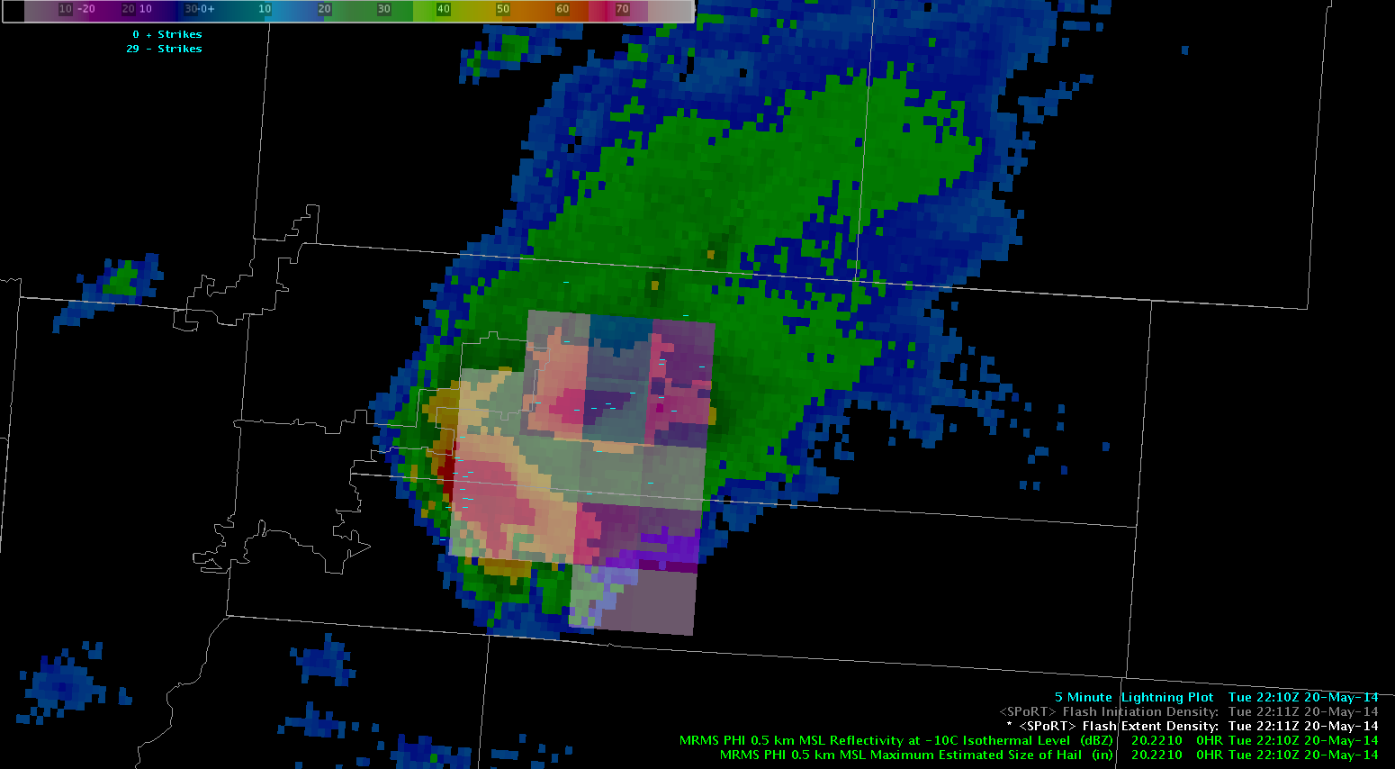
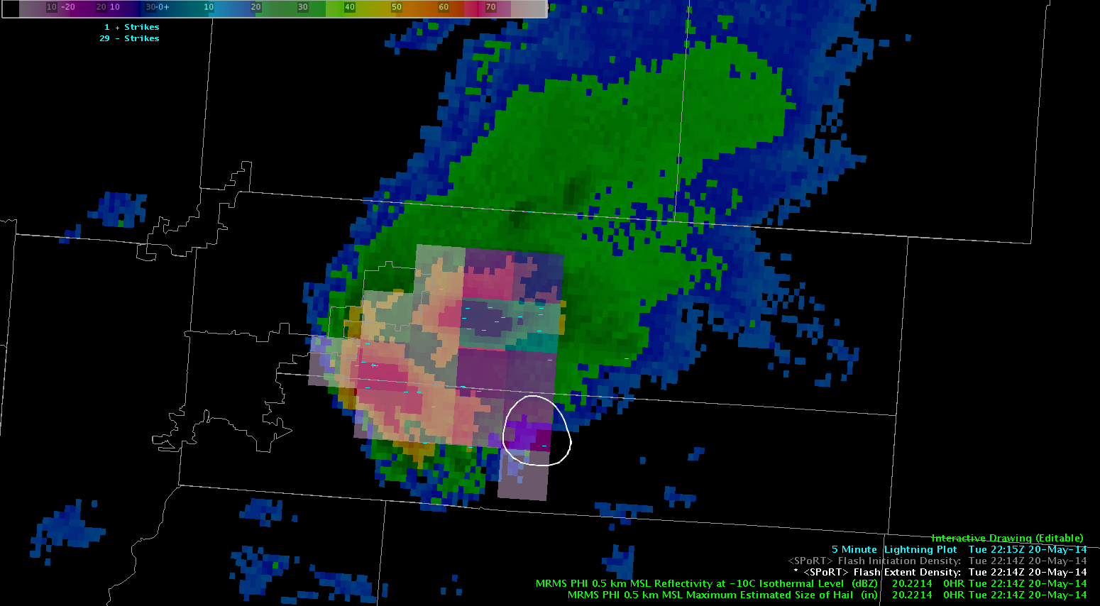
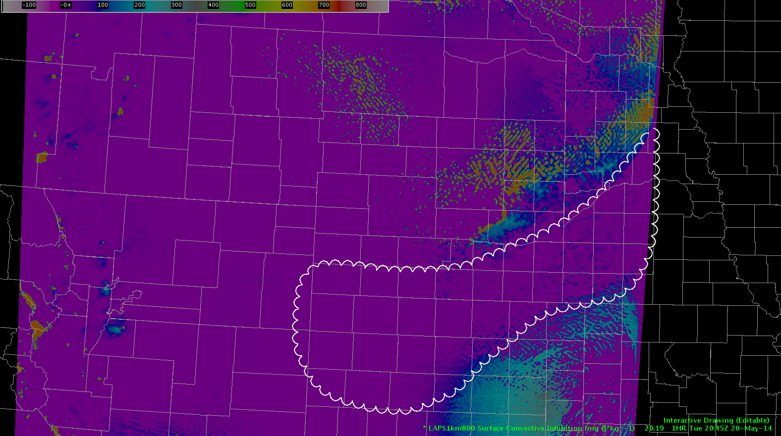
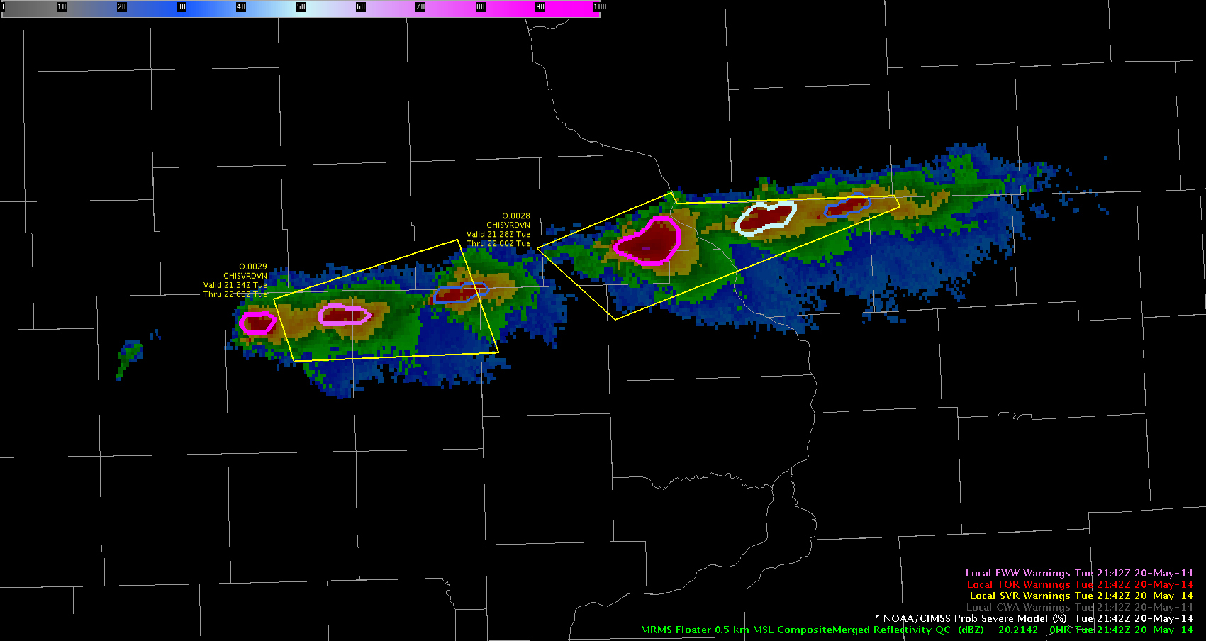
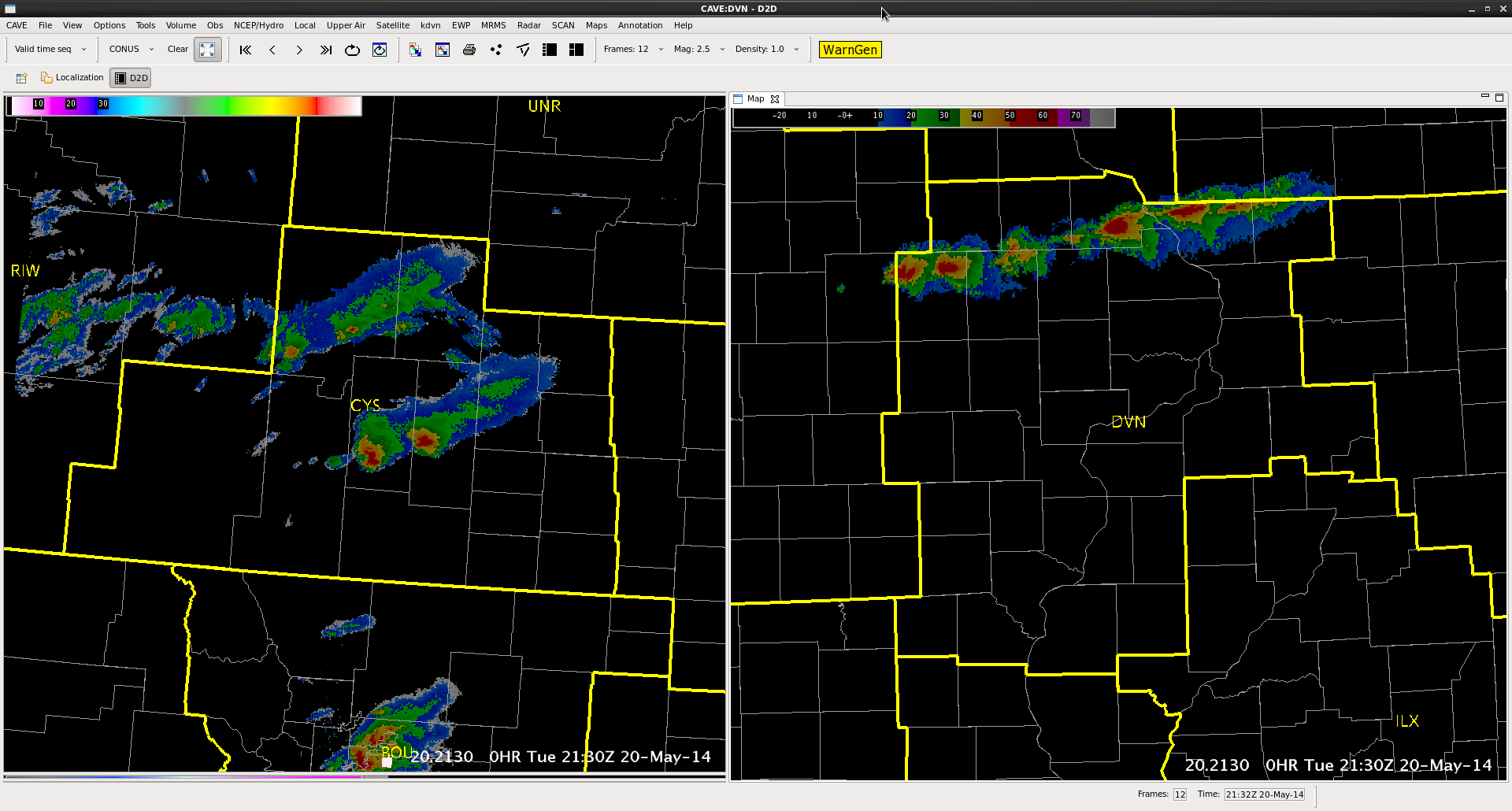
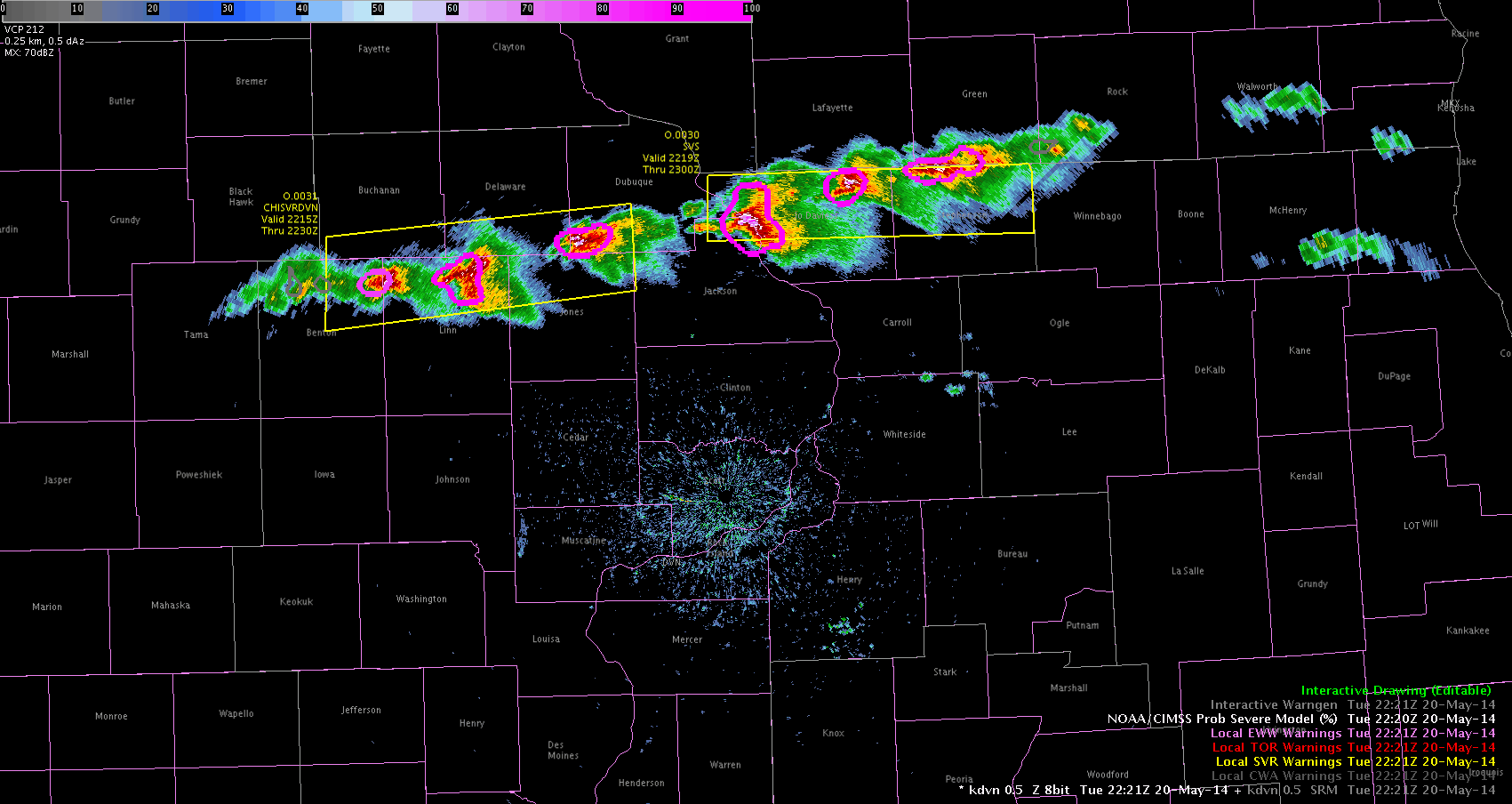
It has been a very active day with storms over our warning area.  The Prob. of Severe tool really helped me focus in on the storms that were more intense and then I was able to use Dual-Pol info to help verify and issue the warnings.  I was able to observe that the Prob of Severe as it followed the strengthening and thus weakening of the individual storms.  As you can see from above…when they turned the hot pink color..is normally when I was issuing the warning and actually allowed the warnings to expire when they started to drop down to the gray color.  This also verified with storm spotter data so I find this tool very useful and I really like it. ~Vollmar

Tags: None

Variability in CI

ci_varability_20_2045

It is interesting to note the variability along the CU field from east-central IA into northern IL. This CU field developed into TSRA the next satellite scan in the regions all along the line. The variability in CI ranged from 27 to 70 percent.

-JB

Tags: None

Nearcast storm feed.

May20th 2259Z

With this post I just wanted to showcase off the Nearcast model’s difference in Theta-E layers as a large area of instability is feeding directly into the lonely storm over Denver. With no slowdown of the instability feeding this storm, it will probably continue into the late early evening hours.

Grant H.


Tags: None

Flash Extent Density and Storm Structure

flash_extent_vsMinus10

Overlaid here is Flash Extent Density (FED; shaded pink and blue boxes) and Reflectivity at -10C at 22:11 UTC.  The lightning information is highlighting where active charge separation is ongoing within the storm, and lightning is occurring. Notice how the FED extends outside of the reflectivity cores within the two storms, highlighting how lightning propagation can and does occur outside where it is actively raining, posing a threat to those caught outside.

FEDvsrefwnldn

NLDN information has been added to the image above from the same time at 22:11 UTC.  The NLDN is represented my the minus signs within the image.  Note the difference in spatial information of lightning that the PGLM provides over traditionally used NLDN cloud to ground points.

Four minutes later at 22:15 UTC, the NLDN reported a lightning strike that occurs outside of the precipitation of the storm (white circle, below).  circle_2214


vLAPS Underdoing CIN

laps_cin_20_2045

Using the vLAPS and looking at the frontal boundary from eastern NEb to the southwest into south central NEb and into northwest KS the model indicates that there is no convective inhibition remaining in the scalped area. Comparison of this to the SPC mesoanalysis indicates that CIN remains in this area, especially in southern NEb and northwest KS where no convection is occurring.

-JB

Tags: None

MRMS units shown (m vs ft)

Screenshot-Merged Reflectivity

Quick Note: When looking at reflectivity of different heights, the typical unit for a meteorologist on radar operation is in ft not meters (m) as this is typical of most radar readouts.  It might be an idea to convert this to ft for faster use at catching the wanted level that is noticed in the base products.

Grant H.

Tags: None

First Warnings Issued

First Warning Issued

I issued my first warnings today on storms that I have been watching.  I watched the Prob Severe product for awhile and saw the storms grown from10% to above 50% and had MESH growing from .08″ to 1″ and above.  That is when I issued the warnings.  I created the polygons based on watching the radar loop and so far the western polygon warned area verifed with 1″ hail in Urbana.  Hopefully the other one does too! ~Vollmar

Tags: None

EWP Operations Update – Tuesday 5/20 – 4:40pm

Both CYS and DVN domains are contained within Severe Thunderstorm Watches and have warned storms ongoing. Right now large hail is the main threat with these storms and our student volunteers are hard at work forwarding reports to our forecasters. We’ll be moving the LAPS domain into the DVN region shortly.

Severe Thunderstorm Watch #160
Severe Thunderstorm Watch #161
MR/MS Merged Reflectivity over both domains at 2130z.
EWP Operations - May 20th at 4:40pm
EWP Operations – May 20th at 4:40pm

-Darrel Kingfield
EWP Week 3 Coordinator

Tags: None

NearCast Supports Weakening

The gradient of theta-e difference remains in eastern WY. Storms have developed and moved east across this convective instability gradient producing marginally severe hail. Throughout the day the NearCast model indicated the convective instability weakens across the NEb panhandle. Below is an email with two supercell moving across the convective instability axis. The lead supercell is currently weakening and also moving out of the instability axis.

storm_weakening_20_22

Tags: None

First impressions with the new tracking tool.

Screenshot-CAVE:CYS - D2D -1

First impressions with the new tracking features. graphs next to the tracking bar in the meteogram may need to be more editable. In this case were were able to zoom out of the Y axis allowing dBZ to show up as a more usable function. However it still is lacking some standardization of axis that is more common from other programs functions like Excel and Powerpoint graphs. Perhaps finding a way to automatically load a standardized graph  when certain meteorological fields show up. (dBZ, VIL, CC, etc..)

Also of note. Shortly after zooming out on the axis…. other panes  that were on screen where not accessible for a very long time . Probably 5 to 10 minutes while writing this blog.

Grant H.

Tags: None