
![]() The tracking meteogram tool is nice, but there is an issue with the graphs that are plotted. They pop up whenever they feel like it, and while I can understand why some variables are plotted, others seem random.
The tracking meteogram tool is nice, but there is an issue with the graphs that are plotted. They pop up whenever they feel like it, and while I can understand why some variables are plotted, others seem random.
-KP
Official websites use .gov
A
.gov website belongs to an official government
organization in the United States.
Secure .gov websites use HTTPS
A
lock (
) or https:// means you’ve safely connected to
the .gov website. Share sensitive information only on official,
secure websites.

![]() The tracking meteogram tool is nice, but there is an issue with the graphs that are plotted. They pop up whenever they feel like it, and while I can understand why some variables are plotted, others seem random.
The tracking meteogram tool is nice, but there is an issue with the graphs that are plotted. They pop up whenever they feel like it, and while I can understand why some variables are plotted, others seem random.
-KP
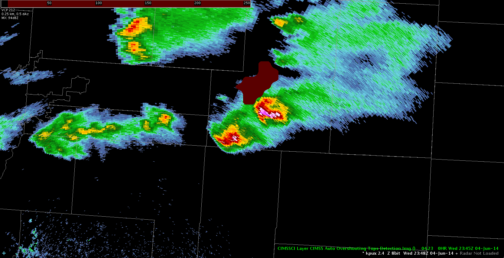
Just a thought which may be crazy but I overlayed Over shooting top Detect on radar ,5 Z
May have value in diagnosing storm structure? Shear etc.
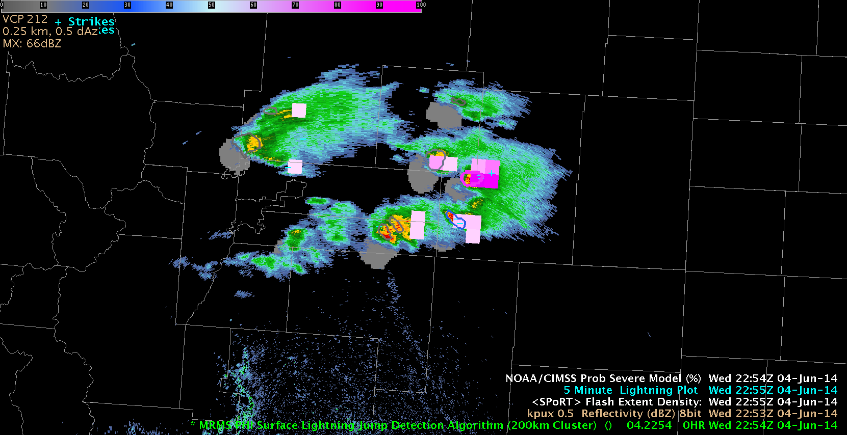
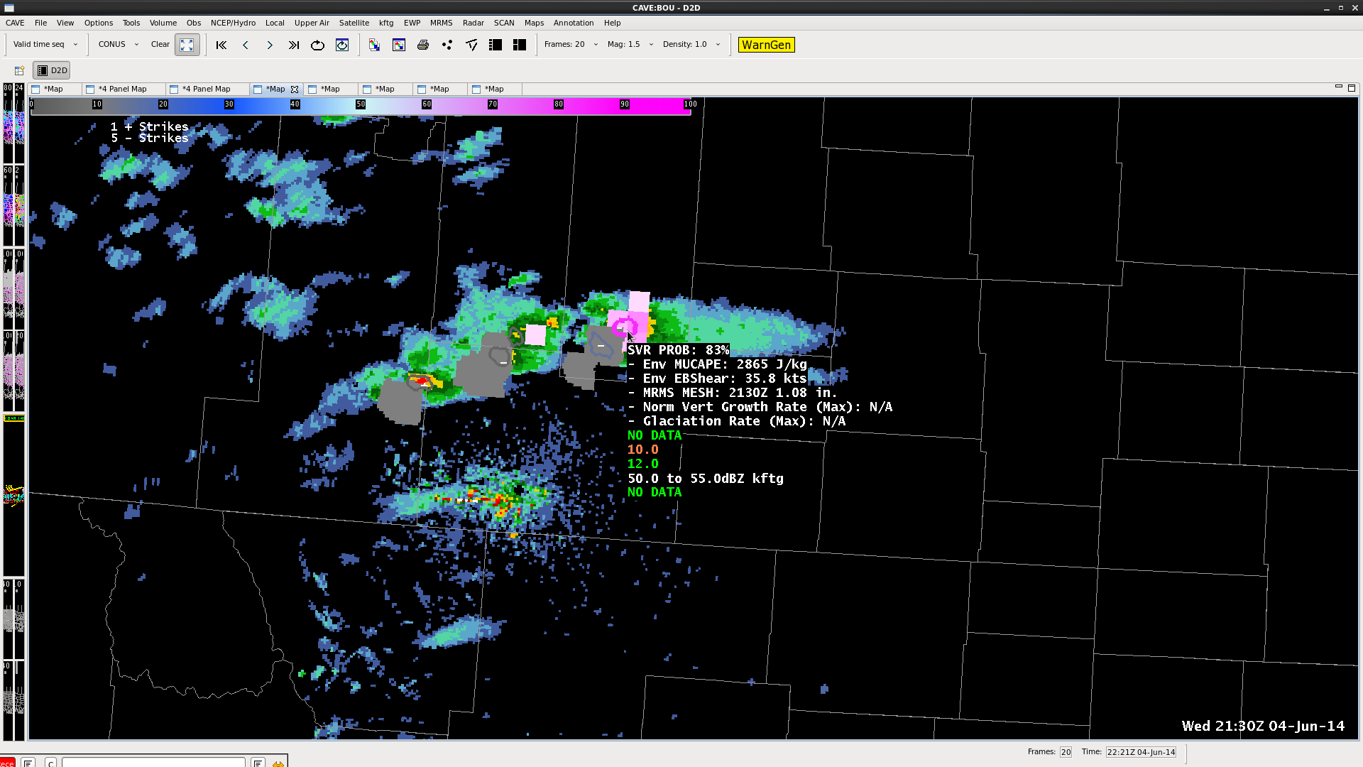
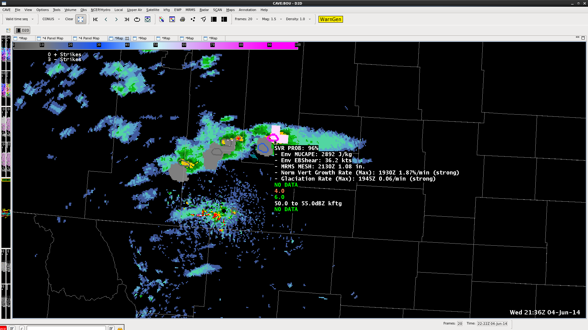
 A warning was issued based mainly on the prob severe which went from 40 to 93% in 3 volume scans. The warning was issued when the prob severe was 40% after increasing from less than 20%. As a side note, WFO CYS did not warn on this storm.
jca
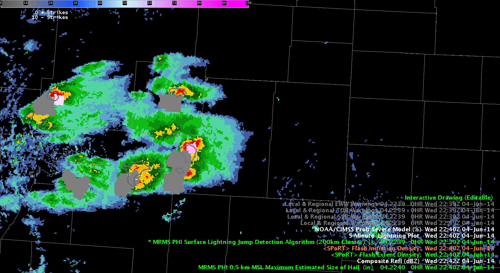 This loop shows the progression of the Lightning Jump Detection Algorithm as the storms grow. Also the Flash Extent Density rapidly increased with the storms and subsequently the prob severe probabilities increased as well. Warnings were issued based on the increase in Flash Extent density, because of the usefulness shown in storms north of the Boulder CWA. This tool was extremely useful, as otherwise I may not have notices the rate at which these storms were increasing.
-KP
We have seen a 5 sigma light detection jump on the storm in e c Colorado. Our group has warned on the storm. Cell to the NW has rapid flash extent incr. as well, as severe wx prob increasing. Have warned on it based on these two parameters.
 Warned on NW storm on image below. SVR Prob incr rapidly.

Cells have begun to increase in E Central CO. Partner issued warning on strongest cell that showed a rapid increase in Flash Extent. Just after I grabbed image below we saw a lightning jump (Cell just west of the storm with highest flash density.) First good day to evaluate flash extend and light jump. Flash extent seems to be the first indicator of increasing updraft, with the lightning jump coming just later on these cells. My first real experience using LMA data, and it is very handy too have! Display seems quite good as well.
D Satterfield
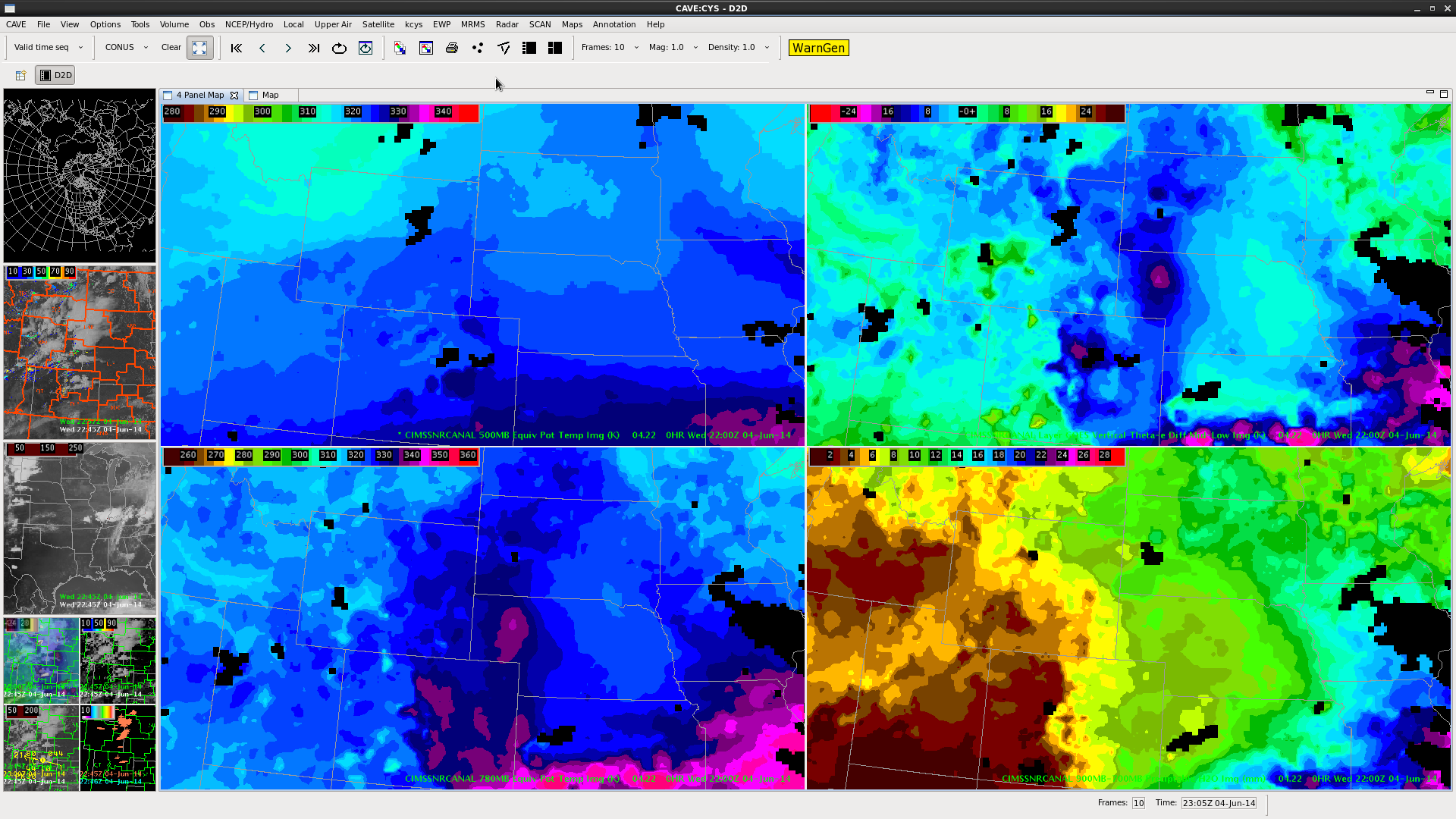 The upper left panel clearly shows a theta-e ridge lifting north from NE CO into SW NE where convection is expected to fire close to 00Z. Stepping through this image clearly show the ridge lifting north indicating a new threat area of possibly severe convection.
jca
Comparing 22Z IR with OUN WRF 2 hour forecast and NSSL simulated IR..
The Simulated IR not as well but is capturing mid/high cloudiness over KS and Okla. HRR does well on cells in West Nebraska and storm in SE CO. (Bottom image).4
 D Satterfield
The progression of images below shows the progression over four volume scans of increasing flash extent density and increasing prob severe percentages over time. While one isn’t necessarily dependent on the other, the strong correlation leads to increasing confidence of severe weather associated with this storm. The lightning jump detection algorithm does not increase here, indicating that a lightning jump doesn’t always precede severe weather. Also, an increase in flash extent density does not equal an increase in lightning strikes, but an increase in the number of strikes that moved through that specific box.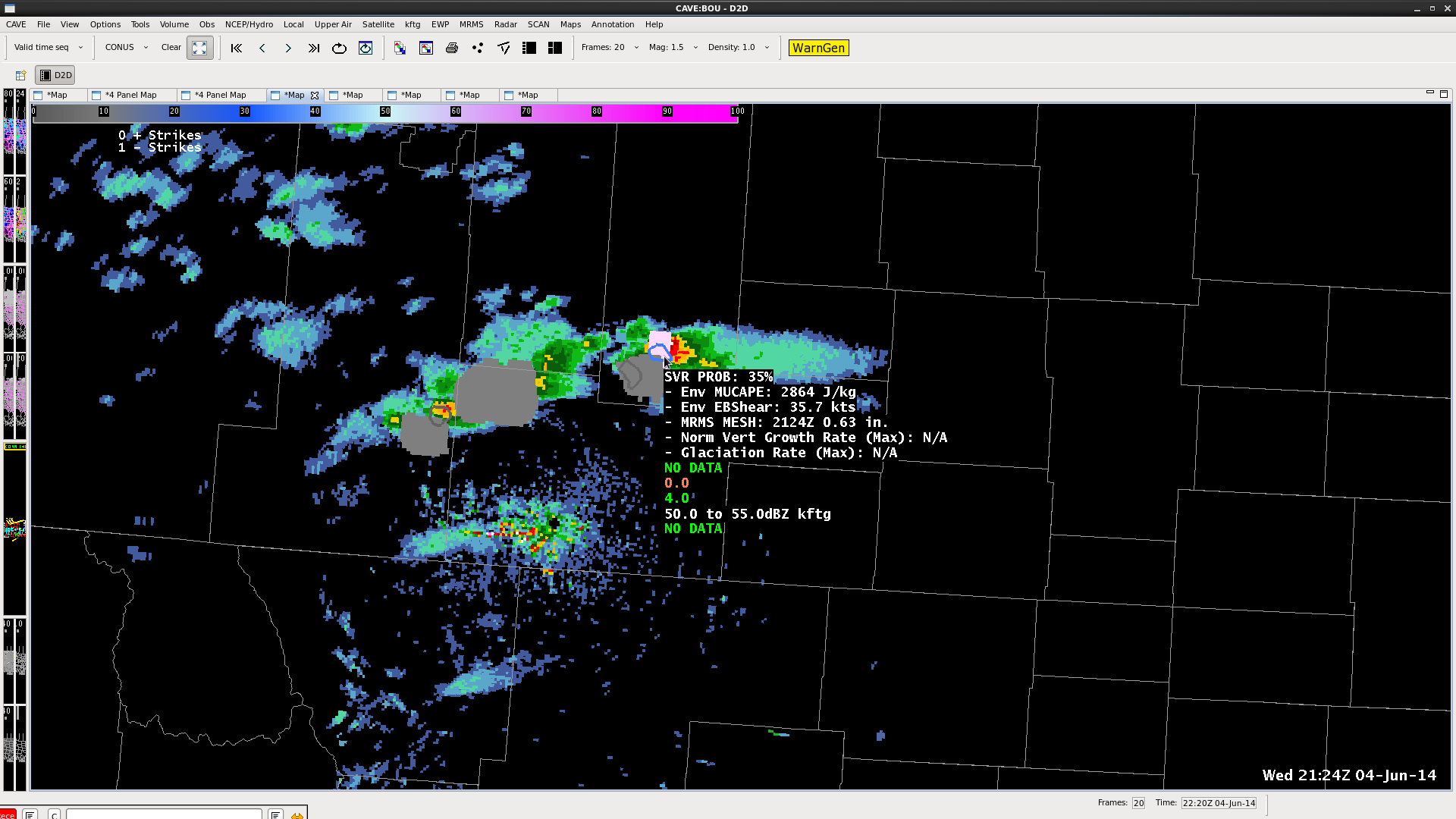
 -KP
-KP
 D Satterfield