


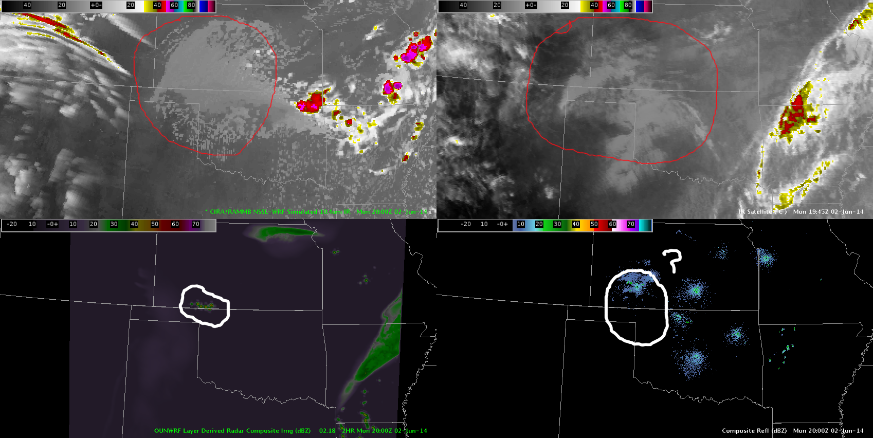
 Forecast satellite from the NSSL-WRF and composite reflectivity from the OUN-WRF on the left, actual IR Satellite and composite reflectivity on the right. In the bottom image, the forecast satellite imagery over the area circled in red is actually doing well, however the radar is not. This indicates that these products are probably not the best forecast tools for convection at this time.
-KP