

For Day 3, we were Midland TX. There were a few storms that formed off the higher terrain. We did not have radar, so we made use of the GREMLIN synthetic radar imagery, and Octane to make severe warning decisions.
First of all, the Gremlin showed increasing reflectivity, and at one point had 60+ dBZ. This factored into the warning decision.
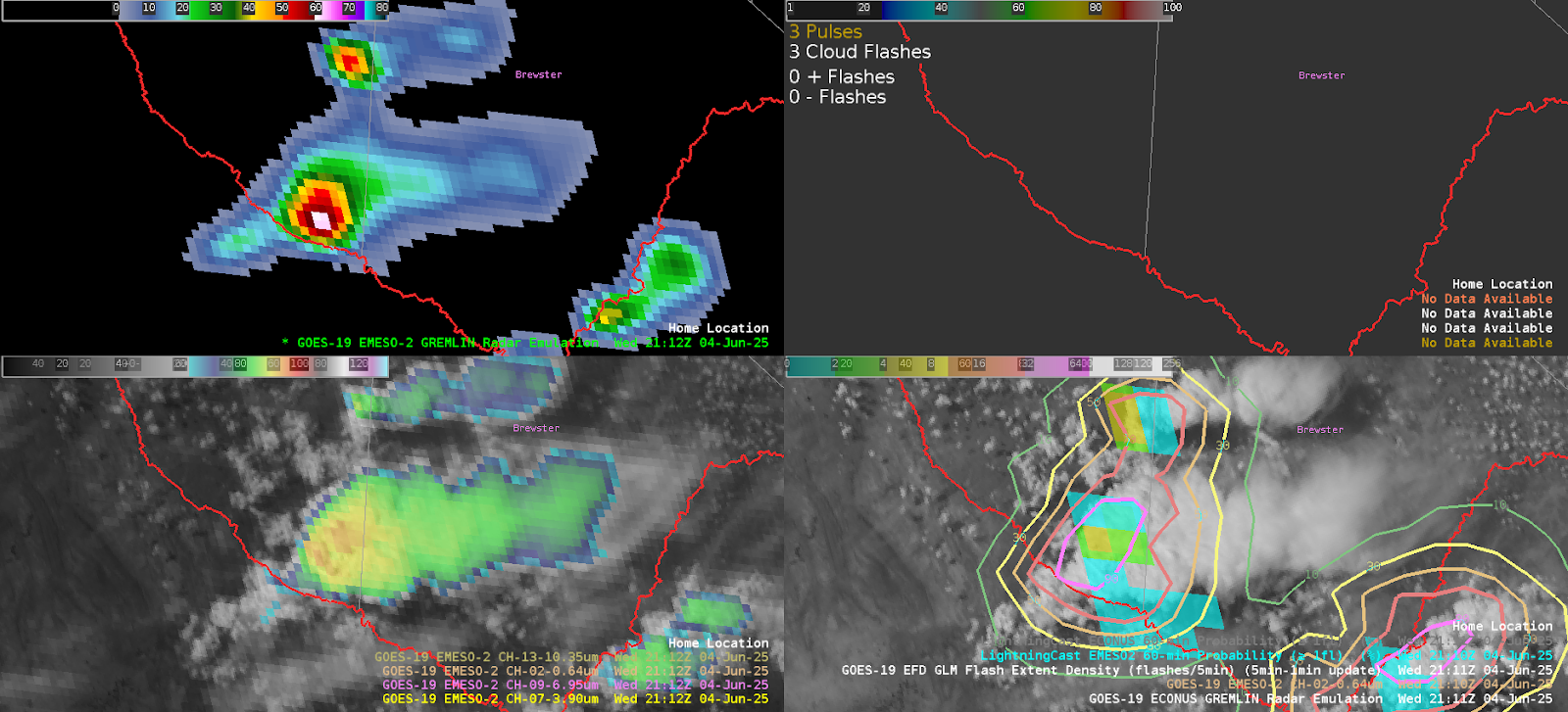
The image above shows Gremlin reflectivity (top left) with LightningCast (bottom right). ENL was in the top right, but it wasn’t loading. The reflectivity of the GREMLIN factored into the “yes” warning decision.
Secondly, the OCTANE divergence showed a persistent area of cloud top divergence on the upshear side of the updraft. This also pushed our team to issue a severe thunderstorm warning.
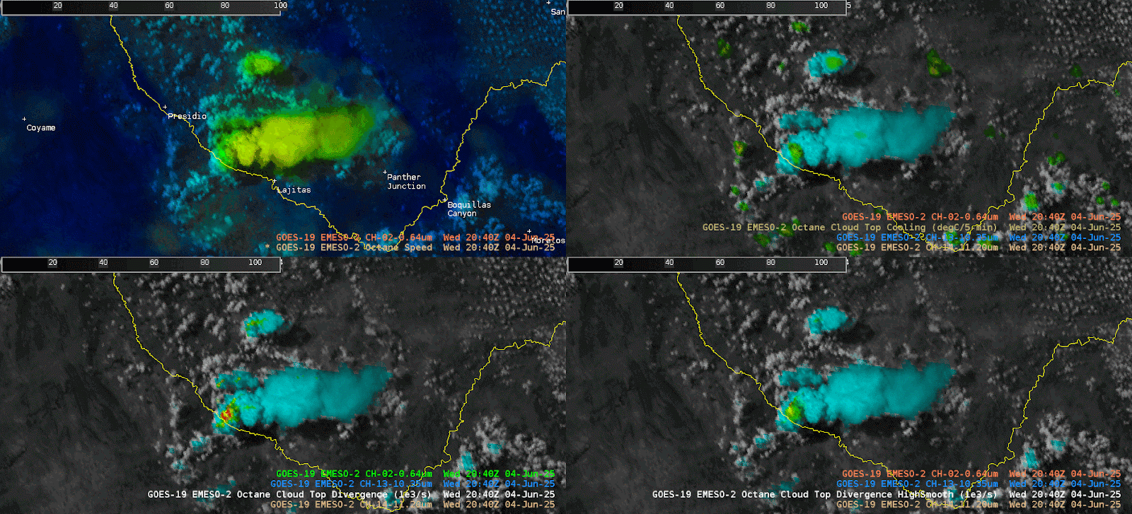
The animated GIF above shows a persistent cloud top divergence signal with the storm of interest across southern Texas. There is another storm in the southeast part of the 4-panel imagery.
Unfortunately there were not any reports, but I did go back and look at the ProbSevere, and the MESH maxed out at around 1.13”. When evaluation these storms, they seemed small, so having ProbSevere in addition to the satellite imagery may have led me to hold off on the warning.
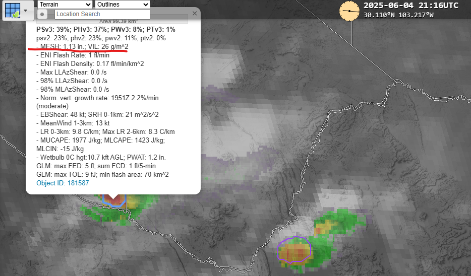
The image to the right shows ProbSevere. This was looked at after the fact, but does line up with the marginal severe storm, and warning that was issued for 1” hail.
– Updraft