Skip to content
U.S. Flag icon

An official website of the United States government

Here’s how you know

building icon

Official websites use .gov
A .gov website belongs to an official government organization in the United States.

lock icon

Secure .gov websites use HTTPS
A lock ( Lock Locked padlock icon ) or https:// means you’ve safely connected to the .gov website. Share sensitive information only on official, secure websites.

  • Home
  • About
  • HWT Home
  • EWP Home
  • Participant Info
  • Facebook
  • Twitter
  • Instagram
  • Youtube
  • Flickr

EWP Blog

Spring Experiments & Beyond

  • Home
  • About
  • HWT Home
  • EWP Home
  • Participant Info

Severe Williamson County

Posted in General on June 8, 2015 by Tiffany.

severe_williamsonDid not have a high lightning count svr_williamson
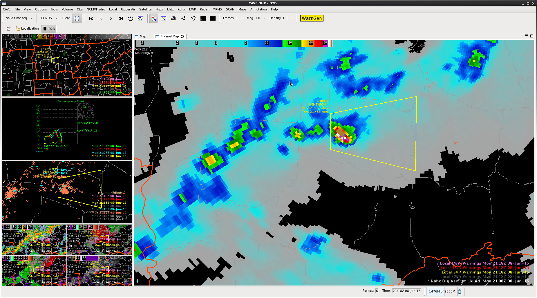
Had a quickly building DVIL
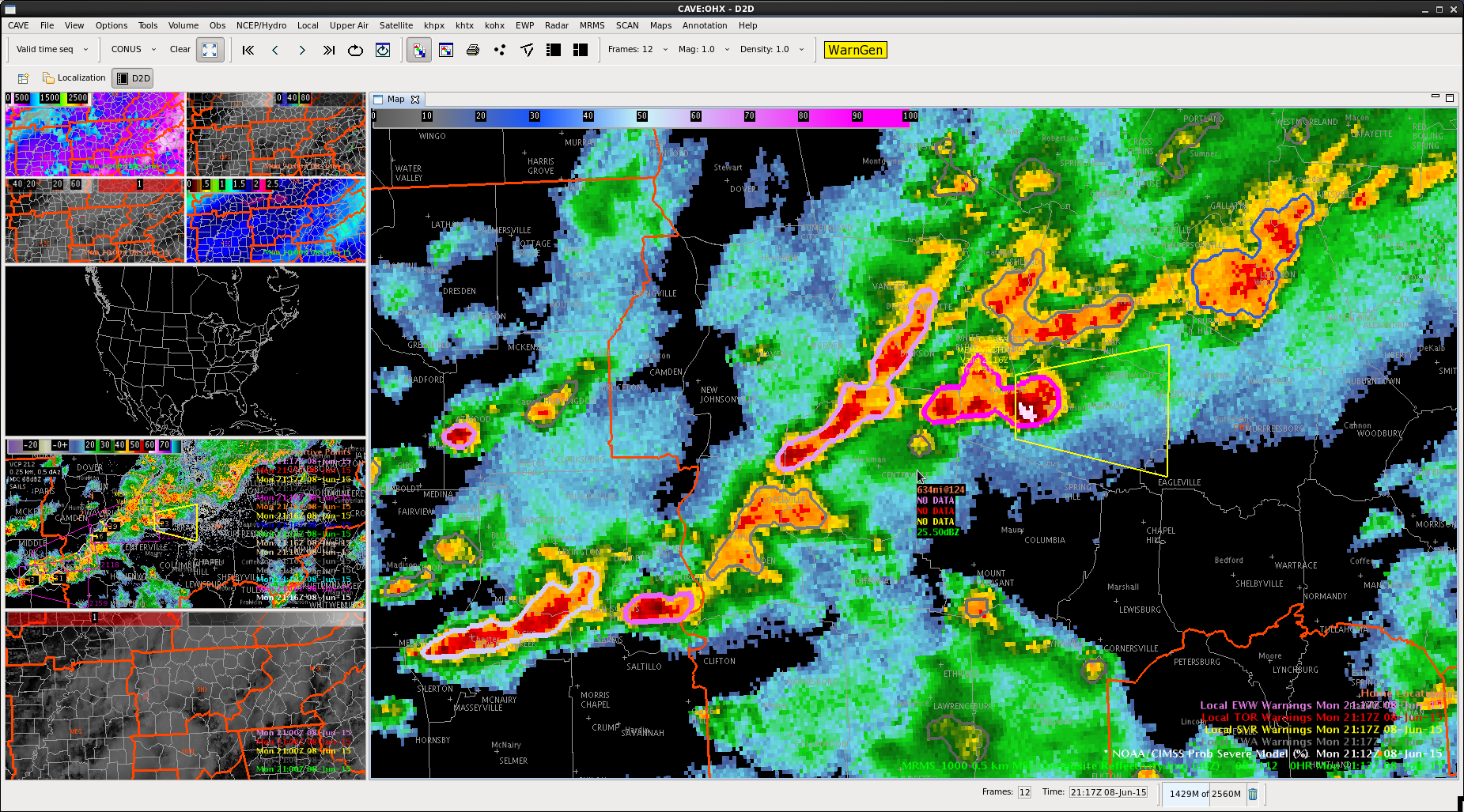
 svr_williamson_1ProbSevere was high svr_williamson_4
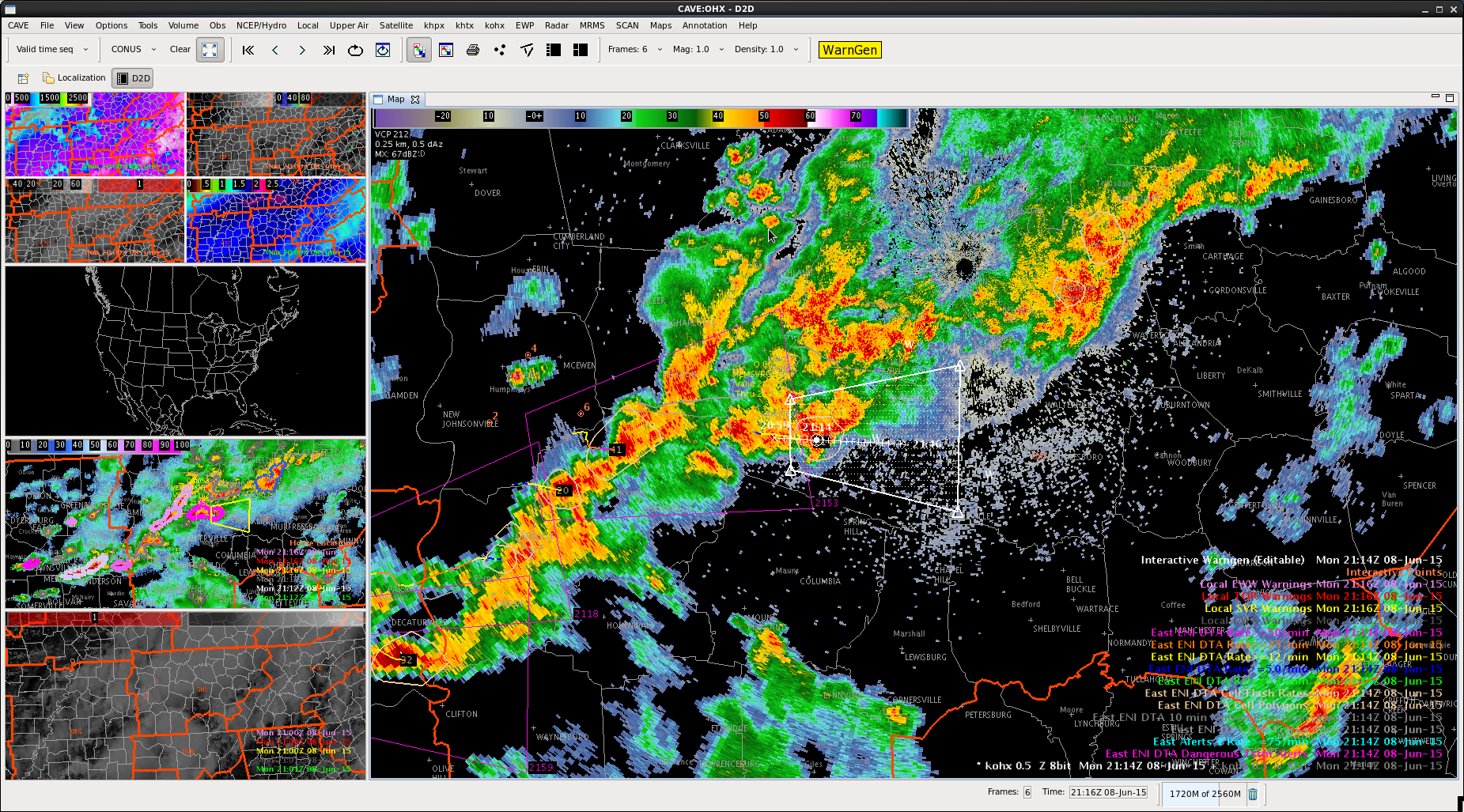
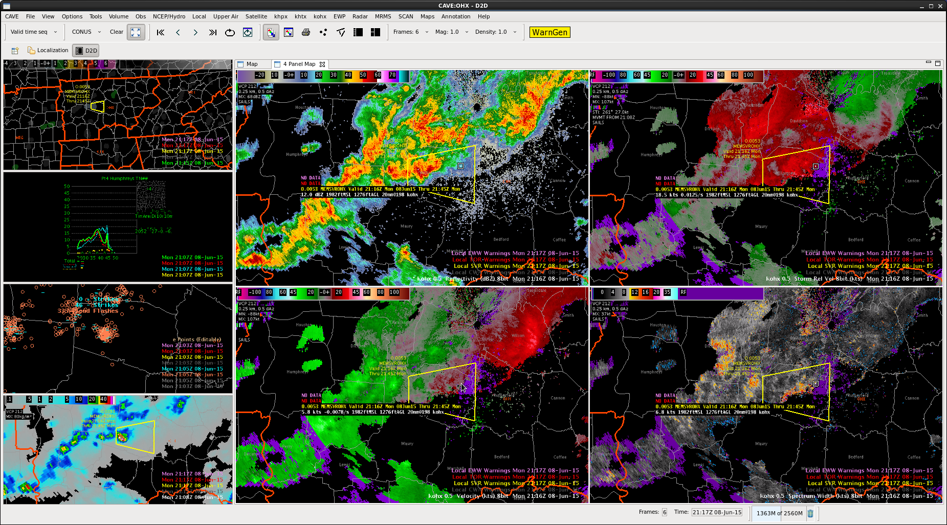
Storm formed on boundary…moving right of mean flow

svr_williamson_5
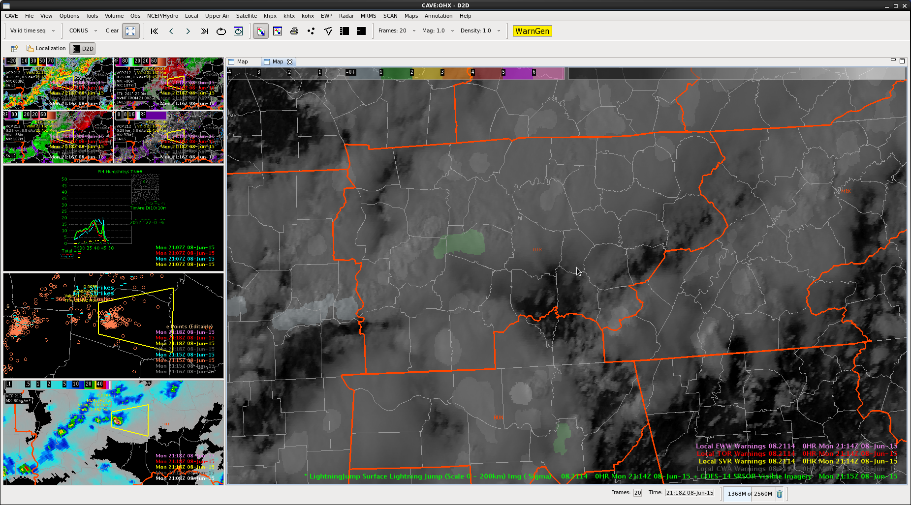
had a 2-sigma lightning jump

Combination of above elements led to warning decision.

DVIL seemed to be the best tool to use here, as well as spectrum width showing the cell going up along a boundary.


Tags: None

Post navigation

« No Products
Severe Probability along a line »

Search the entire NSSL site »

Posts by Date

Posts by Category

  • AllSky (13)
  • Area Forecast Discussion (AFD) (12)
  • AzShear (180)
  • CG Ltg Probability (3)
  • CPTI (4)
  • Daily Summaries (103)
  • DSS (59)
  • Experimental Warning Thoughts (by Greg Stumpf) (22)
  • Forecaster Thoughts (76)
  • General (1,066)
  • GLM (123)
  • GLM DQP (10)
  • GOESR (59)
  • GREMLIN (68)
  • HWT (159)
  • Lightning Jump Algorithm (60)
  • LightningCast (126)
  • Live Blogs (1,149)
  • Mesoscale Discussions (42)
  • News (453)
  • NMDA (22)
  • NUCAPS (93)
  • OCTANE Speed Sandwich (148)
  • Operations Status Message (58)
  • Optical Flow Winds (23)
  • Outlooks (102)
  • PHSnMWnABI (92)
  • ProbSevere (171)
  • Pseudo GLM (16)
  • SPG2022 (68)
  • SPG2023 (92)
  • SPG2024 (94)
  • SPG2025 (83)
  • Total Lightning (22)
  • WAS*IS (1)
  • Webinars (2)
  • Weekly Summaries (40)

Tags

3DVAR ABI All-Sky All-Sky LAP ATPW AzShear CPTI Day Cloud Phase DSS EWP GLM GOESR-Cloud Top Cooling GOESR-Nearcast GOESR-Satcast HWT2022 IR LightningCast lightning jump LJA MRMS NMDA NTDA NUCAPS Optical Flow Winds OUNWRF PGLM PHSnMWnABI ProbSevere ProbTOR RGB Simulated Satellite total lightning Total lightning tracking tool TPW Visualization

Weather Links

  • Live Chaser Cams
  • Live News Camera
  • OK Mesonet
  • OU Hoot
  • RAP Weather
  • SPC Forecast Tools
  • SPC Forecasts
  • WDSSII Real-time

Meta

  • NSSL Home Page
  • Contact NSSL
  • Disclaimer
  • Privacy
  • Accessibility
  • FOIA
  • USA.gov
  • Login
NSSL Home  ·  Contact NSSL  ·  Disclaimer  ·  Privacy  ·  Accessibility  ·  FOIA  ·  USA.gov  ·  Login