

For Day 4, we were DDC. The storm environment was favorable for tornadoes. Our group issued four tornado warnings. This was based on the Octane storm top divergence, ProbSevere, radar, and the near storm environment. Radar confirmed a supercell with a mid-level meso, but the beam was +10Kft above ground, so it wasn’t helpful for the low levels. We kept the tornado warning going based on the environment, and did add 2.5” hail to the warnings. This storm ended up producing 2-3” hail, and multiple tornadoes. The tornado reports were delayed.
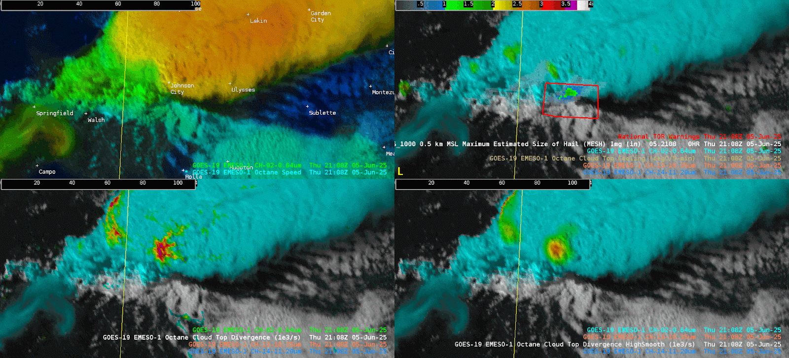
The animated GIF above shows the tornado warnings (red polygons) along with MESH (top right) and no smooth cloud top divergence (bottom left) and high smooth cloud top divergence (bottom right). This was a strong supercell in a favorable environment for tornadoes, so warnings were issued despite the lack of reports or low level radar data.
In addition to issuing the first warning with about 30 min lead time for our forecast area, the Octane was also able to identify a cell that developed a couple hours later behind the main storm, and it showed it as sub-severe. At quick glance, these updrafts look similar on the Day/Cloud (see below), but Octane did not have strong divergence with that second cell, and MESH had only small hail. For that reason, we didn’t issue a second warning, which I think is a big feat. Sometimes not issuing can be just as important as issuing.
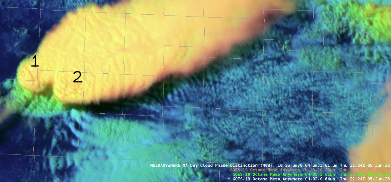
The image above shows two updraft cores on the Day Cloud Phase at 2124Z. These updrafts look similar but the Octane Divergence was able to differentiate and show that updraft 1 had less divergence than updraft 2. (See image below)
.png)
The image above shows Octane Cloud Top Divergence (no smooth left, high smooth right) at 2125Z, corresponding to the Day Cloud Phase image above. This product, in addition to MESH, gave confidence to hold off on a warning for that trailing storm to the west.
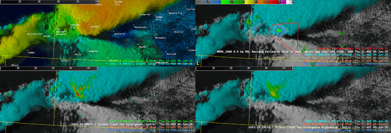
The animated GIF above shows the two updrafts mentioned above, along with the tornado warning (red box) toward the end of the event. MESH is also shown in the top right, with a filter for values less than an inch. Storms are showing a weakening trend in the Cloud Top Divergence (bottom panels) and MESH (top right).
– Updraft