

For Day 2, we were the Wichita Office. They had mainly multi-cell convection, so we only issued 2 warnings, and these were for wind based on the 0.5 deg radar scan. In addition, our IDSS event was in lightning pretty much the entire time, so it was a fairly easy forecast to warn them, and then move on.
However, while evaluating the OCTANE, there was one event in WFO Pleasant Hill that showed persistent divergence aloft, and had this storm have been in our CWA, I would have issued a warning.
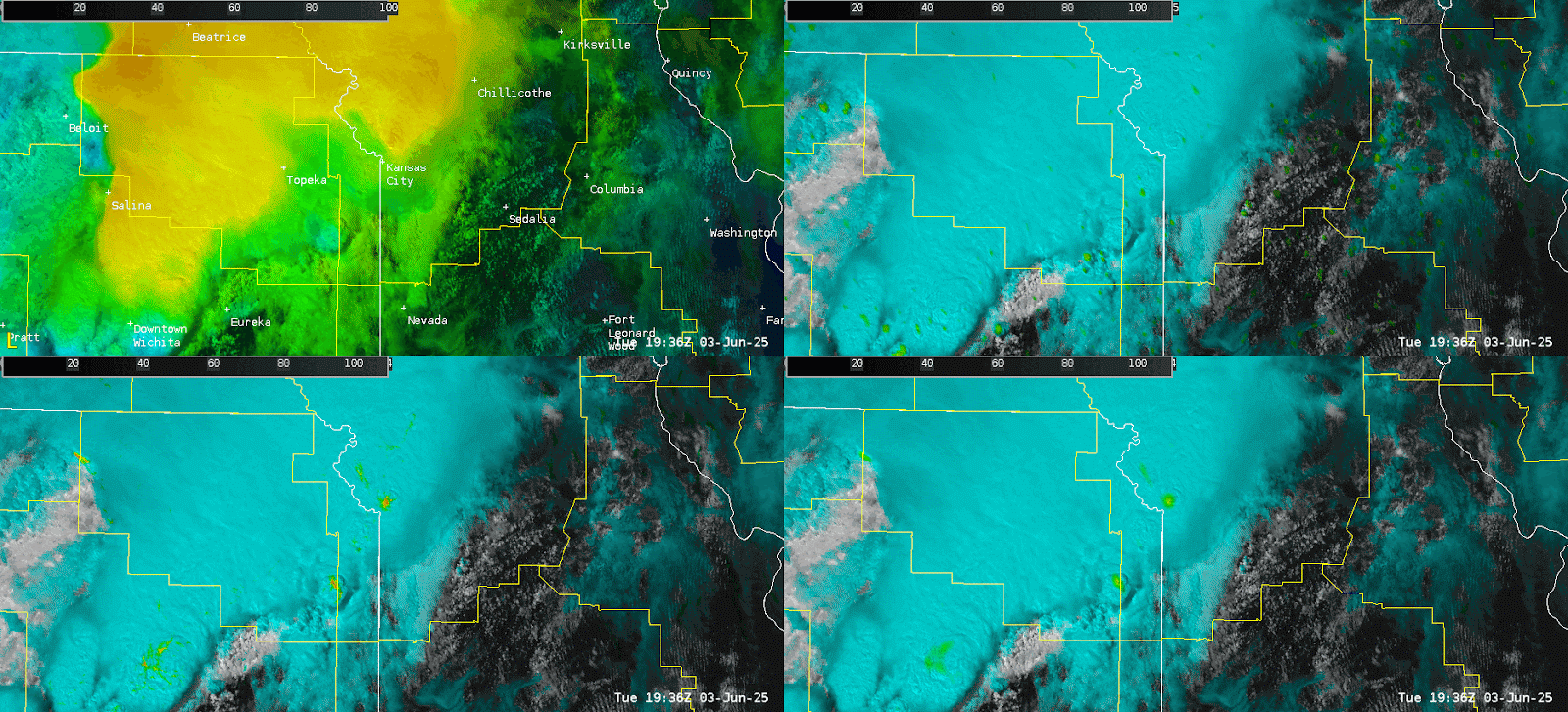
The animated gif above shows OCTANE speed (top left), Cloud top cooling (top right), Cloud Top Divergence (bottom left), and Cloud Top Divergence High Smooth (bottom right). In this case, notice the persistent high divergence values (red) in the lower two panels.
.png)
The image above shows a zoomed-in look at the storm of interest. I would have issued a severe TS warning had this been in our area.