

Synopsis: A broken line of thunderstorms formed along a warm front from southern Oklahoma to east-central Kansas Tuesday afternoon. Storms entered a very moist environment with moderate to high MLCAPE and marginal shear. Due to a southwest to northeast storm motion, the largest threat was flash flooding, if storms became strong, damaging winds and large hail were possible.
Most of the activity in the ICT CWA was sub-severe (with the exception of flash flooding,) however there were times when a few storms pulsed-up enough to potentially produce damaging winds and/or large hail. One storm in particular had a lightning jump (GLM and ENTLN) at 2019Z over Greenwood county. This storm was entering an area that was untapped, however isolation was low.
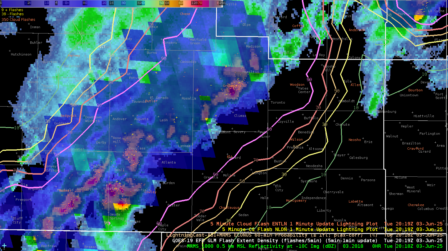
Image 1 Caption: Snapshot of MRMS Reflectivity at -10C, GLM Flash Density, LightningCast ABI+MRMS, 5 Minute CG Flash NLDN and ENTLN 1 Minute Update Lightning
Using the OCTANE Speed and Direction Sandwich product it was evident that the storm of concern in Greenwood county showed changes in local shear coinciding with the lightning jump. The combination of this product with radar and lightning trends increased my confidence to issue a severe thunderstorm warning for damaging winds for 60 minutes.
.png)