

LightningCast V2 did a great job predicting lighting development with developing convection along a frontal boundary in northwest Iowa. It outperformed version 1, as shown by the loop and images below.
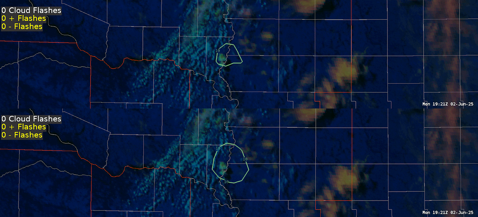
Animated GIF showing LightningCast V1 (top) and V2 (bottom) with the day cloud phase darkened to show detail. The ENI total lighting (yellow CTG flashes, white cloud flashes) is also displayed.
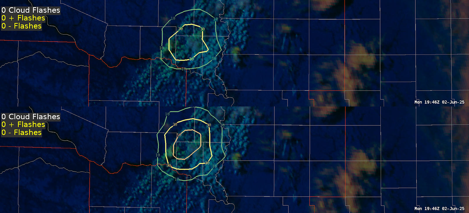
At 1946Z, V2 has a higher probability of lightning (50%) than V1 (30%).
This trend continued throughout, and at 2016Z the first lighting strike was detected. That’s 30 minutes of lead time, which would be helpful for outdoor event IDSS.
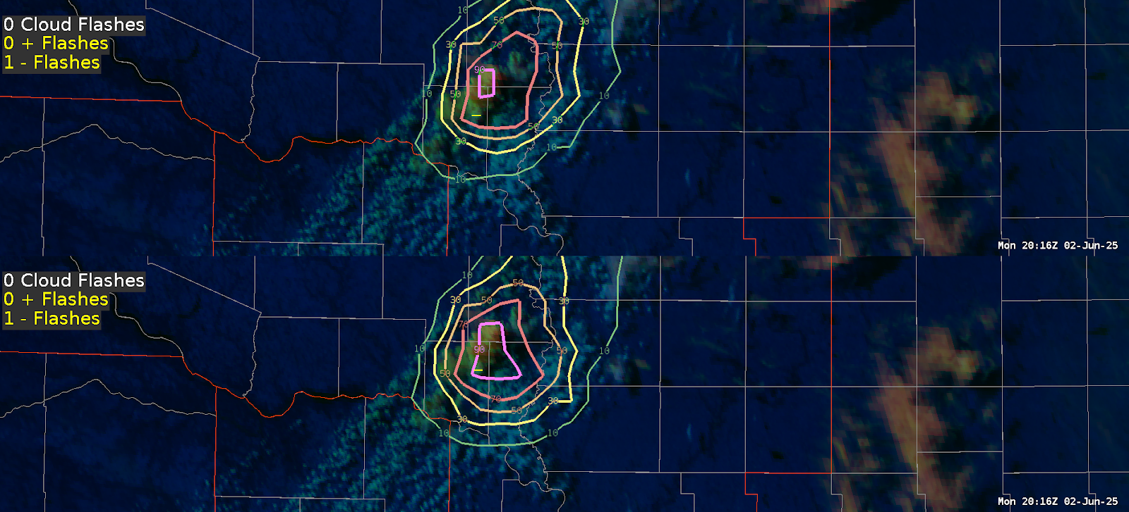
LightningCast at 2016Z with initial cloud to ground strike shown in the yellow dash.
– Updraft