

The environment across the ILN CWA this afternoon was one which favored pulse convection as deep layer shear was fairly weak. At around 4:45, we began watching a storm in the northern portion of the CWA that seemed to be strengthening quickly. Unfortunately, the OCTANE data was coming in around 30 minutes late at this point, so we had to rely on traditional methods to assess storm strength. We decided to put out a Severe Thunderstorm Warning on the storm as radar indicated that it was capable of producing 1” hail. Luckily, the OCTANE data caught up not long after and I was able to analyze it as well.
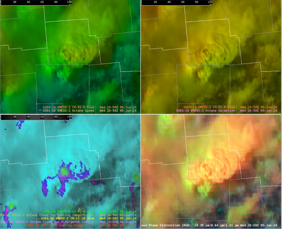
This first image is from around the time that the warning was issued. Looking at the speed and direction products, we see that the gradients are rather diffuse. This is indicative of the weak deep layer shear. However, looking at the cloud top cooling, we see cooling of around 3°C which implies that the updraft was strengthening at the time the warning was issued.
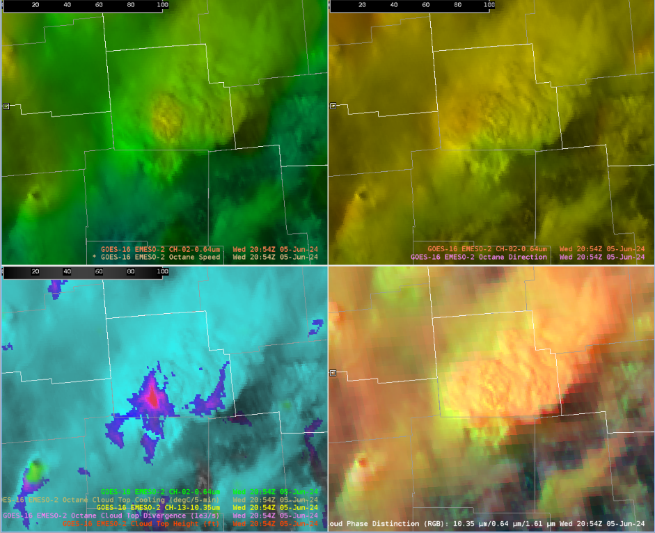
This next image is from 4 minutes later. The speed and direction products still show a diffuse gradient, but the cloud top divergence product really stands out. This lines up with when the storm appeared strongest on radar.
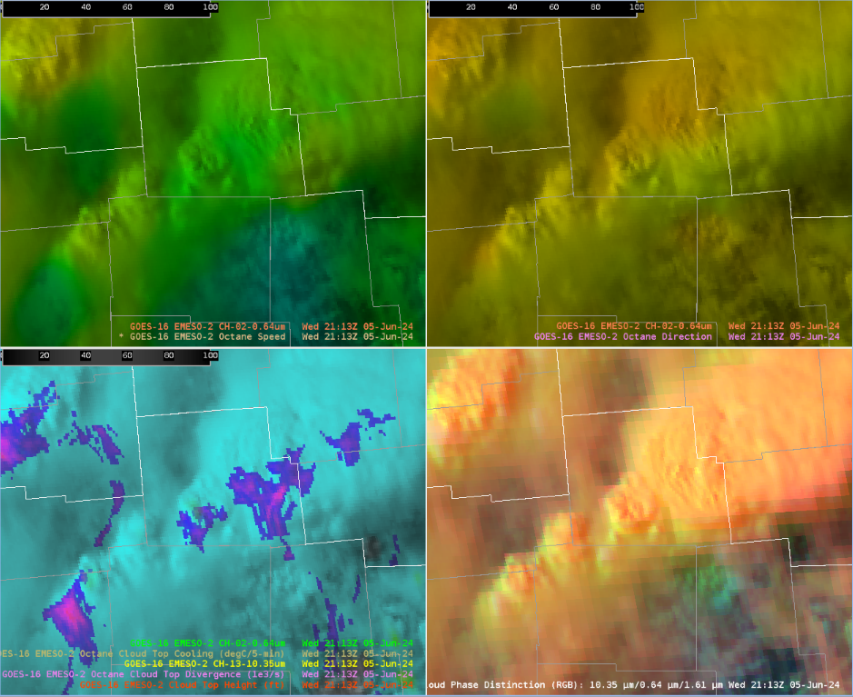
This final image is from around the time that the warning expired. The cloud top divergence is considerably weaker than it had been and radar also indicated that the storm was weaker. We were comfortable with letting the warning expire.
This storm made me think about the utility of OCTANE products in a pulse severe environment. It seems that the cloud top cooling and cloud top divergence products would be significantly more useful than the speed and direction products as you can use them to quickly infer changes in the severity of the storm based on updraft strength.
-EI2018