

Thunderstorms formed over portions of New England (Maine and New Hampshire) along the periphery of an exiting upper level low. This convection was primarily diurnally driven with a lack of forcing.
With marginal storms that developed I wanted to take the approach that I was without certain data, like some radar tools and probsevere. There were two storms that were showing a little promise of getting near Severe limits. One storm developed south of Portland in which we warned on which was very close to the radar cone of silence. A second cell developed further to the west with some dialesing and some poorer radar quality. When going through the various experimental data since the storms were marginal I attempted to see if I could qualify relative storm intensity with the use of OCTANE.
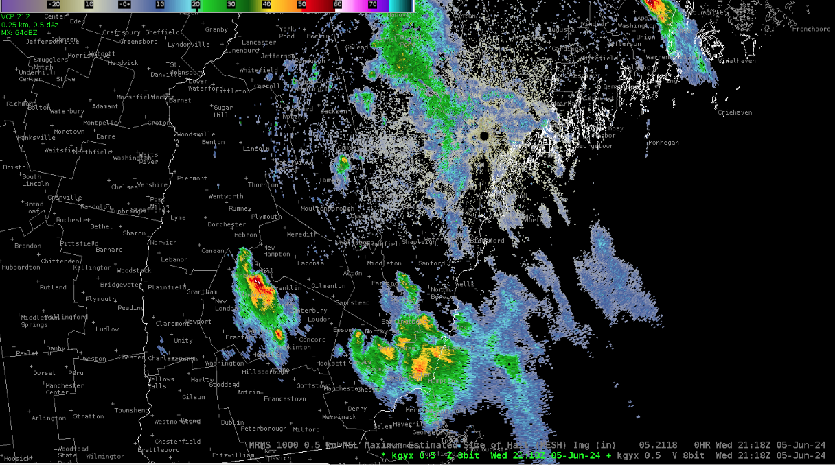
Below you can make out the first cell which weakened towards Portland, however a second cell has ticked up showing 60 dbz reflectivity for this scan at 21:18z.
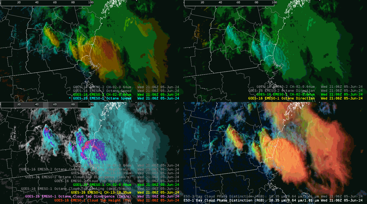
I began examining this second cell a few minutes earlier with satellite products. I noticed earlier with visible satellite data and along with the CTC (Cloud Top Cooling OCTANE product) that there was convective initiation. But then use of the CTD (Cloud Top Divergence -see purple shading in OCTANE bottom left of 4 panel below) also indicated divergence aloft, and in subsequent scans speed divergence was increasing (upper left panel). You can make out on the upper left panel the Octane Speed which shows a second area of speed divergence with activity off to the west. I played with the color table to draw out this feature a touch just as the cloud top divergence indication began to increase in order to attempt to see a visual trend.
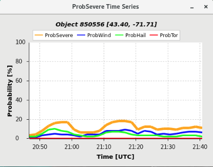
This was a storm that ticked up briefly. I pretended that I did not have probsevere, along with radar reflectivity and velocity. As it turns out ProbSevere did tick up to 20 percent around 21:18z
The decision was made not to warn on this cell. It turned out to be a good thing as afterwards I inspected various radar features and MESH did not indicate a severe hail threat as it only ticked up to under a half inch. And radar reflectivity briefly ticked up to 60 dbz but with no velocity core and thus no severe hazard threat.
What OCTANE provided here was a guide as to where to look next. OCTANE can be helpful, at least it was in this case in terms of where to look next, especially when you get the speed divergence and cloud top divergence (CTD) signatures. IF speed divergence signatures values decreased (lower down the color curve) on the upshear side of the cell, then perhaps that may have been a signal to warn, but they did not increase and this was the proper decision as available radar tools suggested not to warn on this cell.
– 5454wx