

The scenario for the Ohio/Indiana area today is pop-up convection ahead of a cold front, with a gap, followed by the front itself. The pop-up convection was already getting going when we began ops for the day, but a few cells were able to be observed in the developing stages. The main convection with the front was just starting to enter our CWA when HWT ops ended for the day.
Troy Strawberry Festival
The festival was in the lull environment between the pre-frontal convection and the convection associated with the front itself for the majority of ops today, though a couple cells did approach the festival area early on in our shift. We were still getting spun up for the day when those cells developed. It was technically a missed DSS event, but I utilized the on-demand LightningCast dashboard to retroactively look at the situation and see how the LC performed and the utility of the dashboard itself. With this event, LightningCast performed fairly well, giving an approximately 10 minute lead time between the peak lightning probability within the following hour and the first GLM flash. A few minutes of additional lead time could be tacked on if you go back to when the probabilities began to spike. I believe this rapid rise in probabilities to be enough time to quickly give the festival a call, alerting them to the likelihood of lightning within the next hour. However, not sure if we’d be able to tell them it would occur in the next 10-15 minutes.
Darke County LightningCast Progression
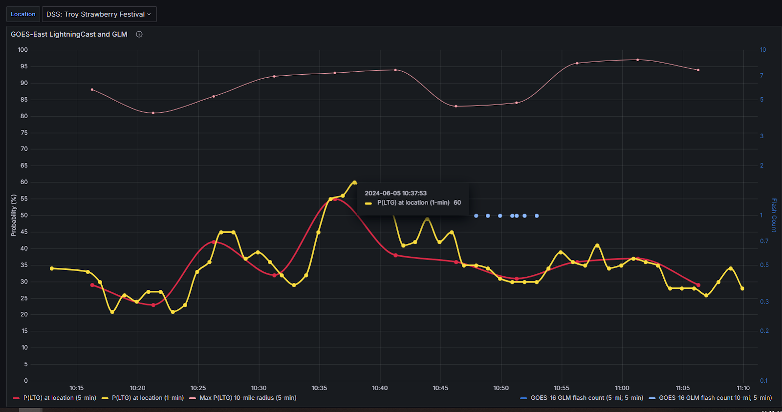
LightningCast dashboard plot showing the time and probability value of the peak.
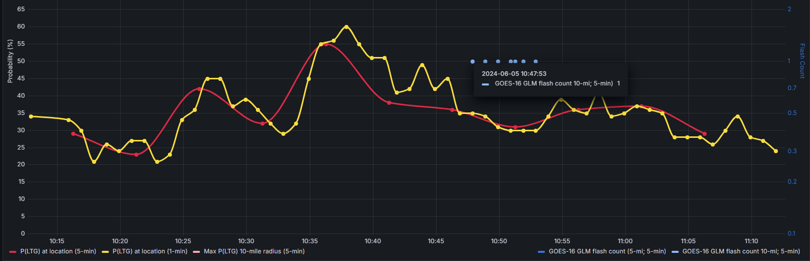
LightningCast dashboard plot showing the time of the first GLM lightning flash observation.
– Loki