

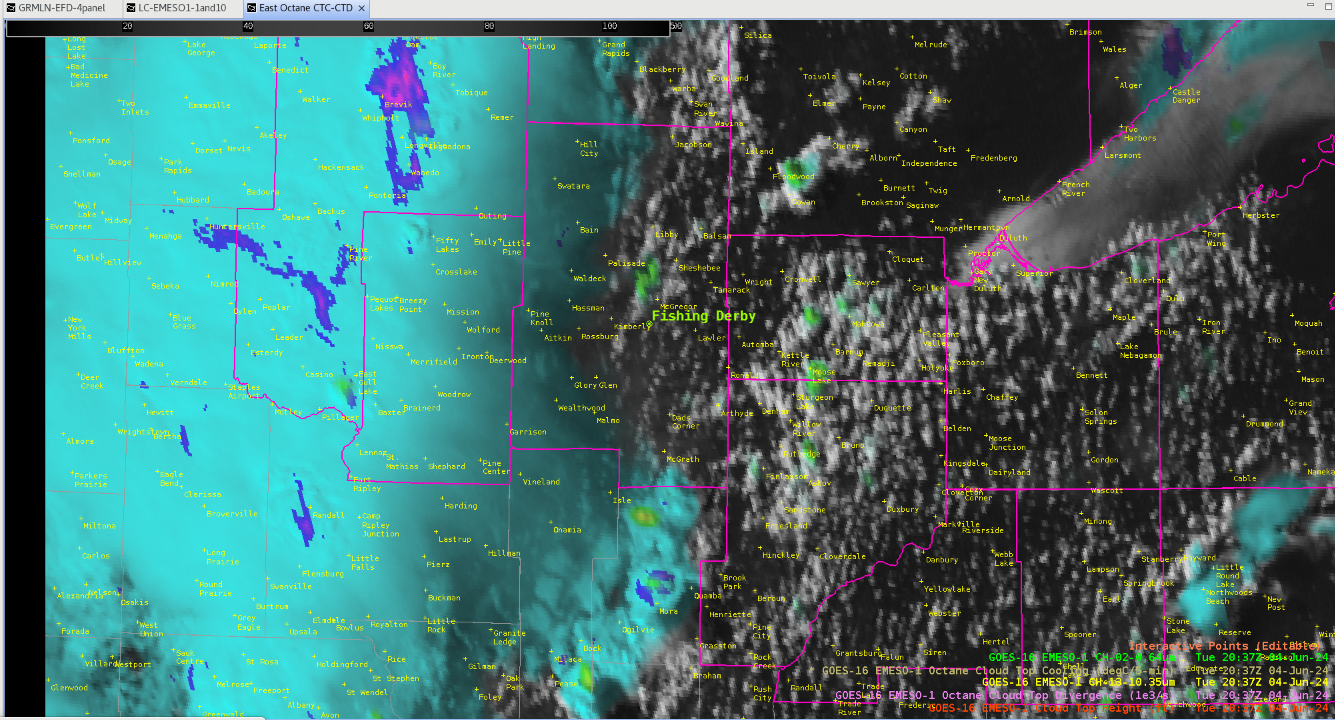
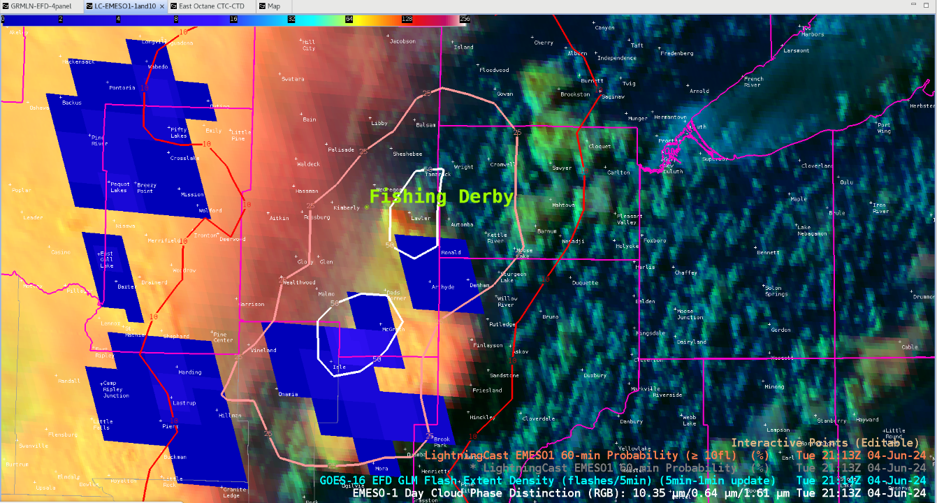
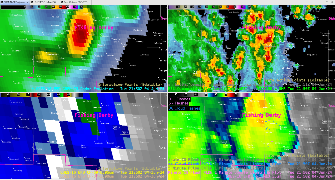
Forecasting in DLH today was challenging due to the radar being made unavailable. However, some of the satellite convective products were able to create accurate forecasts regarding the location of storms and lightning. Firstly, looking at Lightningcast there were gradients of ~25% appearing 1 hour out around the DSS point indicating the possibility of lightning developing within the next hour. This was also supported by Octane, which was showing storms initiating to the south with early signals of cloud top cooling and divergence occurring. Around 1 hour later this seemed to mostly come to fruition, which can be seen on the 4 panel image with GRMLN data on it. Lightning seemed to be mainly concentrated east of the DSS point which was shown in lightningcast. Also these storms originated from the south which Octane began to hint on early out. Overall, it looks as if all three of these satellite convective products did a good job in forecasting possible convection without the use of a radar.
-Sven The Puffin