

One of the things that we noticed was that it appears that model guidance is too slow dropping a weak surface boundary to the south. As a result the convection in model guidance is likely being developed too far to the north of what is likely to actually occur.
Below is the surface winds from the PHS model forecast from the 17z run for 20z. It has a boundary that is near or north of the Texas-Oklahoma border.
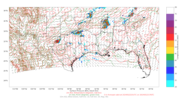
In reality, the boundary has been a bit further south. However, this has been the theme of the day, with convection generally advancing east faster than most high-resolution model guidance. Below are the surface observations across Texas showing how much further south the boundary is, in addition to the fact that the wind field is stronger than what PHS is indicating.

The image below has the forecast model composite reflectivity (top right) nearly a degree longitude to the west of MRMS radar reflectivity (bottom right).

This raises additional concerns, as out ahead of the convection, the PHS forecasts an increase in SRH. If this is unchanged considering the current placement of convection, it may indicate a greater probability of storms rotating. The fact that we’re also seeing a sharper boundary present in the wind field suggests we could also see stronger convergence along the band of developing convection than may be indicated within the PHS forecast.
Kadic