While looking for thunderstorm initiation, my eyes are turned towards anything that informs me whether convection will develop further or decay. There have been several things to note while waiting for instability to move into the region.
The main forecast challenge is the favorable ingredients to produce severe convection has to be advected into the region. The WRF with PHS data demonstrates that initial convection intensifies later in the day as better instability arrives across the region on the bottom right panel. This also corresponds with better dynamics noted across the others entering eastern Colorado. Model reflectivity on the bottom right increases as a result of better forcing over time. Until then, it’s monitoring at what point things actually start turning the corner and using the new tools available to find that point.

And so far, the things found have been what it’s not. So here are some things being observed in this period of waiting. At the beginning of the day, one of the things I noticed was related to the OCTANE detecting warming and cooling. As clouds moved off snowy foothills, it was apparent on the viewer where water clouds appeared warmer than the snow surface, and caused a pocket of cooling to appear on the eastern foothills once satellite could see the frozen snow, and warming whenever a cloud layer shifted overhead obscuring the snow. In the middle of convection, this would probably be irrelevant, but just a thing to note while we wait.

I like the idea of mashing together several products that we’re testing at once. So, I’ve applied the LightningCast, WRF with PHS CAPE, and GLM. The idea will be to monitor how the storm is pulsing compared to with what information is provided from PHS. It’ll also help track in what area LightningCast is lighting up and whether it is heading towards a favorable or unfavorable environment. With LightningCast aiming for detection within an hour, it began highlight a cell that corresponded with favorable instability. The combination of these two helped me hone in on this cell as being more likely to produce lightning than a similar LightningCast to the northwest. The 10% contour formed just before 20z, and steadily increased leading up to the first flashes on GLM roughly 30-40 minutes later. Nicely done!
While waiting, a small cell caught my eye. The area was almost completely clear, and showed very dark on visible imagery, to being cloud covered near Palmer. This made it appear this was about to blow up, but then you can see the OCTANE tool quickly reverse course once it becomes clear it will not develop and it begins to come down on visible.
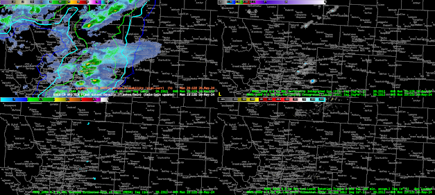
Off to our west, there were a couple cells. Analyzing the tool on GREMLIN, the southern cell was less intense on GREMLIN compared to MRMS, and reversed for the storm to the north. However, neither are particularly intense, but it does indicate to keep a watchful eye and use other products like GLM to assess intensity.
As we move past 22Z and how the WRF with PHS data, it has done an excellent job forming the convection near the Denver Airport, but by Shamrock/Leader/Adena, that cell has not formed. This is creating a region of spurious data due to convective feedback. Some of the model appears to drive convection by the cold pool from this storm meeting instability advecting in from the east. It then focuses on this cell over the others, but this appears unlikely to verify at this point given how it is performing so far. By 00z, the 0-3km SRH bullseye creeps above 1600 m2/s2 moving towards Fremont. I won’t put the image of the new cycle that just came in, but the bullseye got more dramatic over 2000 m2/s2. Not sure if how much those magnitudes are in the realm of possibility.
One of the interesting behaviors lately has been a few storms forming in the cold pool as we approach 23Z. There has been convection developing on the western side of decaying cells. This has me thinking about how this would look for backbuilding precipitation. Would it have this look of the cool purples remain anchored in place while reds for new convection continuously appear to upstream that rides atop the areas of divergence? The signals may not appear robust, since there may not be fast storm motions.
Looking back at LightningCast, I have noted the known limitation of the forecast trying to bridge separate pieces of convection. The gap seems quite large though, and I wonder if there may be other means to QC the LightningCast with existing radar without making it slow to process. Or we can trust that the human eye is capable of noting that radar will confirm the lack of reflectivity at -10 C or higher.
Kadic