Watching a New Updraft Among ongoing Convection
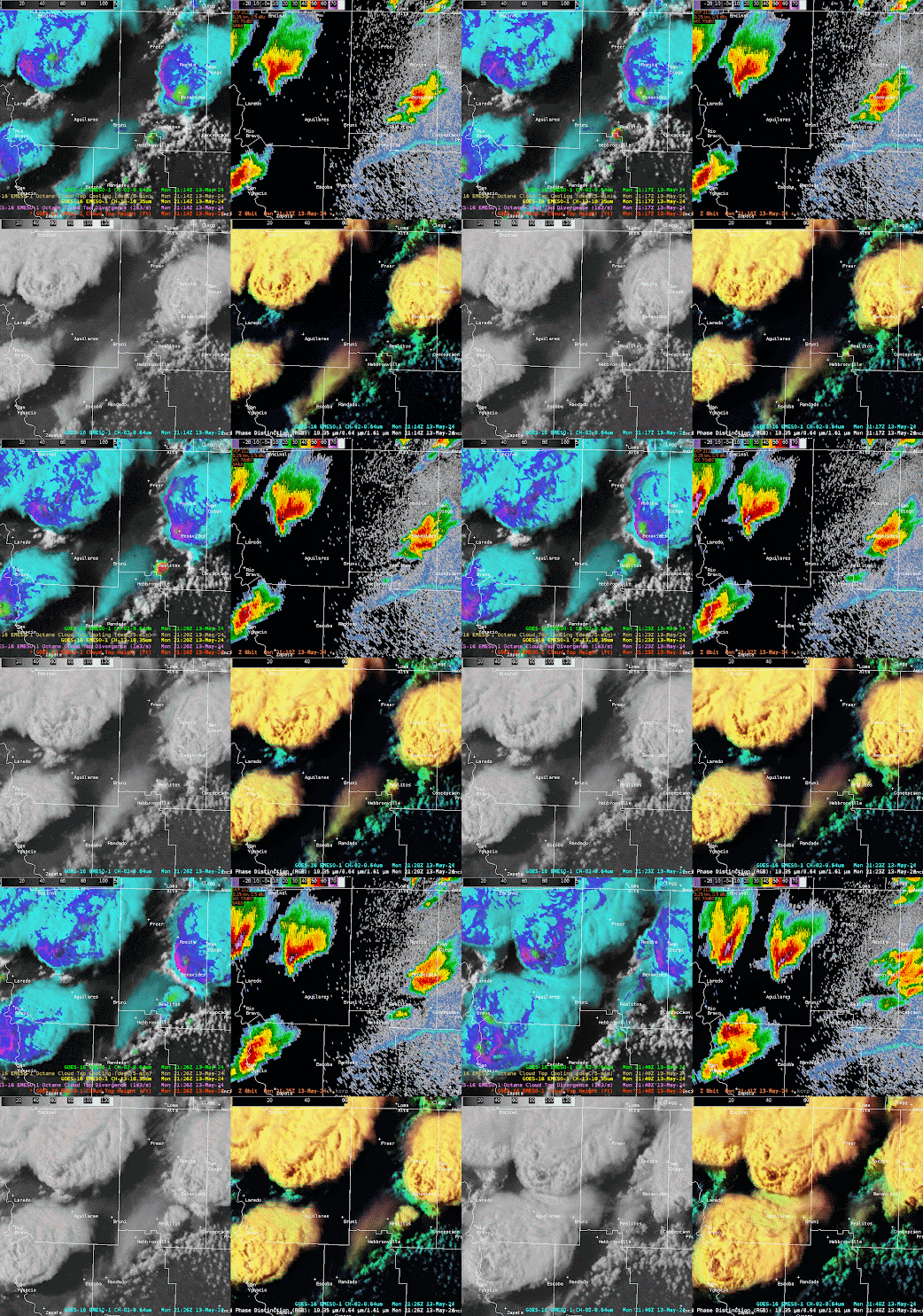
Multiple supercell thunderstorms were ongoing across South Texas along and behind a southward moving outflow boundary within a strongly unstable airmass. At 2115Z, a new updraft began to develop near Realitos, TX to the southwest of an ongoing thunderstorm.
Fig 1: Notice the cooling cloud tops in the CTC image (top right) near Realitos, TX at 2114Z. This updraft is evident in the Day Cloud Phase Distinction RGB and Visible imagery.
About 5 minutes later, the cloud top cooling peaks near Realitos. The first faint radar echo become evident to the southwest of the ongoing supercell.
Fig 2: Cloud top cooling peaks at 2119Z near Realitos. The first weak radar echo is evident to the southwest of the ongoing supercell.
At 2127Z, the cloud top cooling product indicates that cooling has significantly decreased. Meanwhile the cloud top divergence product suggests little to no meaningful divergence is occurring. This suggests that the updraft has weakened and will not likely continue to develop. The latest CRP 0.3 degree reflectivity shows an intensification of the precipitation in this area, but the satellite derived imagery suggests that this intensification on radar is temporary and the updraft will continue to weaken.
Fig 3: Cloud top cooling has decreased and no notable cloud top divergence is observed. There is still considerable “texture” in the visible and daytime RGB. Notice the increase in reflectivity to the south of the ongoing thunderstorms.
The information from the derived products suggest that this updraft will likely not develop into an additional thunderstorm near the outflow boundary. There were several minutes of lead time over radar/visible imagery gained from these derived products to indicate that the updraft would not develop fully into a new thunderstorm. An animation of the updraft sequence is shown below.
wthrman


