
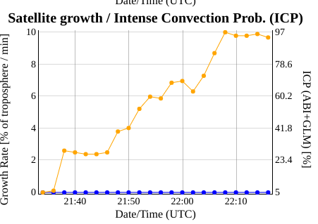
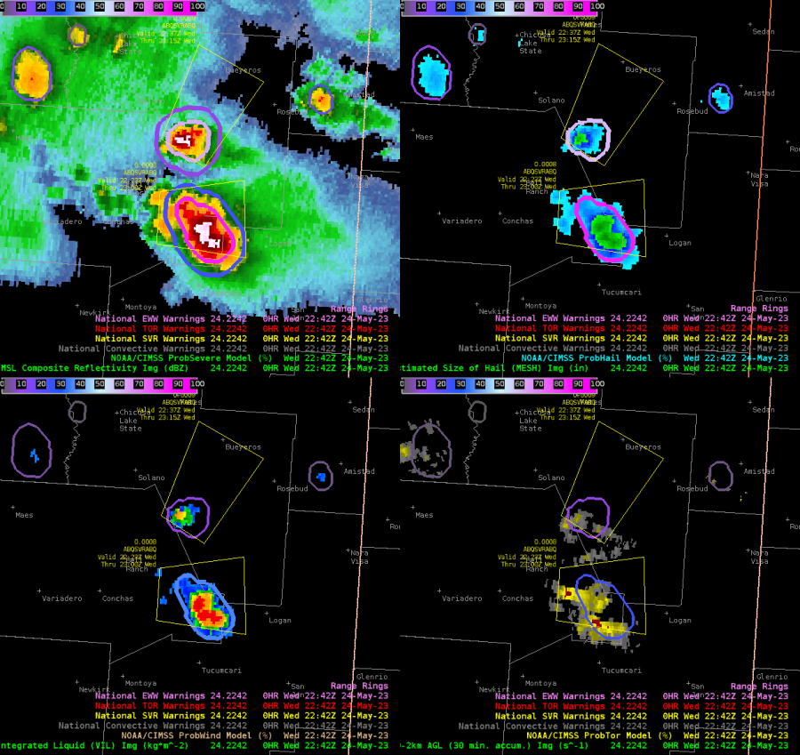
A severe thunderstorm warning decision in eastern New Mexico was a challenge today as it was within a KABX beam blockage and the eastern NM radar, KFDX, was down. The signs of the intensifying storm were found on satellite, GLM, and then slowly ProbSevere as the radar reflectivity heights from KAMA (the nearest valid radar) were very disorganized and slow to respond compared to the trends depicted by satellite and GLM trends. An above anvil cirrus plume, IR thermal couplet, consistent GLM FED/MFE signature, and cloud top divergence depicted by the Octane Speed/Direction product showed signs of strong convection developing. While reflectivity below showed just a minimal 50 dbz core and no 60 dbz core. As ProbSevere V3 gradually increased to around 35%, the ProbSevere Satellite Growth/Intense Convection Prob. quickly increased. The satellite growth/Intense Convection is not weighted as high in V2 and because of that ProbSevere was much lower at the same time. While the radar reflectivity core was still missing, we decided to issue a warning for the storm given the other satellite based signatures. ProbSevere V3 began to show strong chances for severe weather approximately 13 minutes after the warning was issued, and a strong 60 dbz core developed on the KAMA radar shortly after with MESH getting as high as 3.5 inches.
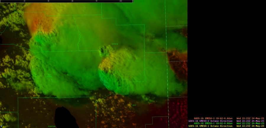 GOES-16 Octane Direction.
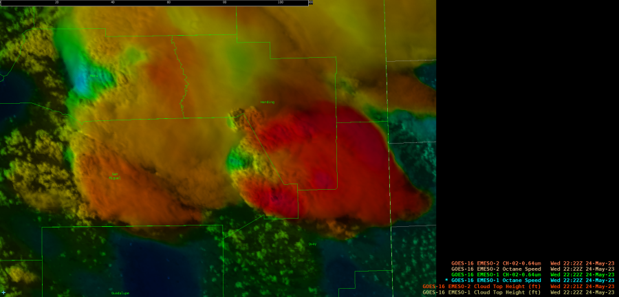
GOES-16 Octane Speed.
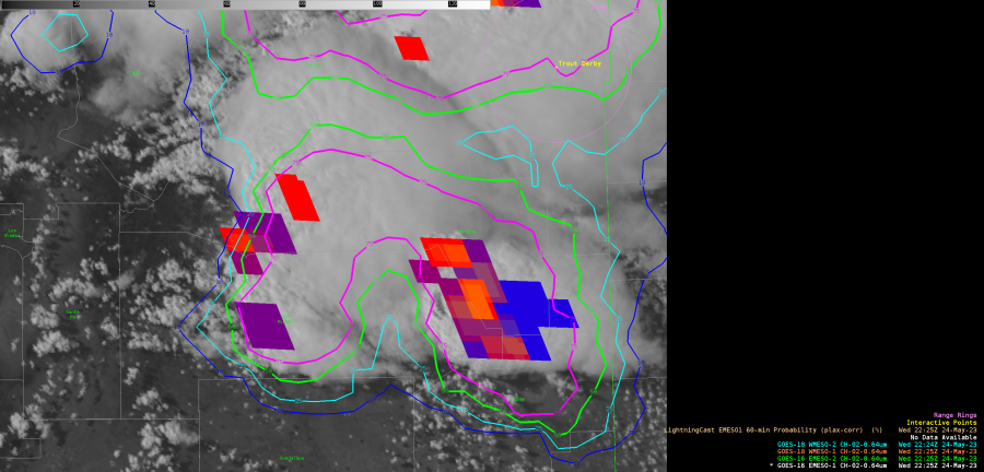
GOES-16 GLM RGB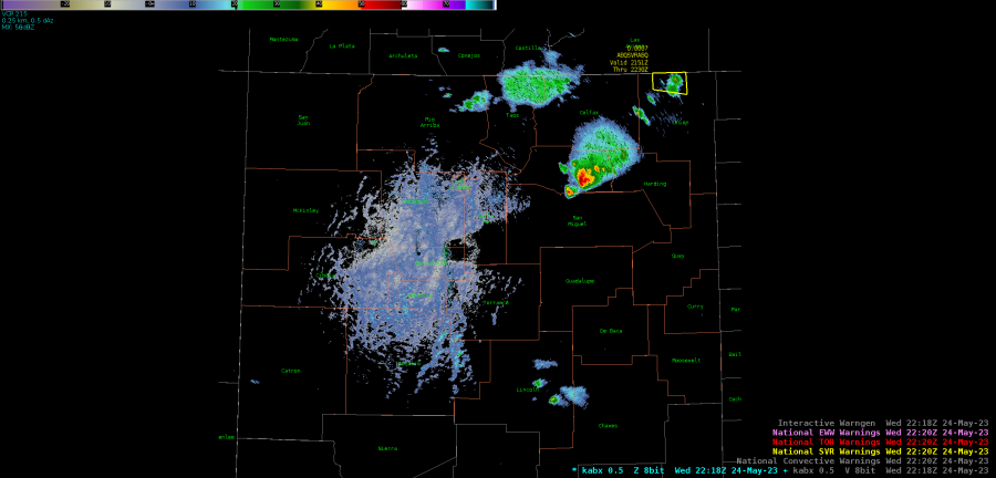
KABX 0.5 degree reflectivity.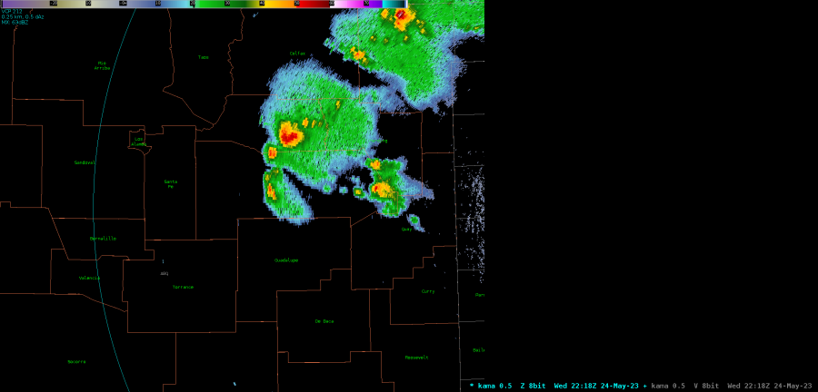
KAMA 0.5 degree reflectivity.
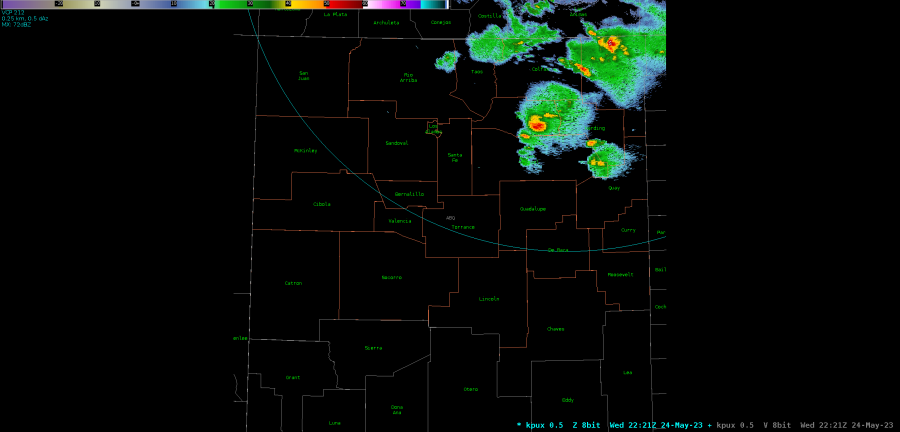 KPUX 0.5 degree reflectivity.

 _
_
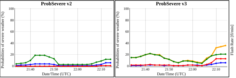
ProbSevere probability charts.
MRMS output showing radar data approximately 20 minutes after warning issuance.
-Thunderstruck
– Joaq