

Our team was assigned to the Glasgow, MT WFO on this day. The area was primed for explosive convective development, with the “triple point” over the CWA. The dryline, cold front, and warm front were all apparent in radar imagery prior to convective initiation.

Although the main “action” fired east of the dryline, in NE Montana and eventually NW North Dakota (see SPC Storm Reports), a few robust storms also developed in the highly-sheared environment over the SE corner of the Great Falls, MT CWA.

A splitting cell was noted in radar imagery from KBLX (Billings, MT). There was an mPing report of one-inch hail with this cluster of storms.

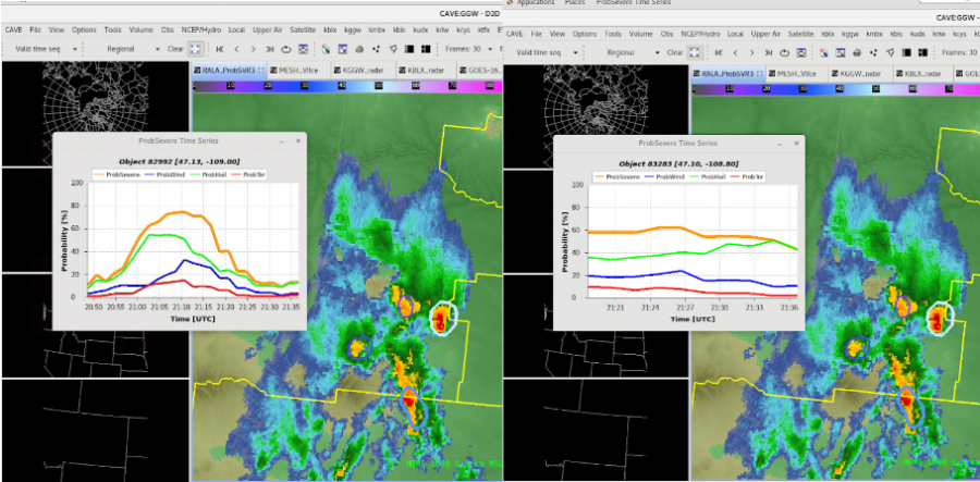
Suppose you were thrown into radar duties without time for a full-on environmental analysis. In an environment conducive to splitting cells, ProbSevere3 can quickly provide guidance allowing the warning forecaster to anticipate which cell will become dominant.
– Professor Frink