
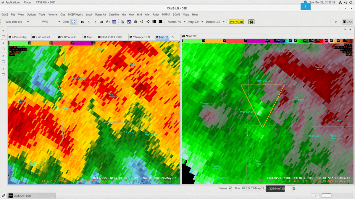
In this case the NTDA was able to detect strong azShear in a messy reflectivity signature. It was difficult to detect any reflectivity signatures with a cell that was approaching New Madison due to a cell merger. There was also evidence that the cell was weakening from 1:30 Z to 2:00Z. Cloud tops were warming on IR, the reflectivity core was falling and lightning count and VII were also much lower at 1:45Z than 1:30Z. But the NTDA picked up on a quickly strengthening velocity couplet. The 0.5° beam was also about 5kft agl which lowered forecaster confidence in a tornado warning.
At 1:55Z NTDA probs were at 20% and quickly strengthened to around 50% at 2Z then peaked out at 84% at 202Z. Looking at the velocity data at 201Z I may have assumed that there was a daliasing issue since there was such a rapid increase in the outbound velocities at 0.5°. Had I not already had a warning in place from when the storm was stronger I’m not sure I would have issued one for this couplet. But we had an LSR at 205Z near New Madison with a tornado possible tag. The NTDA was very useful to pick up on this signature when most of the other data showed the storm weakening overall and the reflectivity was not very helpful.
There were two other interesting features of the NTDA for this case. At 202Z the azShear, divShear and Abs Velocity max were all decreasing from the previous scan but the probability actually went up from 72% to 84%. Another interesting thing was how quickly the probability decreased after the peak of 84%. 2 min after the peak, the prob dropped to 3.3%. I was not expecting to see probability drop this rapidly. Albeit the velocity signature was much weaker.
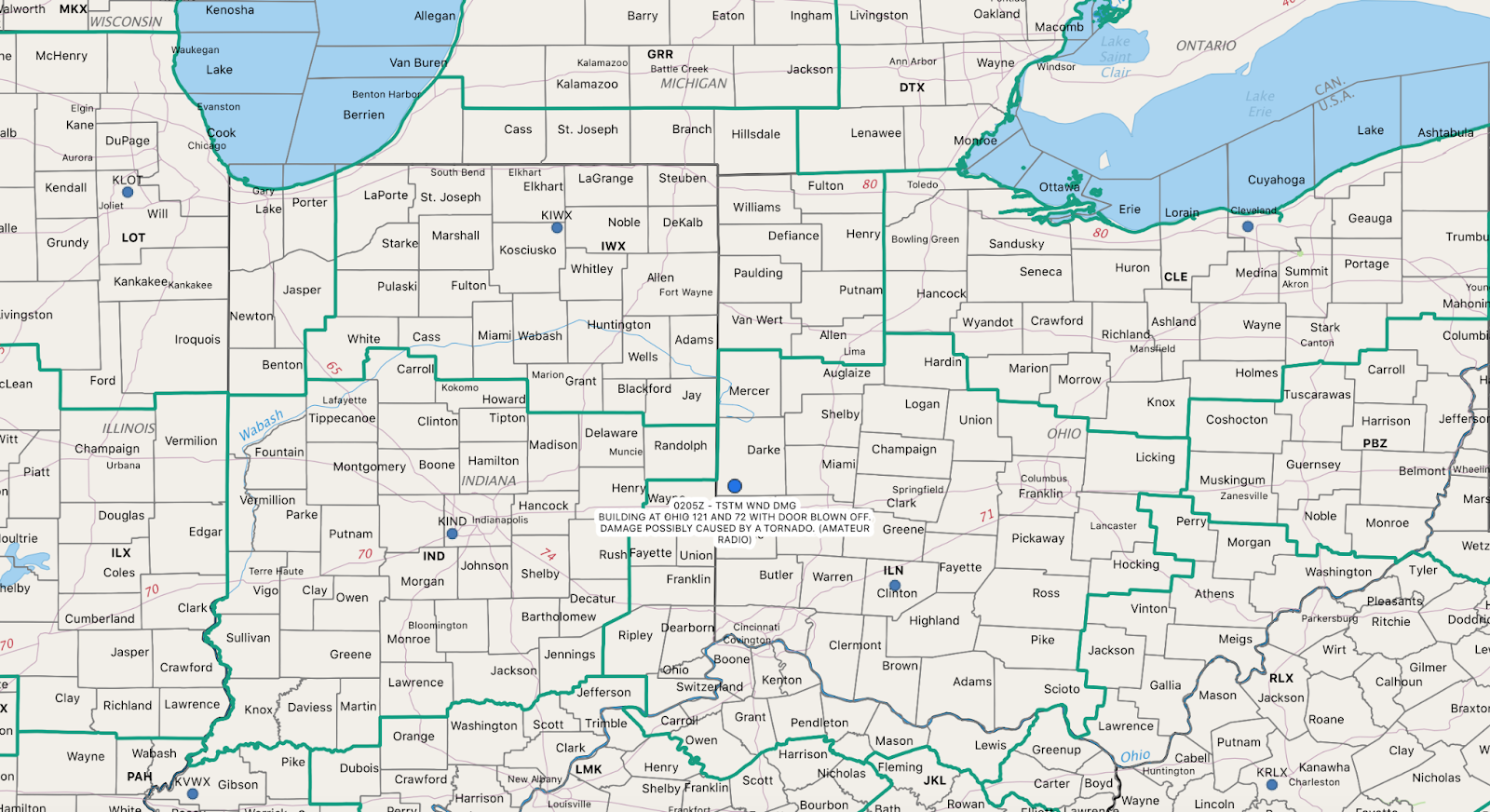
BUILDING AT OHIO 121 AND 72 WITH DOOR BLOWN OFF. DAMAGE POSSIBLY CAUSED BY A TORNADO | Darke County | Near New Madison
– Gerry Bertier