New cell popping up on edge of cloud shield. Got a head start on wind potential here with 50 mph SPS and pea sized hail.
Charley
Official websites use .gov
A
.gov website belongs to an official government
organization in the United States.
Secure .gov websites use HTTPS
A
lock (
) or https:// means you’ve safely connected to
the .gov website. Share sensitive information only on official,
secure websites.

New cell popping up on edge of cloud shield. Got a head start on wind potential here with 50 mph SPS and pea sized hail.
Charley


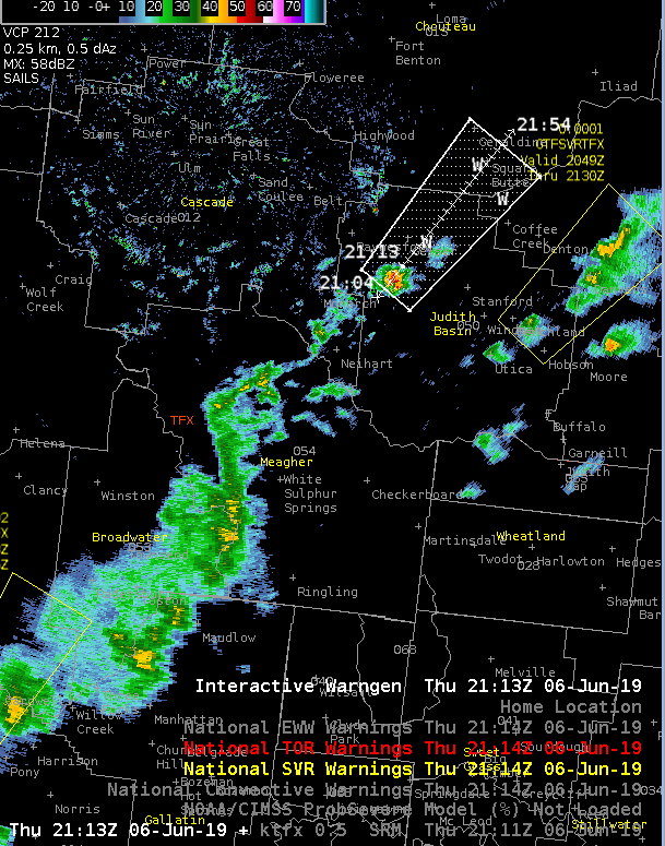
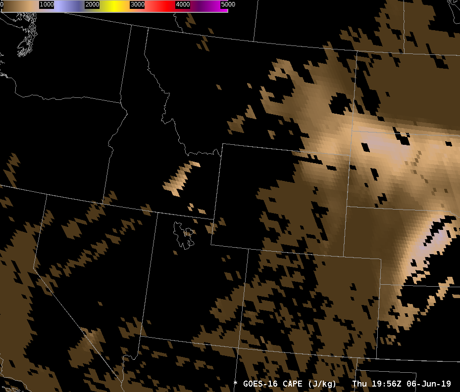
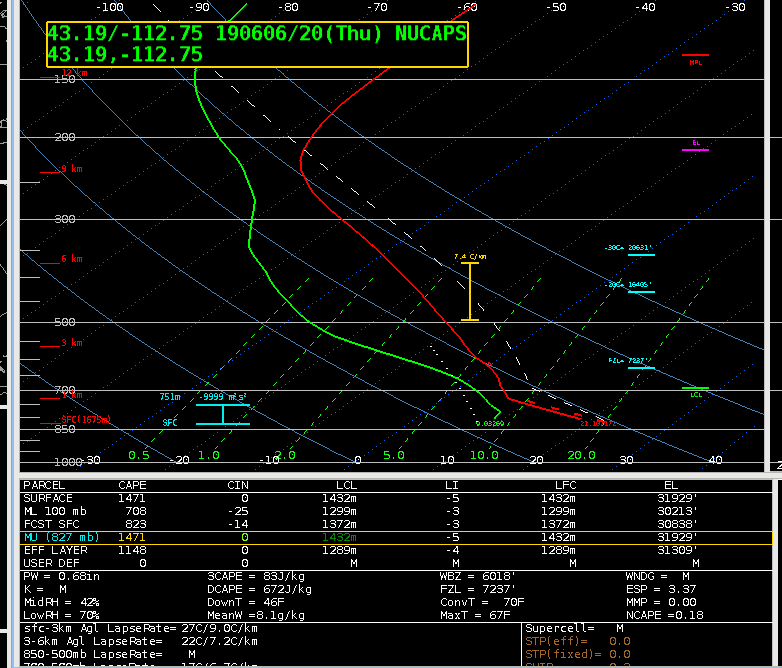
Point in eastern TFX area shows higher CAPE on the latest RAP sounding from SPC, compared to the modified NUCAPS sounding. That area is popping now with new cells.
Charley
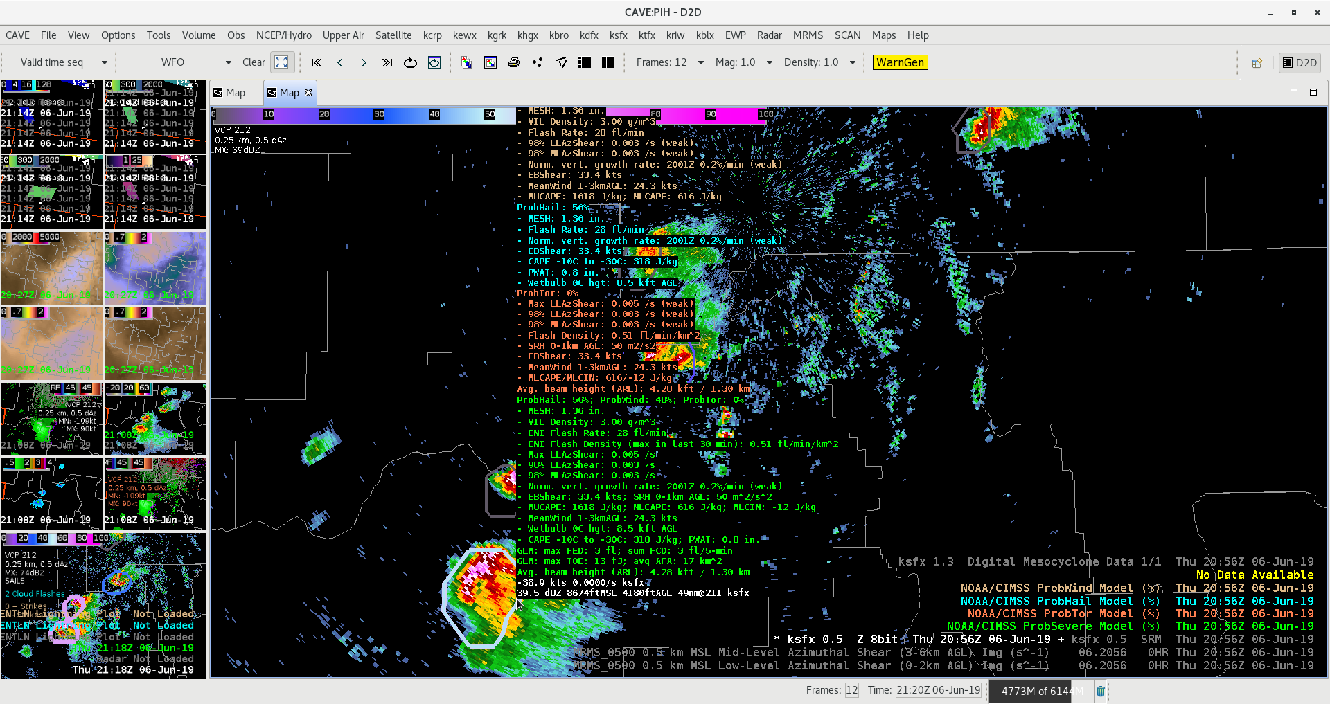
Had an interesting opportunity to watch a quickly intensifying cell relatively close to the radar. While ProbHail did a decent job monitoring the trend in this cell, its (2 to 4 minute) latency in an environment conducive of rapidly intensifying cell could possibly lead to a reduction in Lead Time. By monitoring the cell via All-Tilts BR/BV/CC/ZDR and GOES-East Satellite Imagery via Mesosector, I was able to get roughly 5 additional minutes of lead time on my warning (ProbHail was less than 45% by warning issuance). A good reminder as to how the ProbSevere suite is best utilized as an additional tool, and not necessarily the deciding factor in warning ops, especially in freshly forming cells.
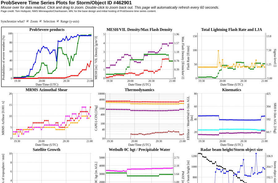
Quick update: The earlier warning did verify with quarter-sized hail. I did find some utility with the ProbHail when it came to making the decision to re-issue the warning or not, especially as the storm began to near the “cone of silence.” Accessing the time series which continued to show >95% ProbHail and a quick glance at a neighboring radar, I had enough forecasting confidence to continue the warning downstream.
—————————————————————————————————- Mountain Bone
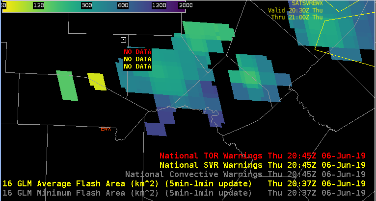
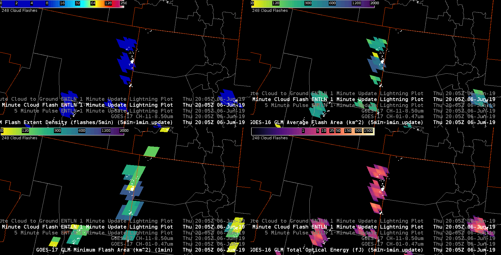
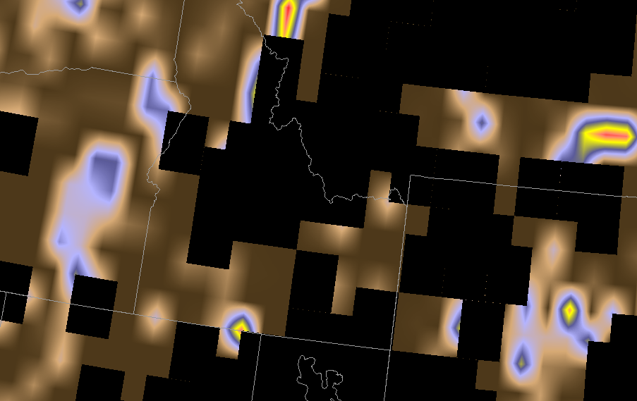
An adjustment in the color scales for the GLM Avg Flash Area and Minimum Flash Area to something of blue in the “cool” end to bright red in the “hot” end, signifying active and new convection, might help forecasters better interpret the data quicker.

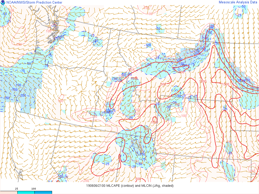
Had separate reports of 51 and 58 mph from earlier storms in the area. ProbSevere wasn’t very high in those cells, and neither was the lightning FED. Given a high DCAPE environment, decided to pull the trigger a little earlier on some of the stronger cells going up.
Charley
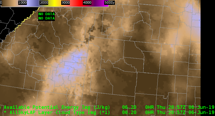
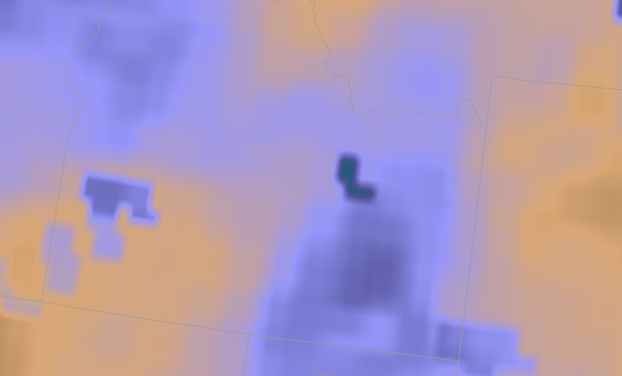
Just prior to 20z the All Sky LAP CAPE shows 1000-1200 J/kg of CAPE across eastern ID. However, most of this is in a cloudy or GFS layer depiction. Looking at the GOES 16 derived CAPE, it only shows a narrow region a calculated data in eastern, ID that is about half (500-600 J/kg) of what is shown by the All Sky LAP.
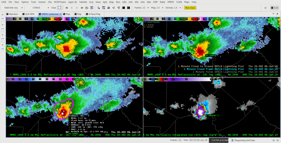
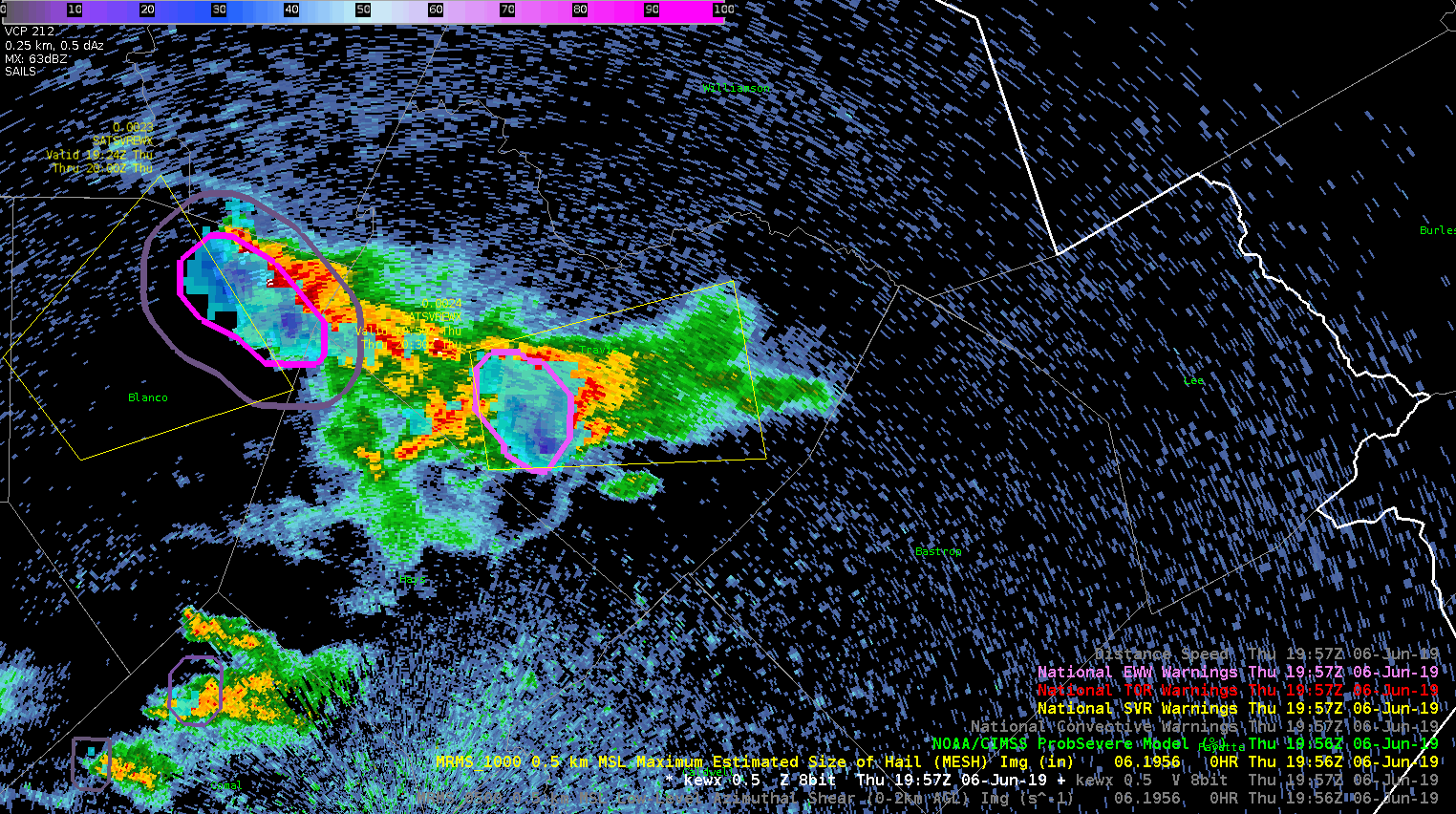
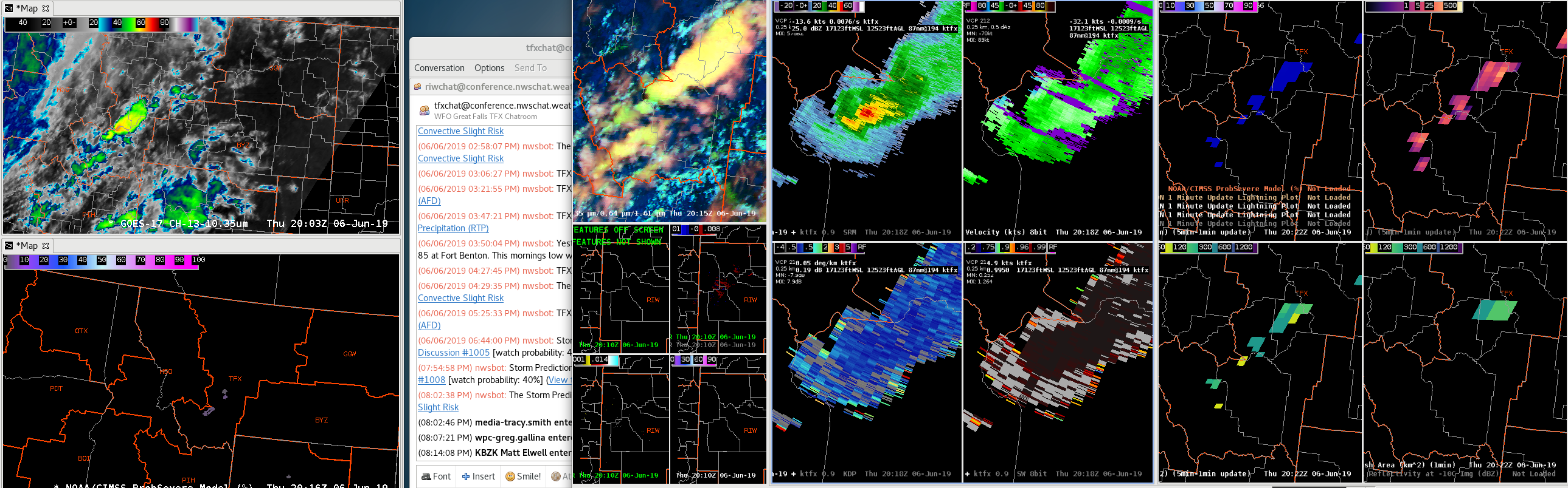
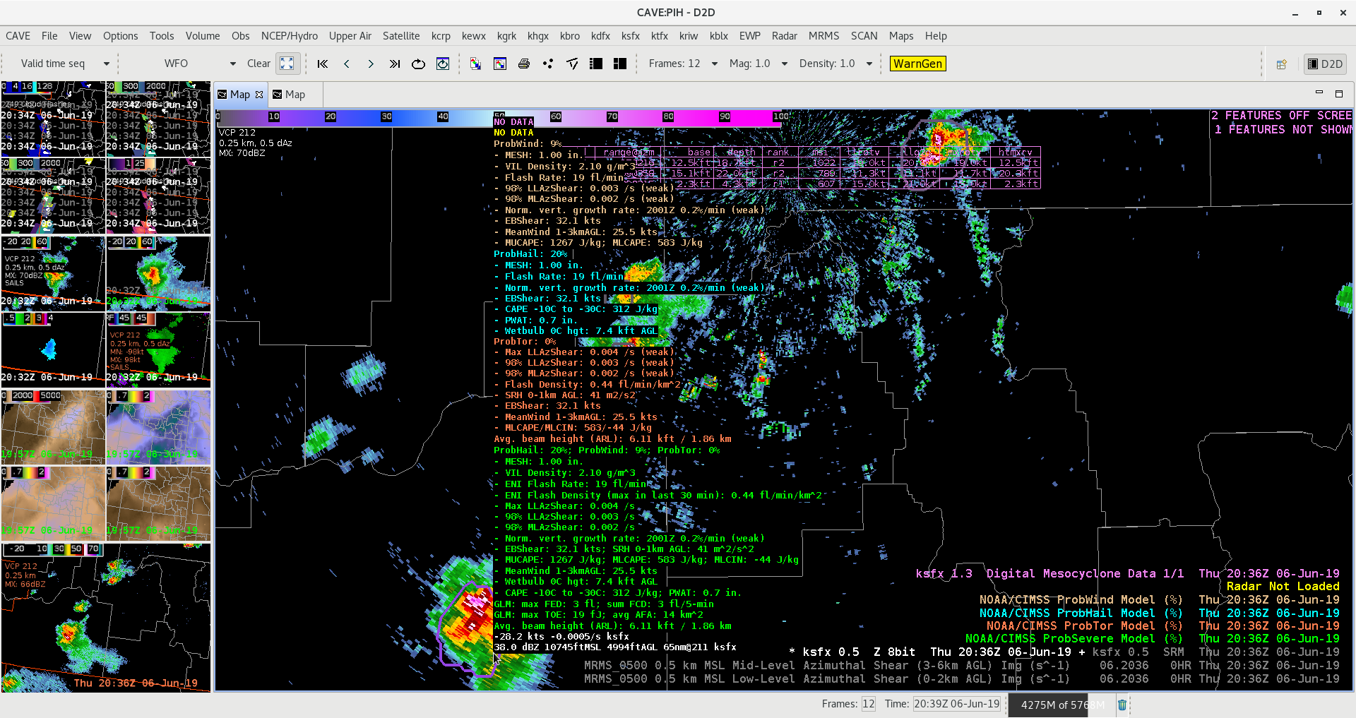
Across the EWX CWA, we’ve had a number of splitting cells. The gif below includes 0.5 reflectivity with MESH & ProbSevere overlaid. As the cell begins to widen north-south, both MESH and the ProbSevere polygon elongate and split.
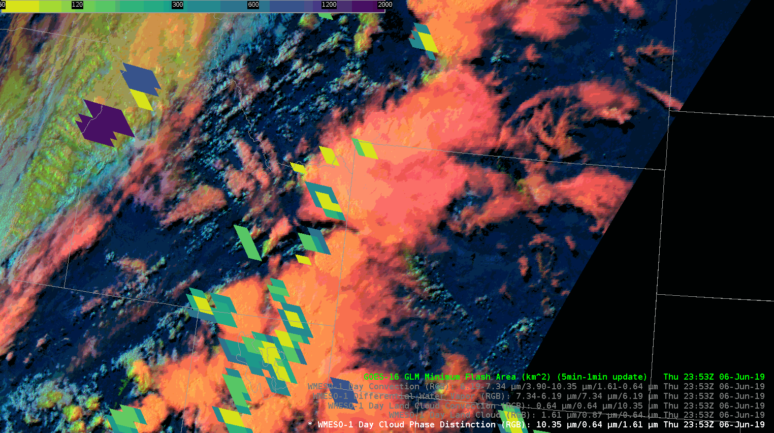
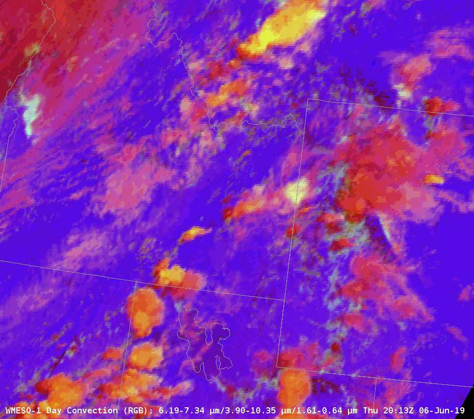
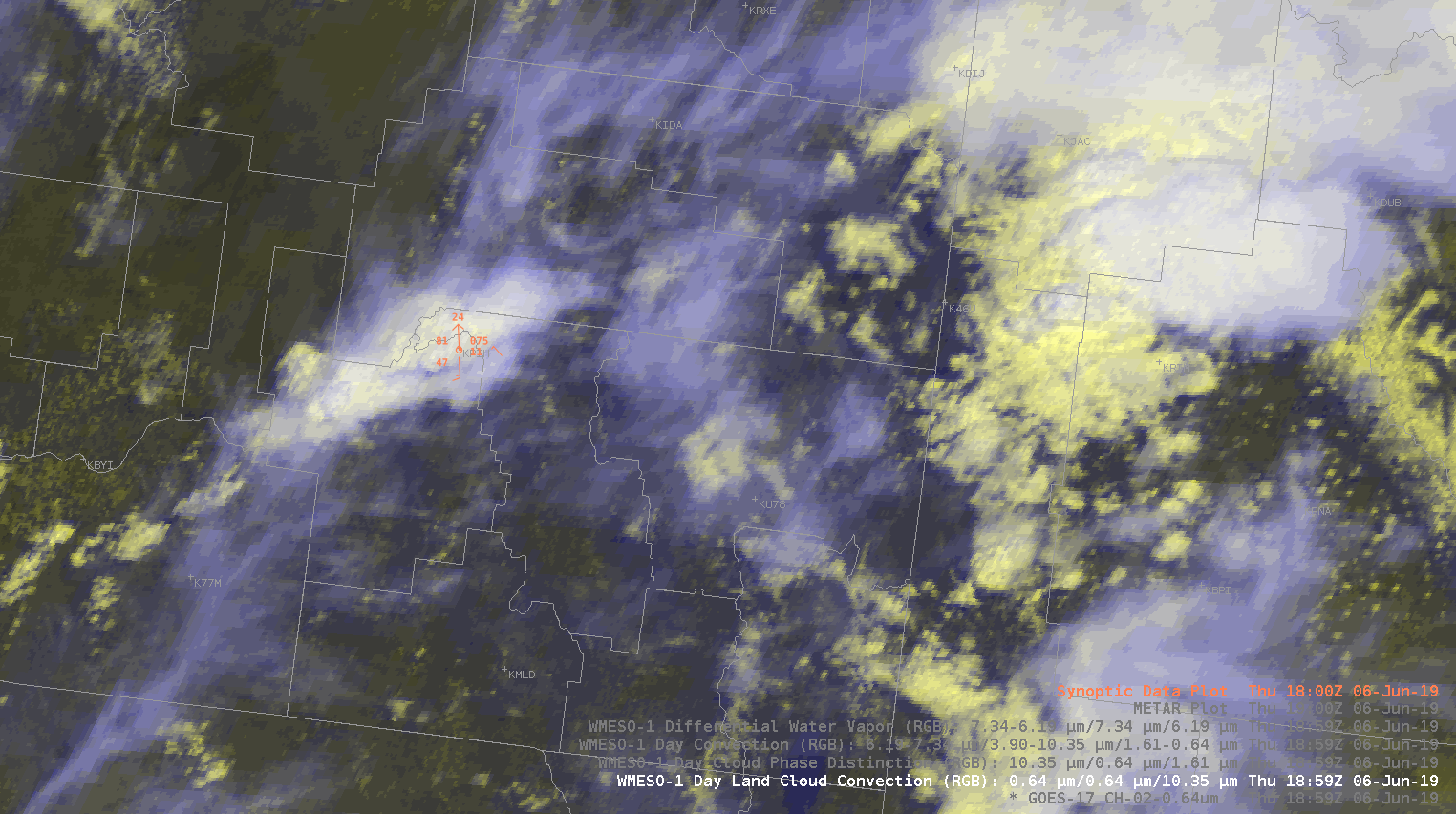
The day convection RGB depicts stronger updrafts moving from northern UT to southern ID as of about 2030z. This area is under a severe thunderstorm watch with no warnings in effect at this time.
IR shows that cell as having the coldest cloud top. Donovan heights are around 20 kft for 50dbz to get 1″ hail. This cell is near it, but ProbSevere is not too excited about it just yet. MESH is under dime-sized and thus ProbHail is 7% now. Will monitor for further development. Issuing SPS for pea sized hail now.
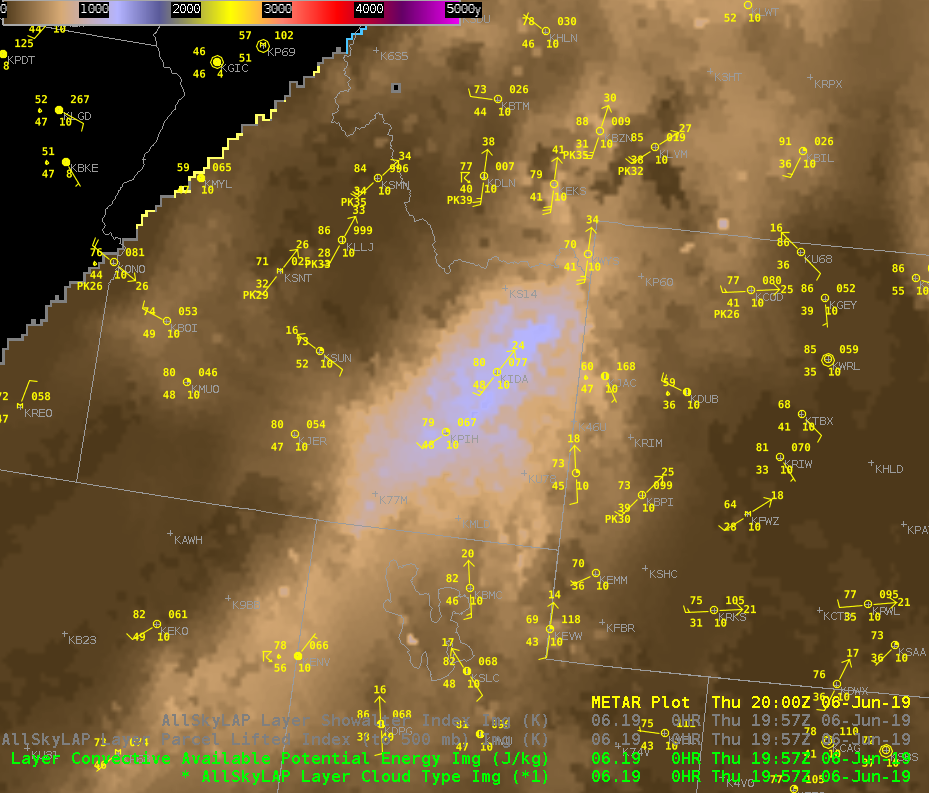
We’re currently monitoring conditions in eastern Idaho. Right now I’m using various applications to analyze and initialize current conditions. Currently AllSky is showing cape around 1000kj, and PWATS around .80 inches.
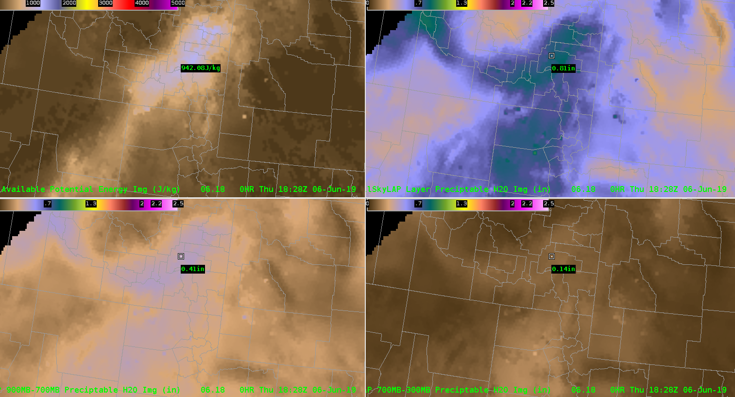
That PWAT value on the morning sounding just west of the area was close to .64″. Seeing how moisture levels are lower to west I can interpolate that the moisture values are similar to what’s show on allsky. The allsky 900-700mb also seems to pick up on the relatively moist area in the lower half of the atmosphere.
Looking downstream we’re noticing a line of developing convection using the Day land cloud RGB. It’s helpful to analyze just how high the tops of the storms are getting combined with cloud tops.
Zooming in closer I can examine the few storms that have popped up more closely. The RBG help the differentiate between the ambient cirrus clouds from the growing storms. That might not have been as easy to see using a typical visible view.
The AFA and Minimum flash area maximums are hinting at growing convection just downwind. That growth leads to me to anticipate further intensification as these storms move into a more favorable environment in eastern Idaho.
As storms begin to intensify probsever eis picking up on the strongest activity. Probsevere began to ramp up for the cell just south pf Pocatella. That combined with traditional radar methods lead me to issues a warning for that cell.
A similar situation unfolded with a south just south of CWA that I debated on warning. The probsevere values did show and uptick. Eventually the storm fell apart as it pushed into southern Idaho.
We’re watching a few cells in the southern half of the viewing area. As NUCAPS comes in I’m comparing it the allsky cape. The allsky cape is around 1100kj.
The modified sounding is putting out about 700kj of ml cape. While the nonmodified is much lower down to 500kj.
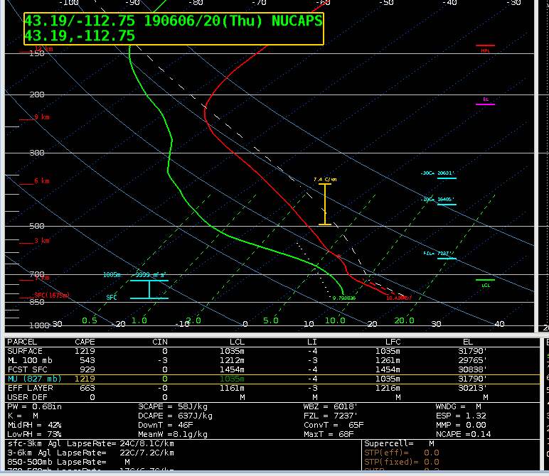
We don’t have a midday sounding to see which one is initializing the best. For what it’s worth. The rap cape output is around 500kj.
The TPW was close to the observed pwats as well. It was outputting about .65″.
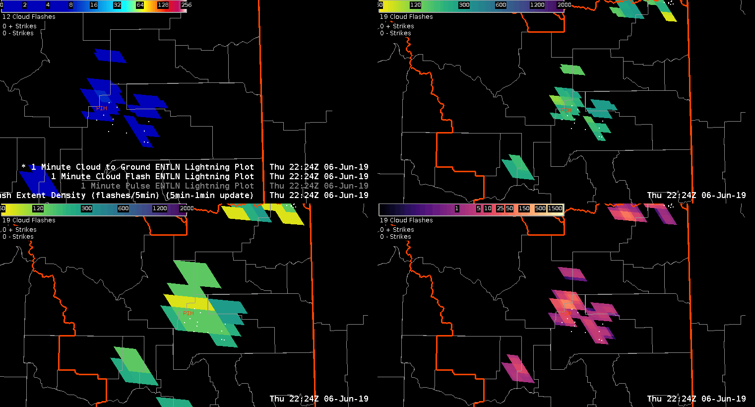
The FED has been fairly low this afternoon which isn’t typical for what I have been usually see. However, the AFA and the MFA are higher indicative of growing updrafts. I’m thinking the FED might be lower because of potential hail in the updraft.
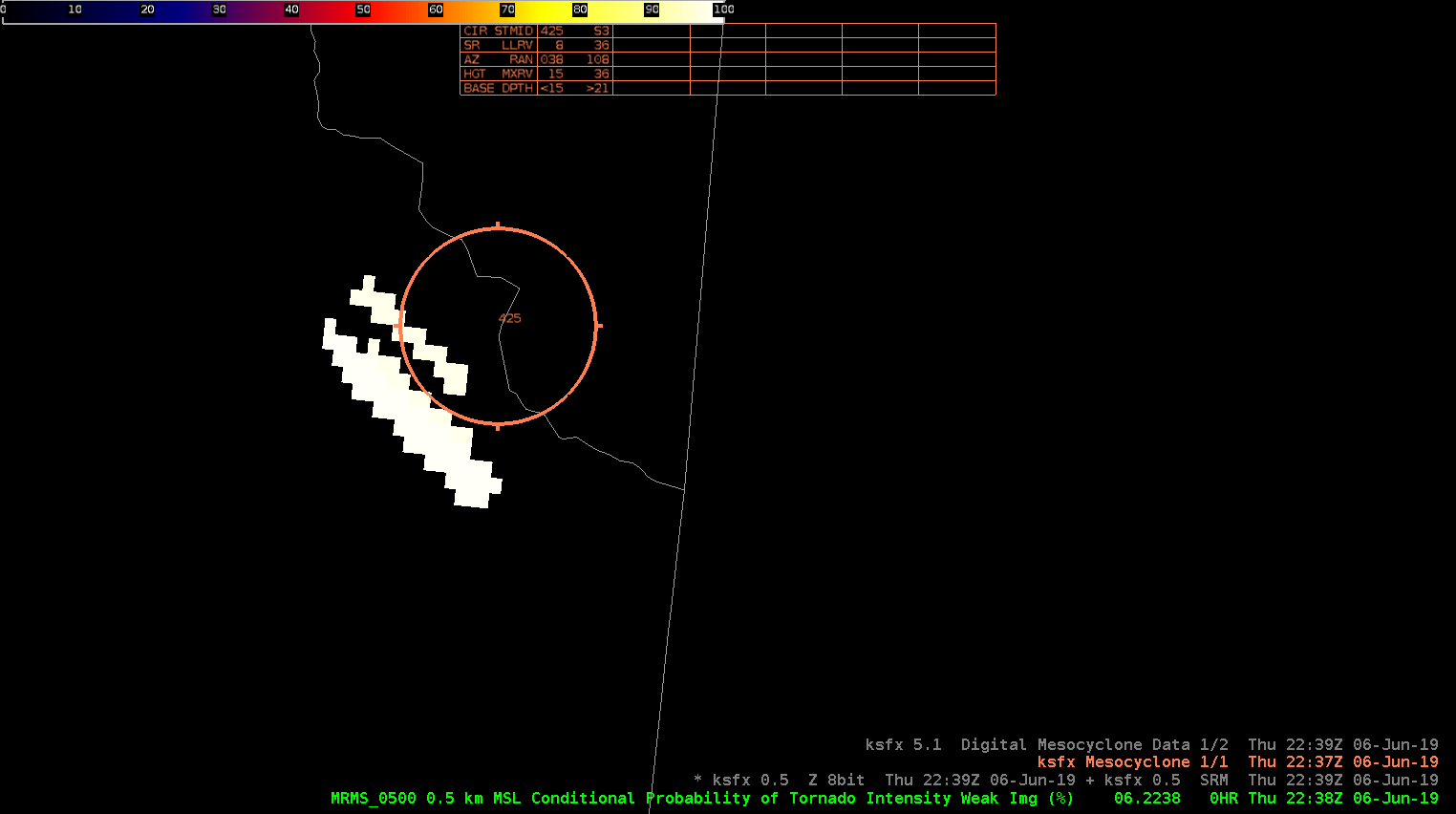
The cell pushing out of Freemont county Idaho continues to intensify as it pushed into Montana. Both the MD, and NMDA were picking up on a high meso that was clearly seen on SRM.
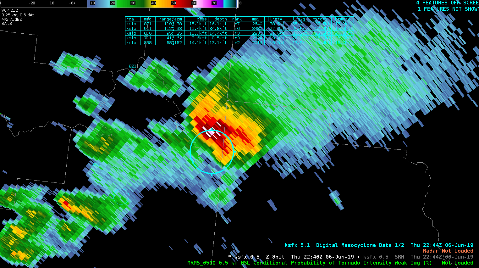
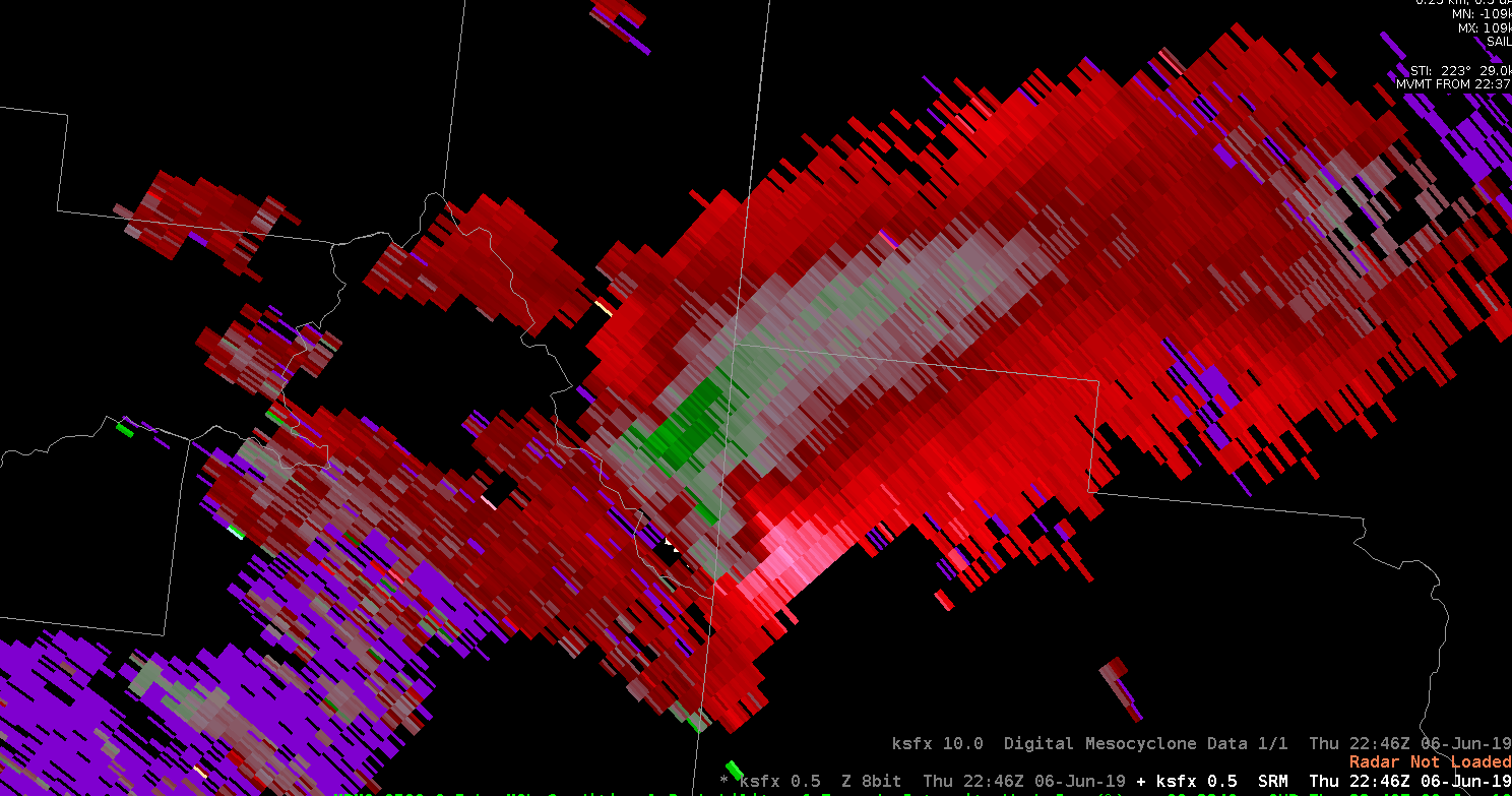
The CPTI was showing high probabilities as well. I still wasn’t as concerned about a tornado threat due to how high the base of the storm was. It was interesting to see though.
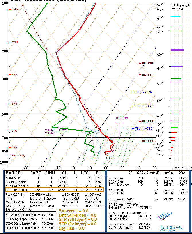
The forecast cape and cin values came in from the NUCAPS, but it wasn’t usable for my area because their was a lot of missing data.
The actual Pocatella office issued a warning for Freemont county. Using typical radar methods the storm didn’t look like it warranted a severe thunderstorm warning, but satellite and MFA showed new convection was still firing up. Right after looking at satellite there was a report of a 54mph wind gusts.