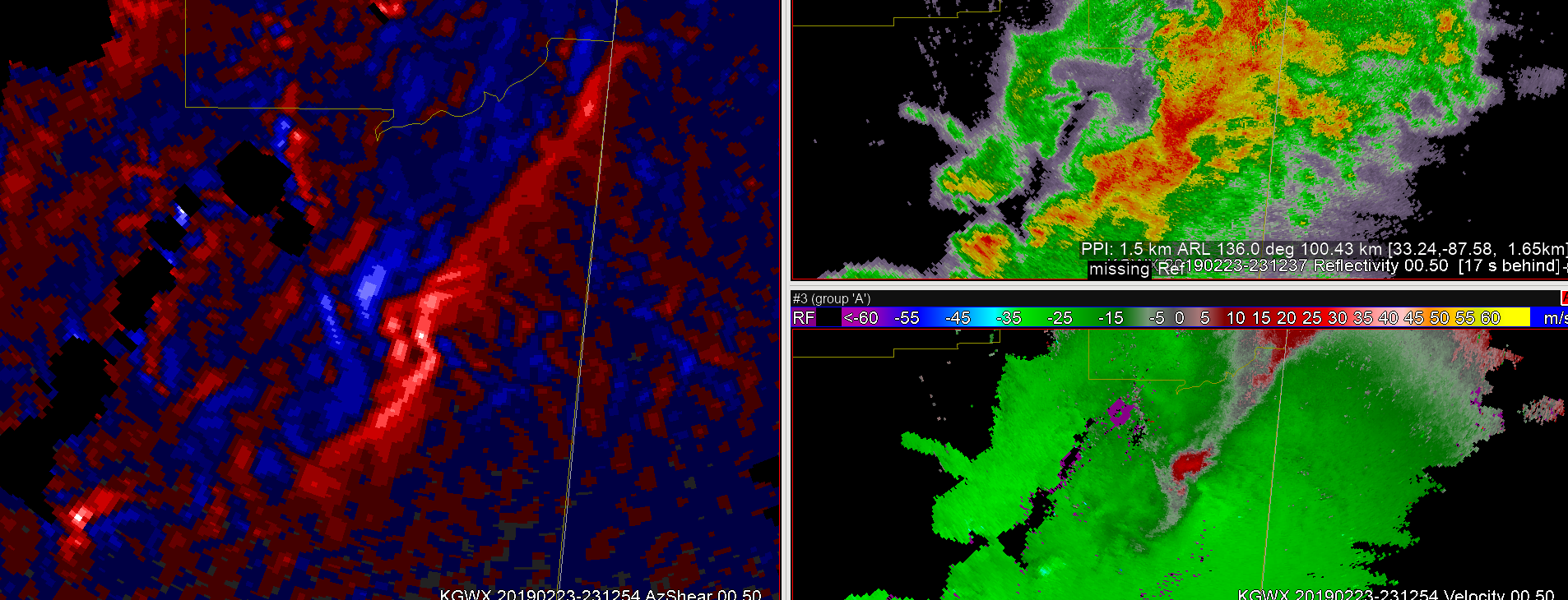
At first exposure the single radar AzShear product appears to highlight mesoscale regions of interest. Looking at the 2/23/19 ern MS/wrn AL case beginning around 2308z there is a broad area of reflectivity with some evidence of an embedded supercell in east-central MS. The AzShear product shows a linear region of positive values with enhanced values around the potential circulation. Advancing to 2312z the linear AzShear feature has now taken on an S-shape, with enhanced values immediately northern portion of the S. At this time there is a broad low-level circulation.

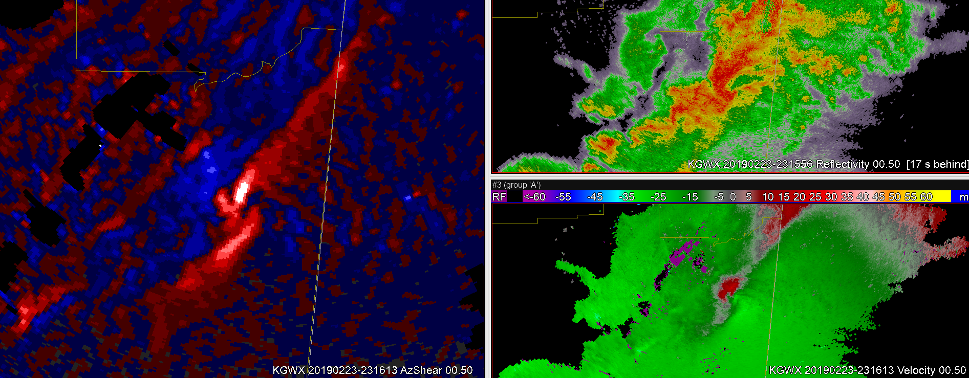
By 2316z, there is now a break in the ‘S’ in the AzShear, and at this time the low-level circulation is tightening as a supercell is apparent in the reflectivity.

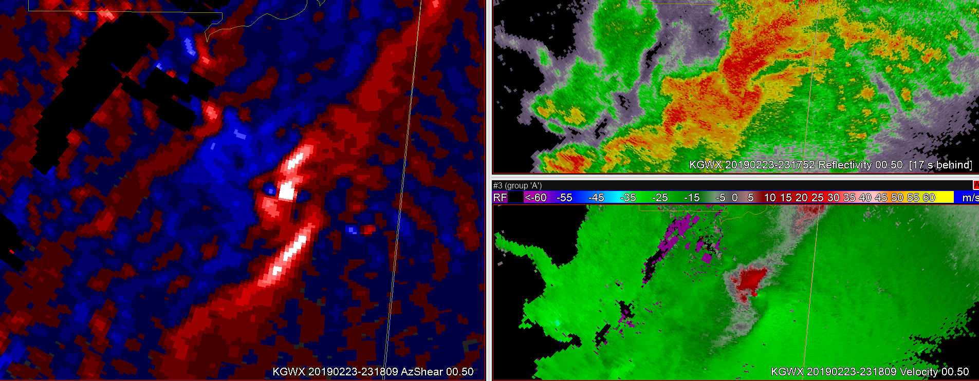
About two minutes later the low-level 0.5 degree circulation is now gate-to-gate. AzShear values are high at the circulation, but also highlight shear along the interface of the FFD and the inflow, as well as along the RFD region.

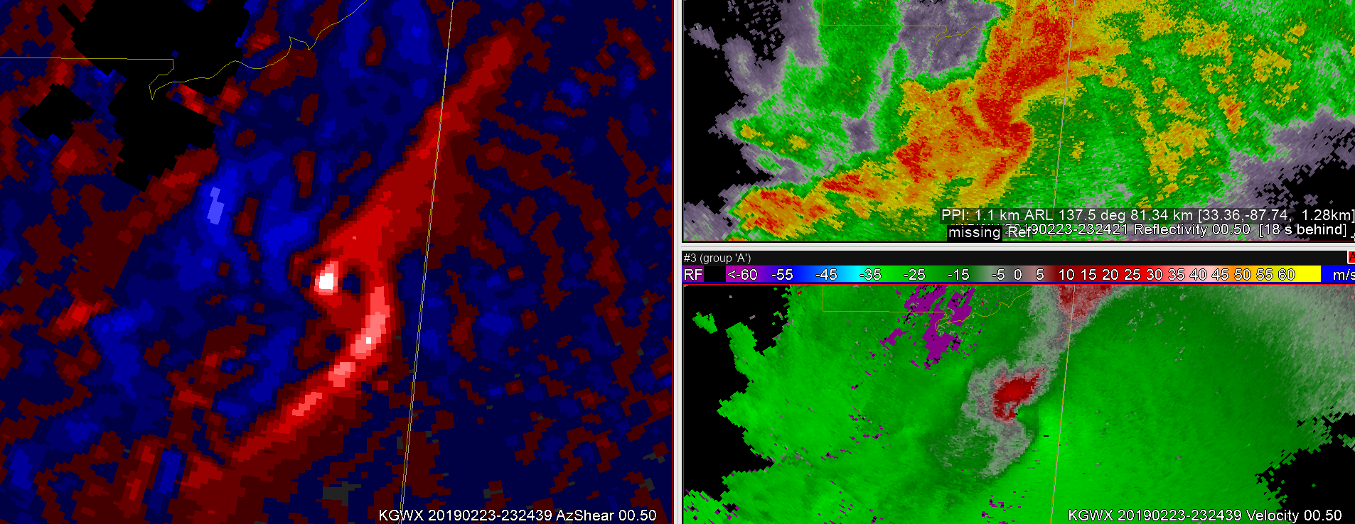
This same general pattern would continue for the next several minutes. However, by 2324z the trailing RFD or mesoscale cold front pushes ahead of the main circulation and merges with the FFD/inflow interface as the storm appears to mature and the main circulation becomes occluded.

After this time the main circulation fades and the convective organization appears to either transition or recycle. In summary, the single radar AzShear product appears to highlight other regions of interest where shear is present outside the main circulation. These features are important in tornado development and supercell life-cycle, but are not always apparent in reflectivity or in velocity. Of note, the detail in the single radar product has a tendency to become lost or muted in the merged product.
One challenge would be color scales for different portions of the country. Would a color scale for the southern plains be sufficient for the mid-Atlantic, or would smaller weaker features be less noticeable?

