
Hi all,
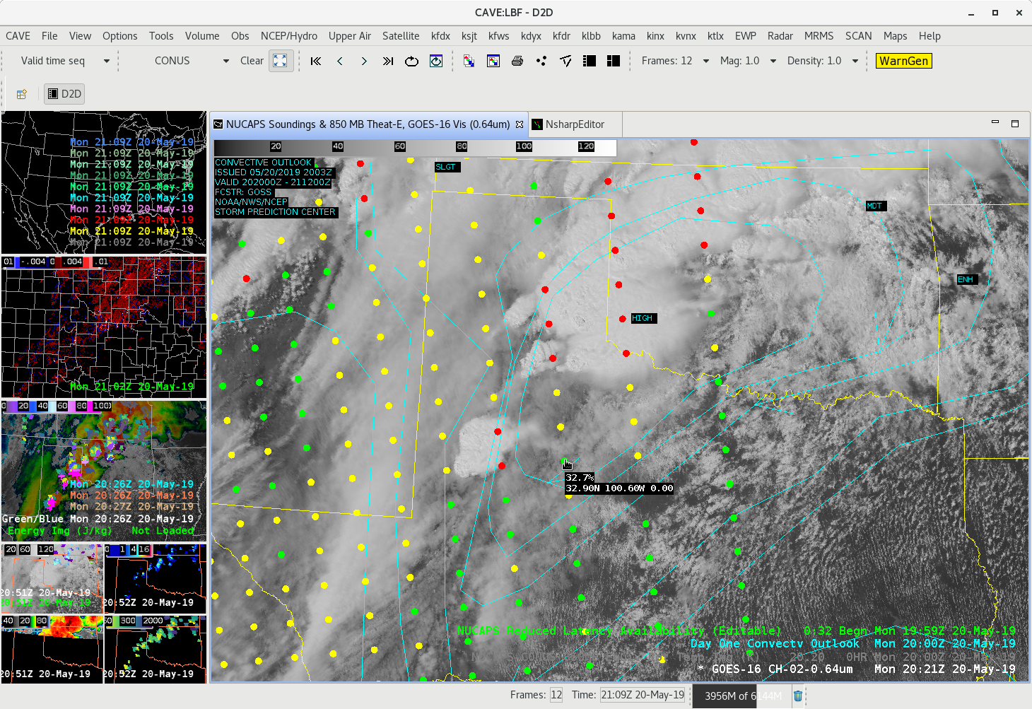
Ok, just a couple of quick observations and comparison of a NUCAPS (direct broadcast) sounding with a modified sounding over an area of interest this afternoon. The NUCAPS sounding locations and the particular sounding of interest can be seen in Image 1 below.
The next image below (image 2) shows the Direct Broadcast NUCAPS sounding valid ~2000 UTC 20 May 2019. The sounding indicates high CAPE values at this sounding location (~2800 J/Kg MUCAPE, and 2400 J/Kg MLCAPE), and steep lapse rates aloft, in excess of 8 C/km. This type of atmospheric profile would support severe weather in the area today.
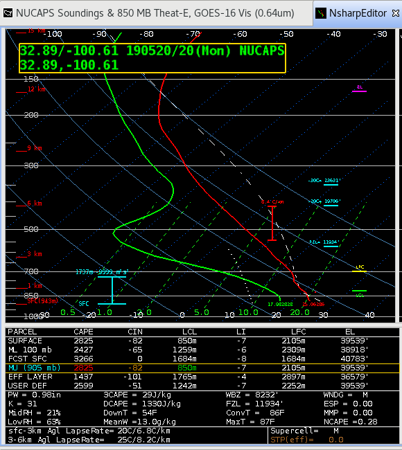
The next image is the modified sounding taken at the same location. Notice the increased CAPE values…

By the way, soundings in this general area, including the yellow soundings indicated high CAPEs with “reasonable” looking values. However, there was a fairly significant gradient noticed in overall low-level instability noticed in soundings to the east of this location. This could be a good case for the NUCAPS team to go back and take a further look.
-Kris W