
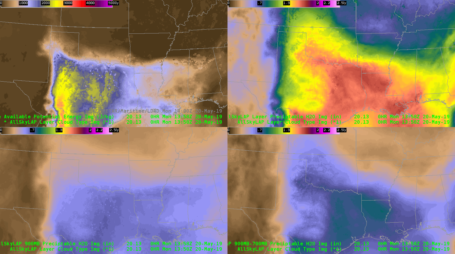
A 4 panel showing CAPE (top left), along with 3 different PW images shows the moisture and instability profile across the panhandle region eastward into the southern Plains. The CAPE images show the warm frontal boundary lifting north through the morning, with instability eventually spreading into the far southeastern corner of the AMA CWA. The dryline shows up well in the surface-900mb PW imagery (bottom left) as well.
-64BoggsLites