

Short answer: Yep.
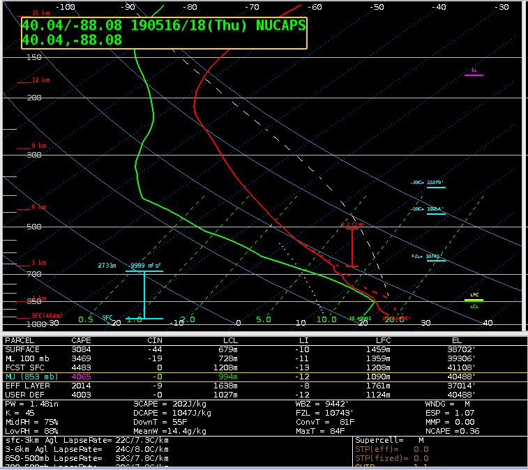
Since there were no 18-19Z special soundings from the IL/IN area, I looked to the AllSkyLAP CAPE which was only getting GFS retrievals in the ILX area. Those values were around 2300 J/KG or so. The NUCAPS modified sounding near Champaign/Urbana, IL (shown above; the closest green dot to the storm that produced the severe hail), suggested more than 3500 J/KG of MLCAPE. Yesterday’s NUCAPS soundings suggested that the NUCAPS CAPE values were a bit high, but the ProbSevere MLCAPE values at the time of the baseball size hail in Westville (2105Z) were near 2773 J/KG. So, yes, plenty of sources suggested high CAPE and thus there could be large hail in the area.
Also of note: The operational GOES 16 CAPE did not show any values because of clouds across the area.
-Tempest Sooner