
A late season trof moving onto the west coast has everyone east of the Rockies excited for tomorrow and the weekend. It is associated with an unusually late season and significant rain event throughout CA with afternoon storms scattered about in the central valley, deserts, and Sierra Nevada. The GLM was able to detect lightning in several storms in CA and NV. NOAA-20 made an overpass around 21Z and provided several viable soundings in the San Joaquin Valley and near the CA coast.
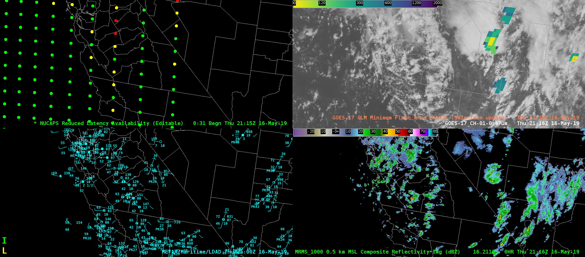
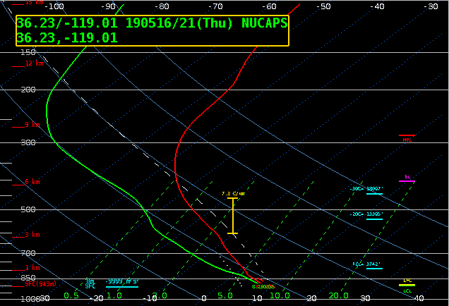
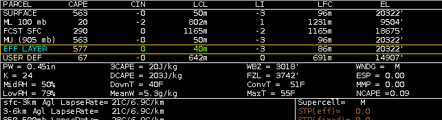
The NUCAPS sounding centered in Tulare County is shown below. MUCAPE values on the order of 563 J/kg were supportive of low-topped thunderstorms. Neighboring soundings indicated similar or slightly reduced values of instability. With the focus on severe convection east of the Rockies, it is nice to see NUCAPS perform so well in a completely different region and dynamical regime (namely post-frontal open cellular convection).
Brian Kahn