
Just before tornado formation (as in just before CC hole develops) on leading discrete supercell, Az Shear product quickly ramps up in values and would be useful in getting warning forecaster attention that there is a strengthening low-level circulation there. 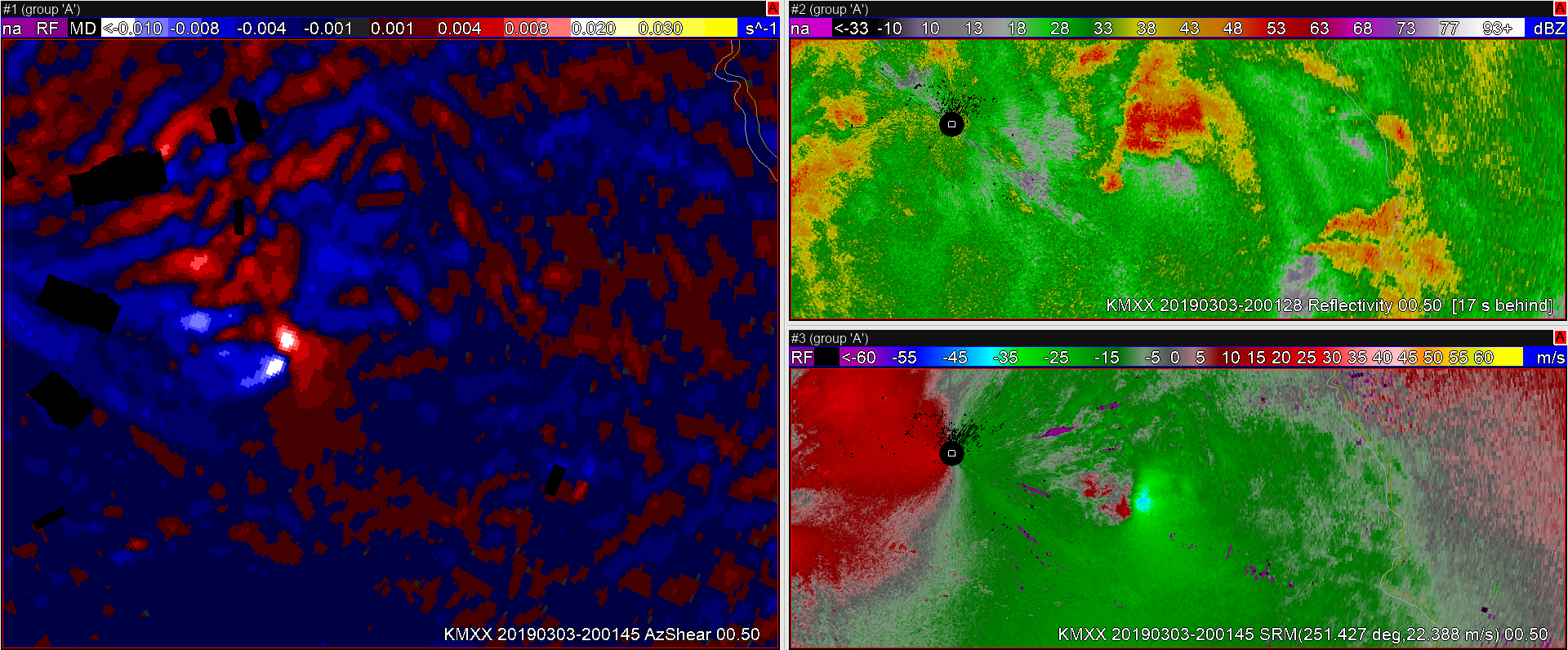
Stepping back and looking at the squall line, the Az Shear product quickly allows the warning forecaster to visualize the s curvature in the squall line, and quickly isolate the central segment of the squall line that is becoming more favorably oriented with the environmental shear. Here I was able to more quickly focus attention on the segment of the line that would go on to produce a tornado.

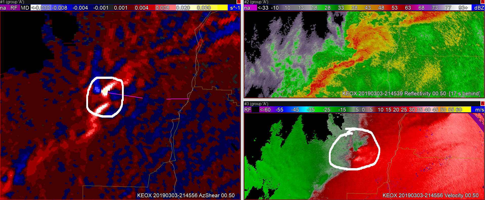
A couple of scans later, the AzShear quickly trended up before true gate-to-gate couples appeared in the velocity product. This would help the warning forecaster get a jump on the areas of tornado formation.
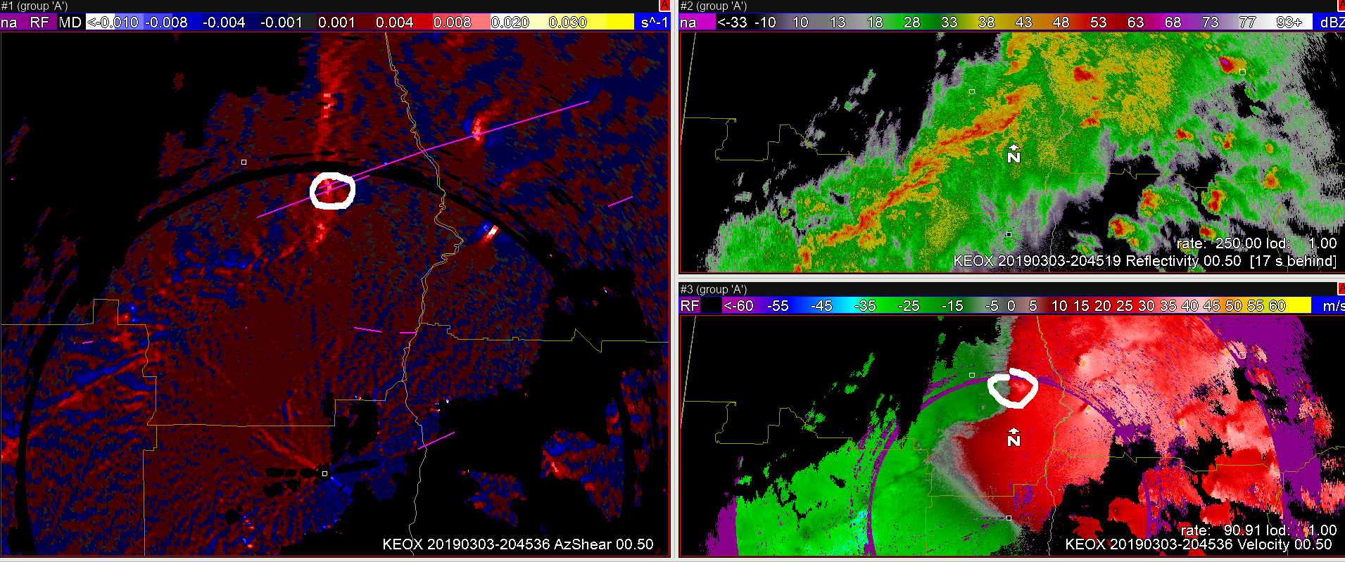
Viewing angle and distance from the radar definitely important. In the images below MXX is much closer to a QLCS tornado and viewing from behind the line. While EOX is south of the line looking down the length of the line, and viewing from a greater distance. Here the low-level QLCS circulation is much more evident in MXX, while it gets lost on EOX. The area of interest is marked by the white circle on each image.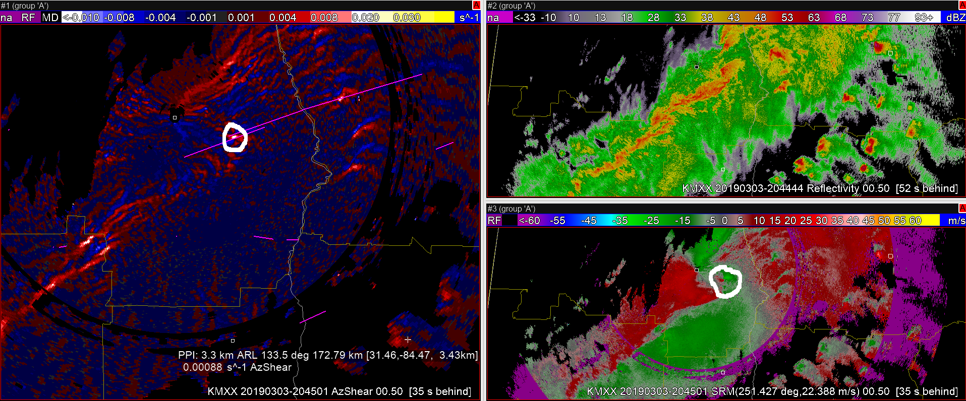
Felt the main benefit of this product may be for QLCS tornadoes, and could extend warning lead time. In the example below, a mesovortex along the line is more easily identified by viewing the AzShear product over the raw velocity data. This will allow the warning forecaster to more quickly identify the important areas along the line that will need monitoring. By expanding the color table at the top end of the color curve, it was easier to monitor the trends in the strength of the circulation. This combination could allow the warning forecaster to more quickly identify a circulation and start drawing up a warning while monitoring the trend of that circulation as input to the warning decision. Overall feel this could really help forecasters extend warning lead times on QLCS tornadoes by a couple of volume scans. This is a huge help as these tornadoes are already the hardest to warn on with lead time.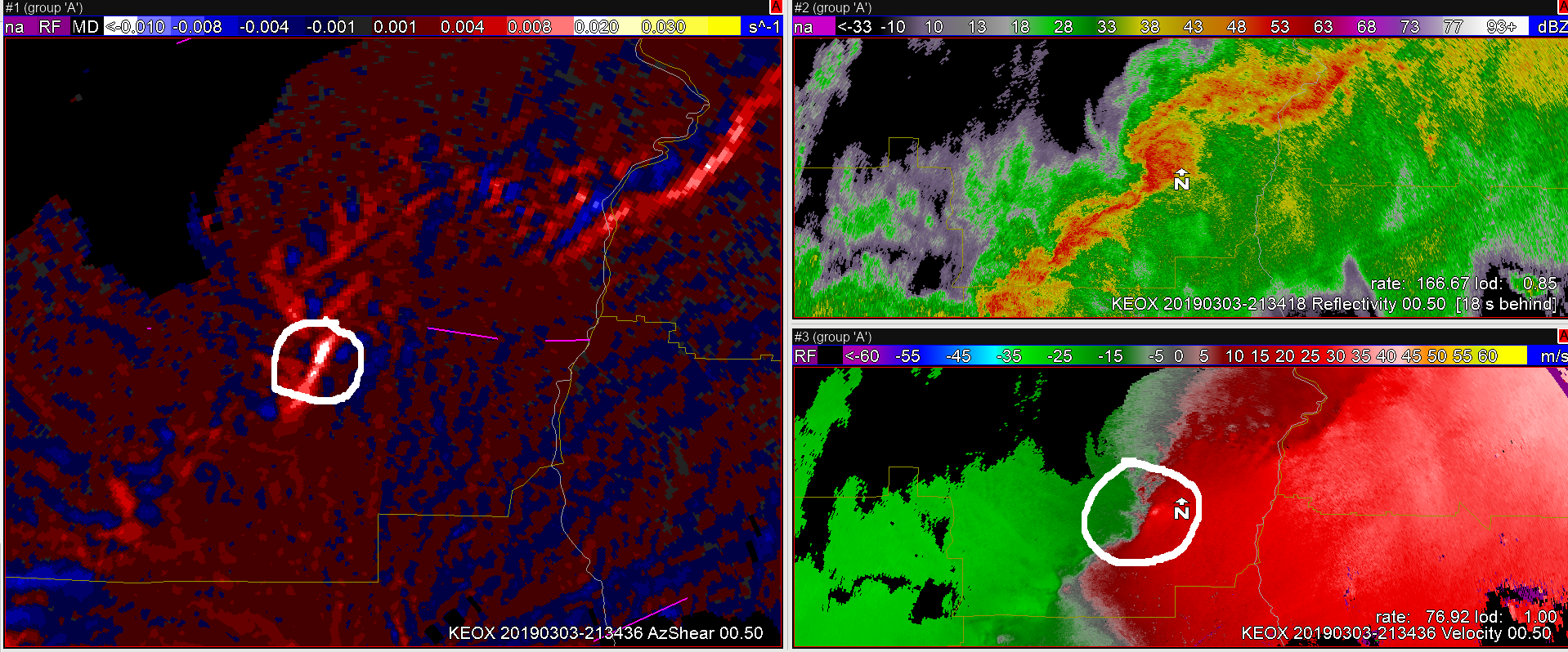
— warmbias —