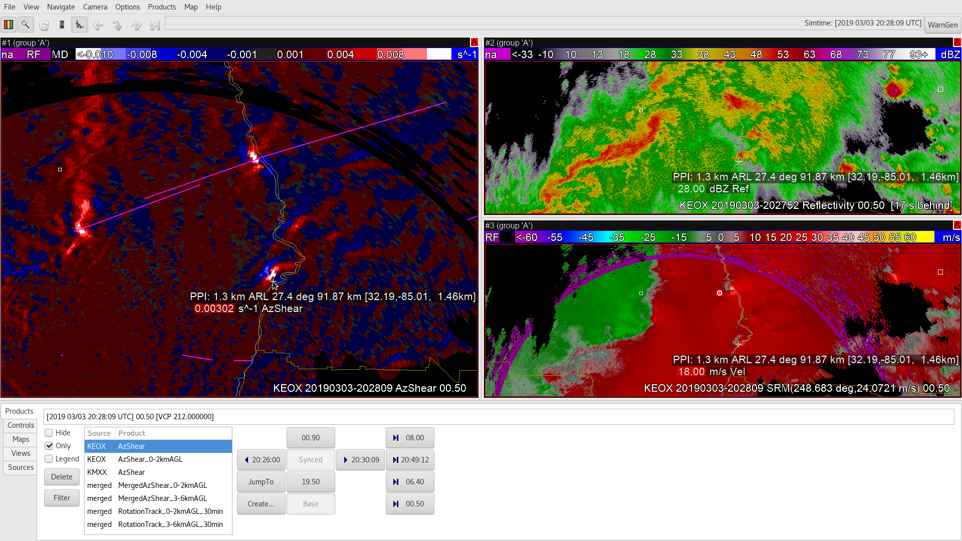
Attached below is one example where the AzShear from a single radar/single tilt (KEOX 0.5deg) is indicating a comparable magnitude couplet with one storm as it is for the known tornadic supercell just north of it. The important item to note here is that both of these couplets are fairly far from the radar at this point, which means the AzShear is being impacted by elevation. This would be a good case in which having a different color scale may be of use to determine the differences in strength of the couplets. This is also a case to make sure to utilize the closer radar and not rely solely on one radar that may be primarily farther (if possible). In addition, this similar intensity in couplets is significant in recognizing that a tornado may not be observed even though the couplet is identified from one specific radar in case there is not a closer radar at the time.

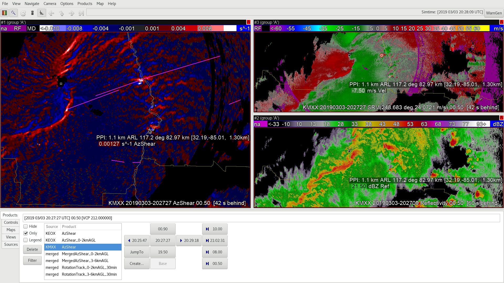
Below is the same circulation at the same time, but now identified by a closer radar (KMXX 0.5deg). The difference in magnitude of the same couplets are quite apparent.

Another area to note between KEOX and KMXX is the QLCS feature, where the closer radar is able to detect better resolution of the low-level AzShear features of the line compared to the farther radar. The farther radar is clearly sampling a higher elevation/swath of time creating a broader region of maximum AzShear. Both the merged 0-2km product and the single radar AzShear product can be helpful in seeing the vertical structure of the AzShear for this line. What’s also important at this time is the tornadic track (pink) begins around this time of the circulation.
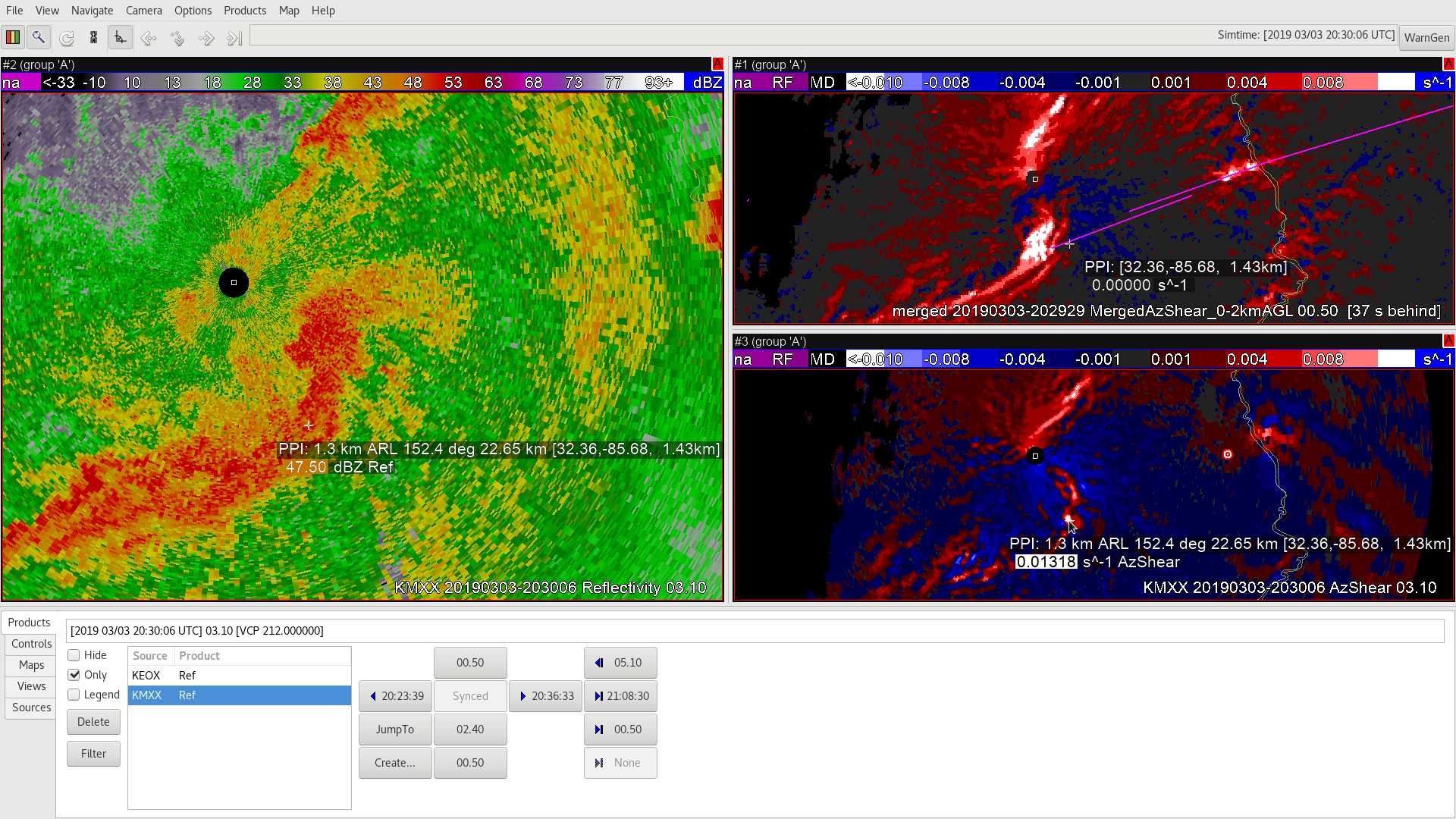
The QLCS feature in the single-radar AzShear has a better focus and greater “resolution” of small-scale features, versus the merged 0-2km AzShear product. See image below and the mouse location of the center. The maximum center is also farther ahead of the maximums in the merged product, which is important to realize when issuing a tornado warning. Also of note, the supercell to the northeast that is producing a tornado track is indicating multiple AzShear couplet maximum locations for the merged product (above right) vs the regular AzShear product (lower right).

I, personally, find the single-radar AzShear product closest to the radar the most useful for identifying a potential for low level tornadic circulations. I would use the 0-2km merged radar product as perhaps a “big picture, earlier lead time” type of product during the initiation stage of features. -shearluck
