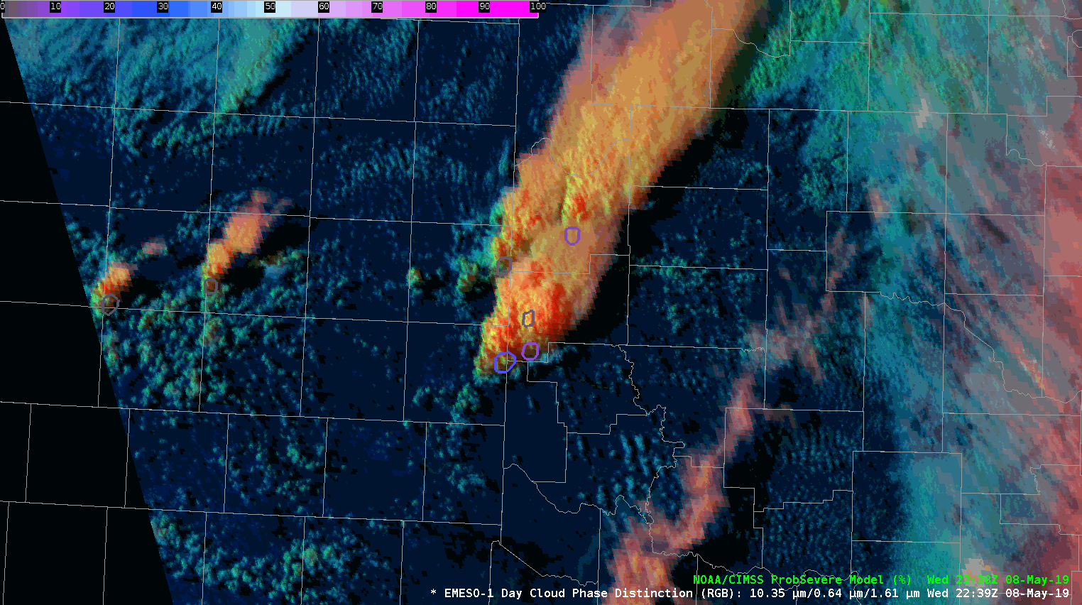
Although ProbSevere products are typically used coincident with radar data, but can also be applied to satellite imagery. Using ProbSevere with satellite imagery can provide a visualization as to where the strongest parts of a thunderstorm may be located .
This loop shows developing & strengthening convection across the Texas Panhandle and far western Oklahoma, via Day Cloud Phase imagery with ProbSevere overlaid.