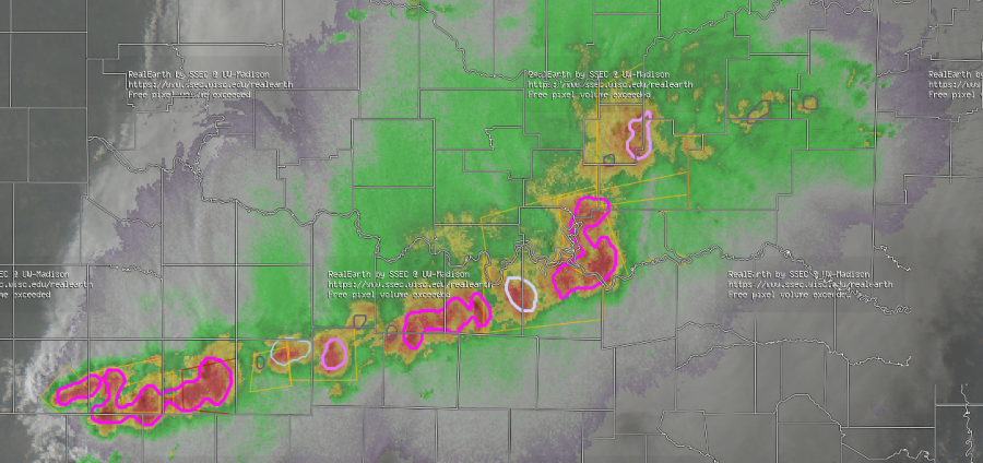
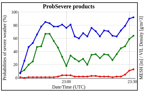
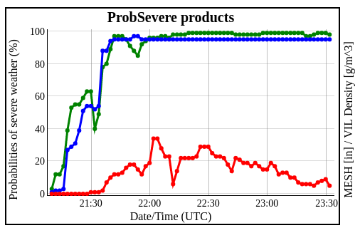
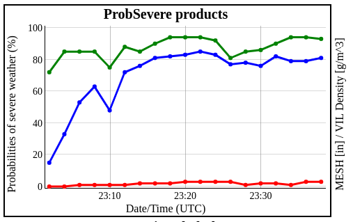
ProbSevere seemed to have a pretty good handle on the dominant severe threat as initially discrete storms early in the day, began to congeal and grow upscale into the early evening north of the Red River. This can be shown in same sample graphics below. The first two trend graphics are from storm objects over the northern, maturing portion of the MCS, generally north of the Red River where mainly wind damage reports were observed (and some small hail). The second two trend graphics are from somewhat newer storms that were developing southwestward into northern Texas where primarily hail (and wind) were observed. – Quik Twip