

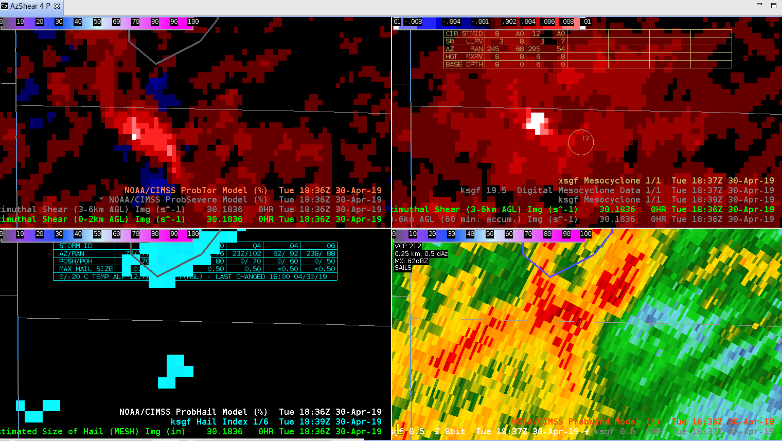
This storm has had consistent Azhear max for past several volume scans, but again does not seem to match low-level SRM scans very well. Prob Tor has increased and remained steady at about 75 to 77 % CPTI has remained slightly over 50%. Upgraded SVR to Tor possible. Reflectivity structure suggests increasing organization with well organized ZDR arc arc suggesting increasing SRH. May upgrade to tor shortly given better storm structure in base data. Quick Twip
Month: April 2019
Meso-analysis for CI
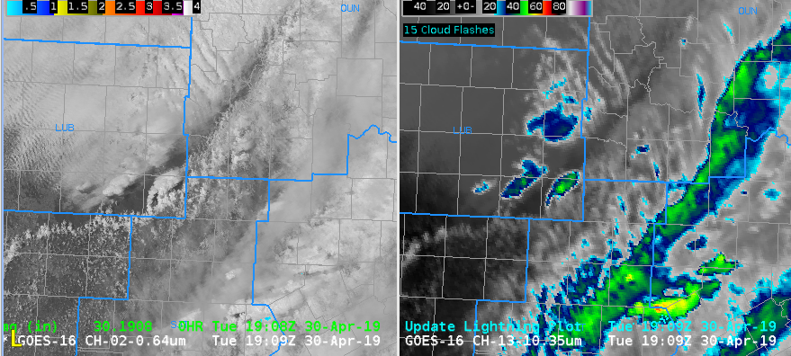
Figure A
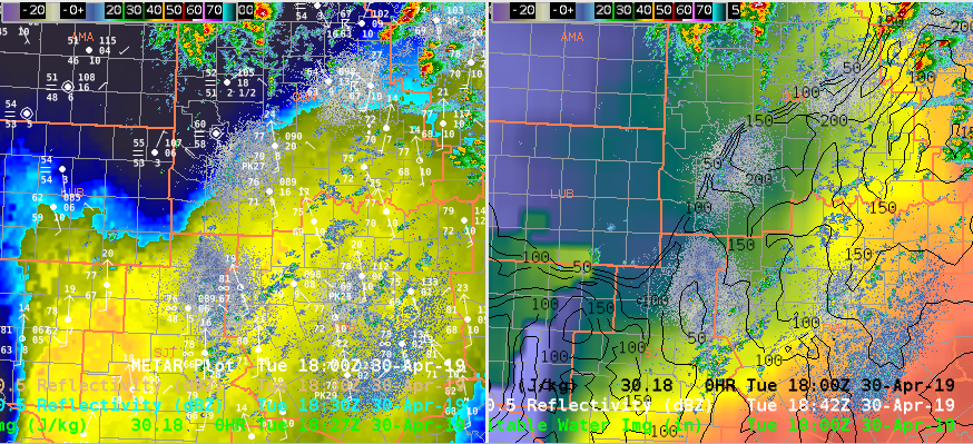
Figure B
Watching for new storm development in SW Oklahoma with GOES-16 Vis/IR showing a new storm developing in Figure A. Area of interest will be in southwest Oklahoma with frontal boundary stalled out and high CAPE from All Sky Layer in Figure B(left image) meanwhile right image shows All Sky Layer PW with RAP13 0-3km CAPE in black contours. This environment would be favorable for severe weather and possible tornadoes if storm can remain on the frontal boundary. -Jake Johnson
Advantage of AZ Shear
Favorite part of the Azimuthal shear product so far is it can highlight some areas of the storm that need to be investigating…if you are watching a different storm and want to do a quick look at your CWA this can grab you attention to a storm that needs to be looked at next.
South Beach
That’s Not My CWA – But Still a Nice Above Anvil Cirrus Plume
Nice AACP with the severe cell over Osage Co OK. Thermal couplet had a min of -73C and a max of -57C. Also a weaker AACP on the cell moving out of NE OK. 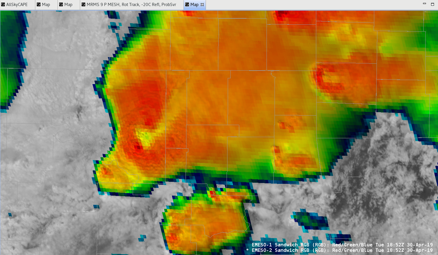
Contours-a-plenty in ProbSvr
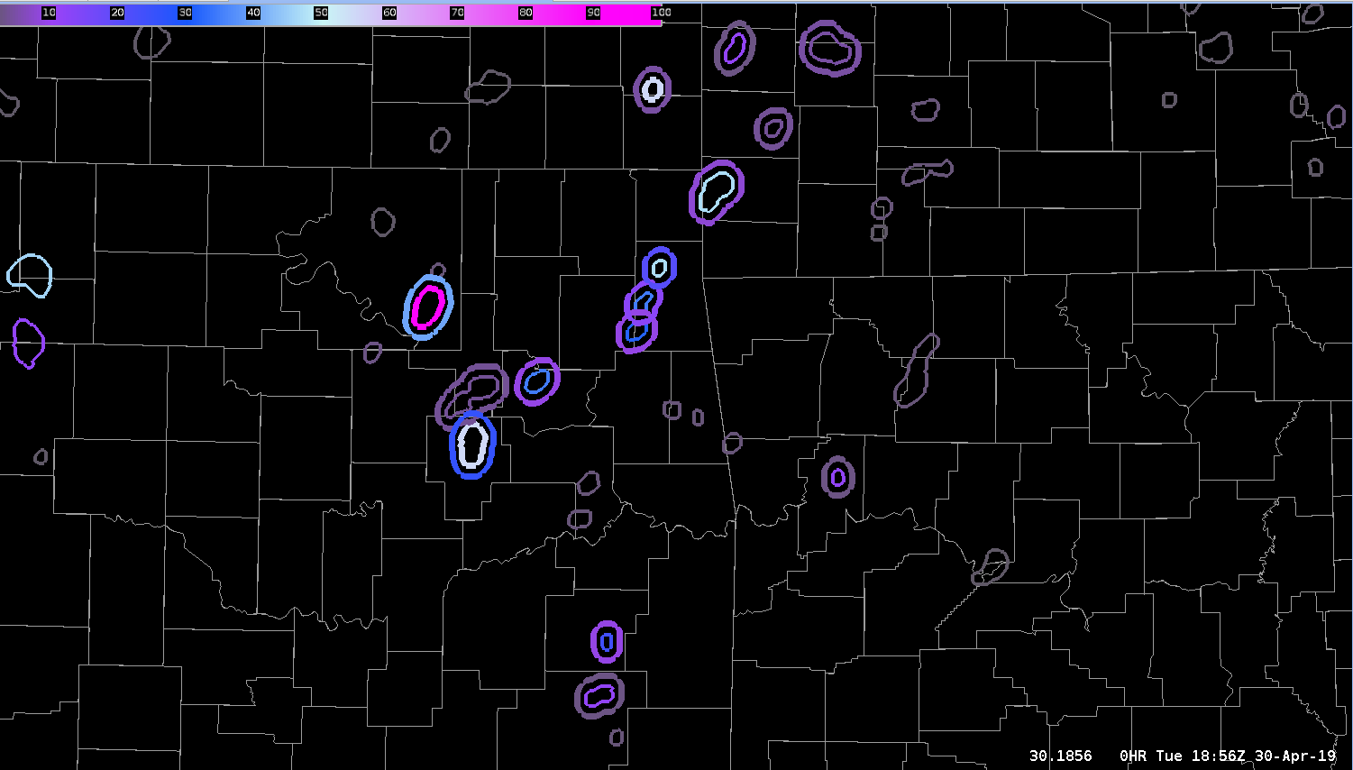
ProbSevere double contours were plentiful at this time showing the utility that certain “big” days may need to be modified to increase the threshold for the second contour. This was the default 3%. Only a couple of the circulations were worth investigating in reality.
— S Coulomb
AZShear and CPTI Product for TUL SC
Watching storm northeast of Hominy @ 1854 utc. 0-2 km AzShear has been showing persistent max with the cell but seemed to displaced to far west of broad circulation. 0-2 kn Azshear not very helpful with this storm given displacement. CPTI has been showing consistent 50-55% 80 mph intensity probs for past several scans. – quik twip
Merged AzShear w/ non severe storm
The AzShear product showed a consistent, distinct circulation associated with the updraft core within a multi-cell cluster moving through the western part of SGF’s area. The velocity couplet was anticyclonic in nature. The feature was stronger in the 3-6 km AGL layer than at the surface.
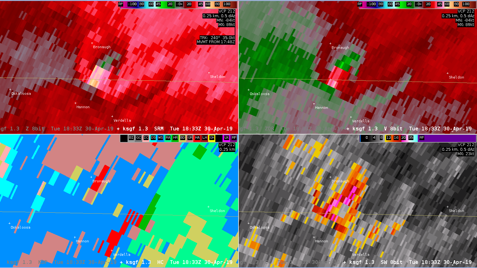
— S Coulomb
All-Sky LAP CAPE and Boundaries
The All-Sky LAP CAPE product is rather useful as a quick and dirty SA tool to quickly identify boundaries and their approximate location/orientation. While the actual CAPE values given are not as important (perhaps better to rely on obs, mesoanalysis, and short-term models for that), the LAP product does very well with identifying the key location of the gradient and subsequent boundary. The boundary location in today’s case is rather obvious, but this product will likely prove useful in more diffuse situations.
–Stanley Cupp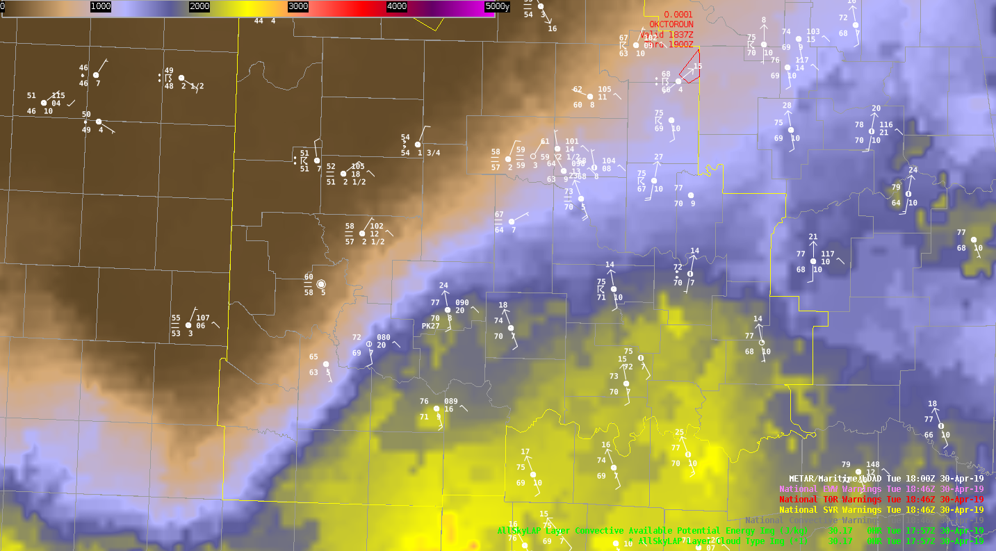
Merged AZ-Shear 0-2km

AZ-Shear Merged 0-2km:
Notice AZ_Shear Merged 0-2km was not well defined with the rotation couplet as compared to the base/SRM velocity products from a single radar. This product seems to work better in the single radar form versus merged form.
-Jake Johnson
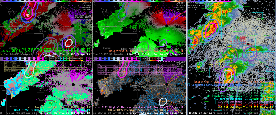
GOES Sandwich/ProbSever/GLM
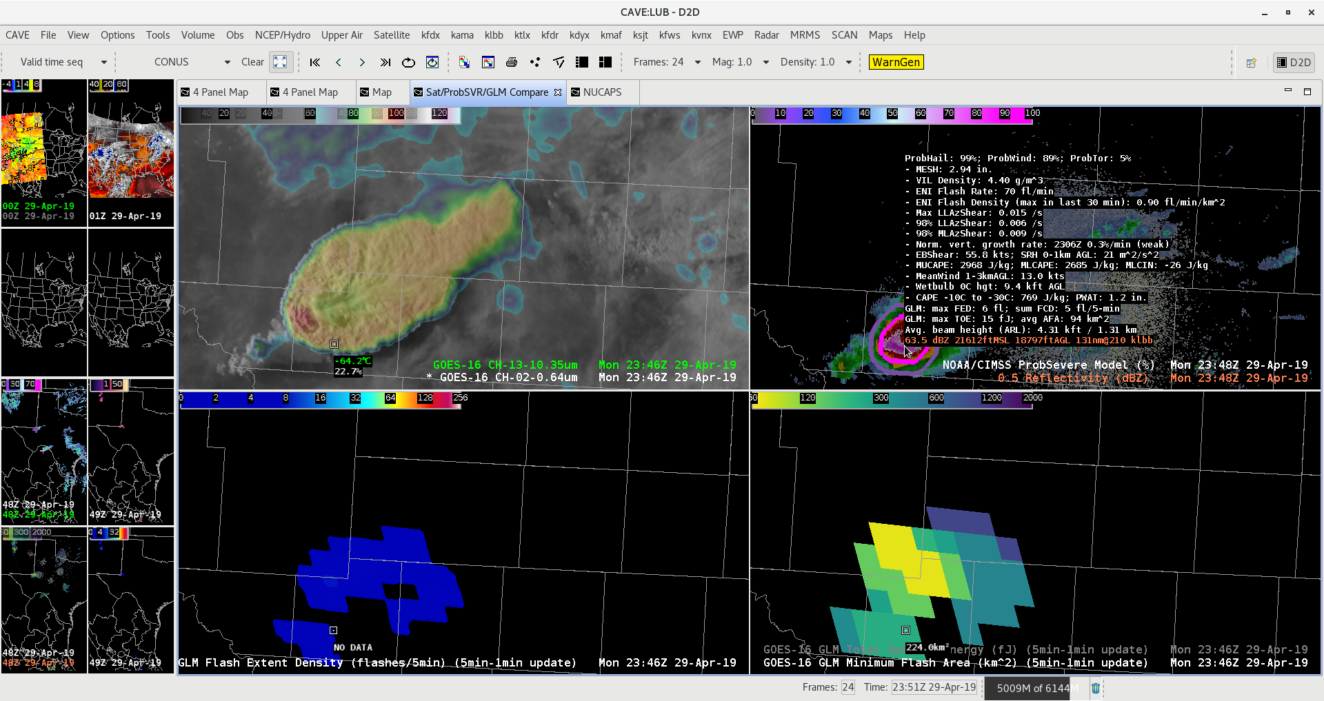
GOES-16 Sandwich Product showing a nice above anvil cirrus plume. ProbSVR showing 99% for large hail and Tor prob 5% with nice double rings. GLM Min Flash area remained in place with overshooting top of this supercell.