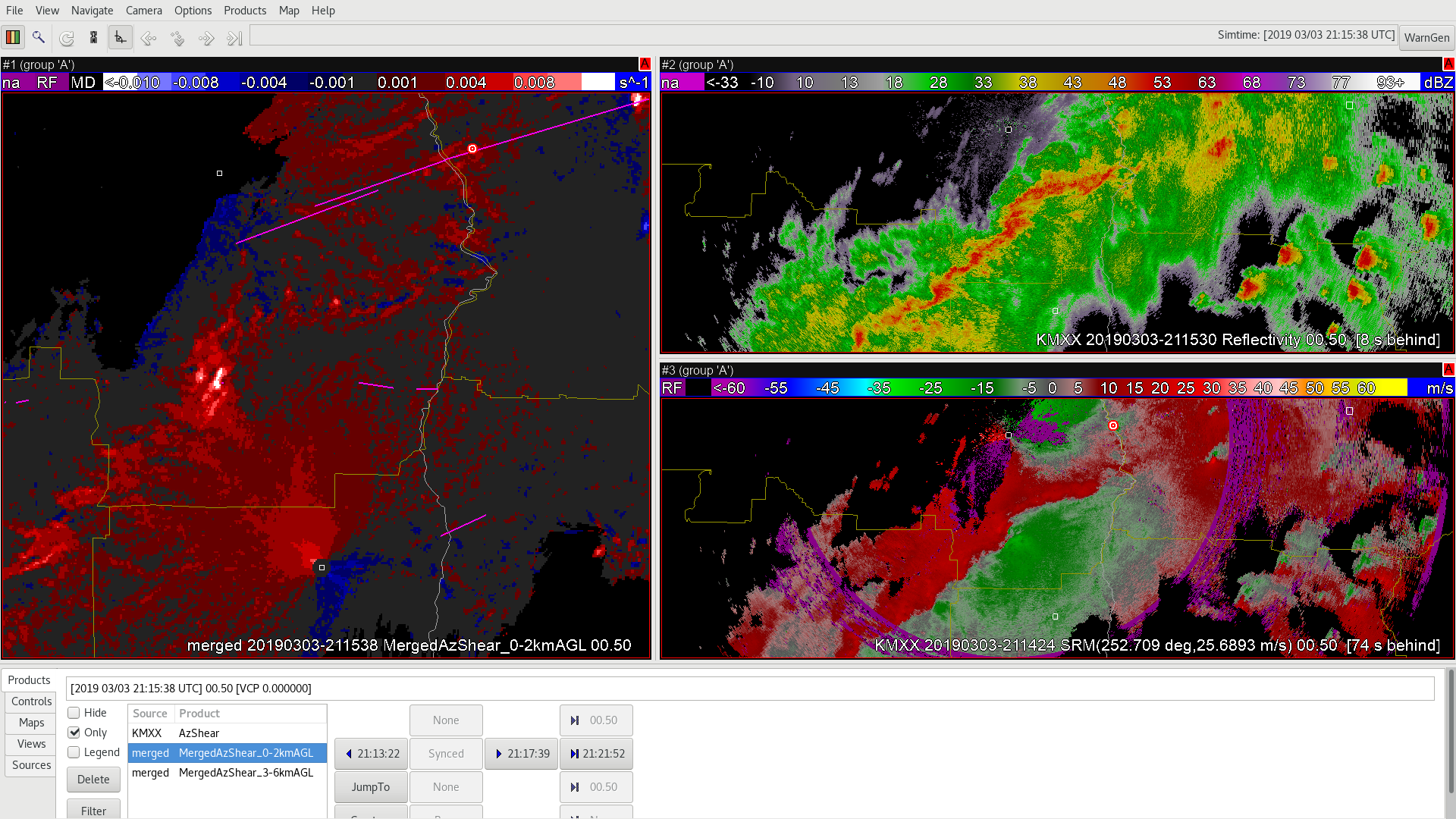
Zoomed out from the single radar (KMXX) in this case there is a lot of convergence going on along the line of thunderstorms but in this view you might not notice that a small circulation has formed in the velocity data. There is no obvious reflectivity signature but there is a local max in the AzShear Data – in this cased the Merged AzShear 0-2km AGL data. Lets investigate that further. 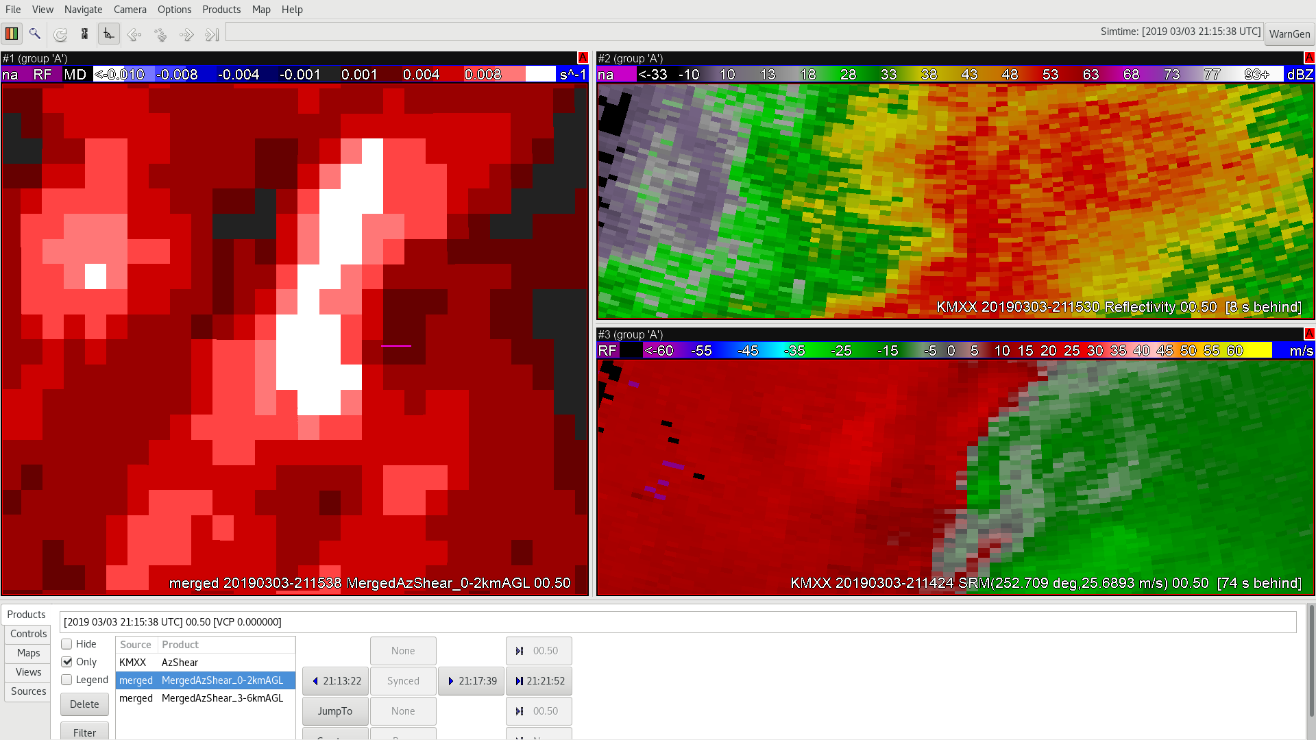
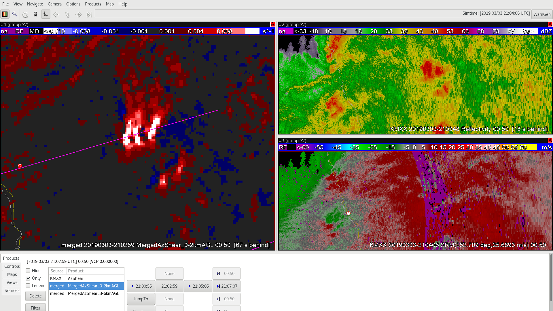
Zooming into the Merged Maxima you can now see a clear couplet in the SRM velocity data. And the pink tornado track line does confirm a tornado formed at this point. This is an example where on a broad scale the Merged Product (and the single radar as well) provided some Situational Awareness to a tornado that was not visible on the single KMXX velocity very readily.
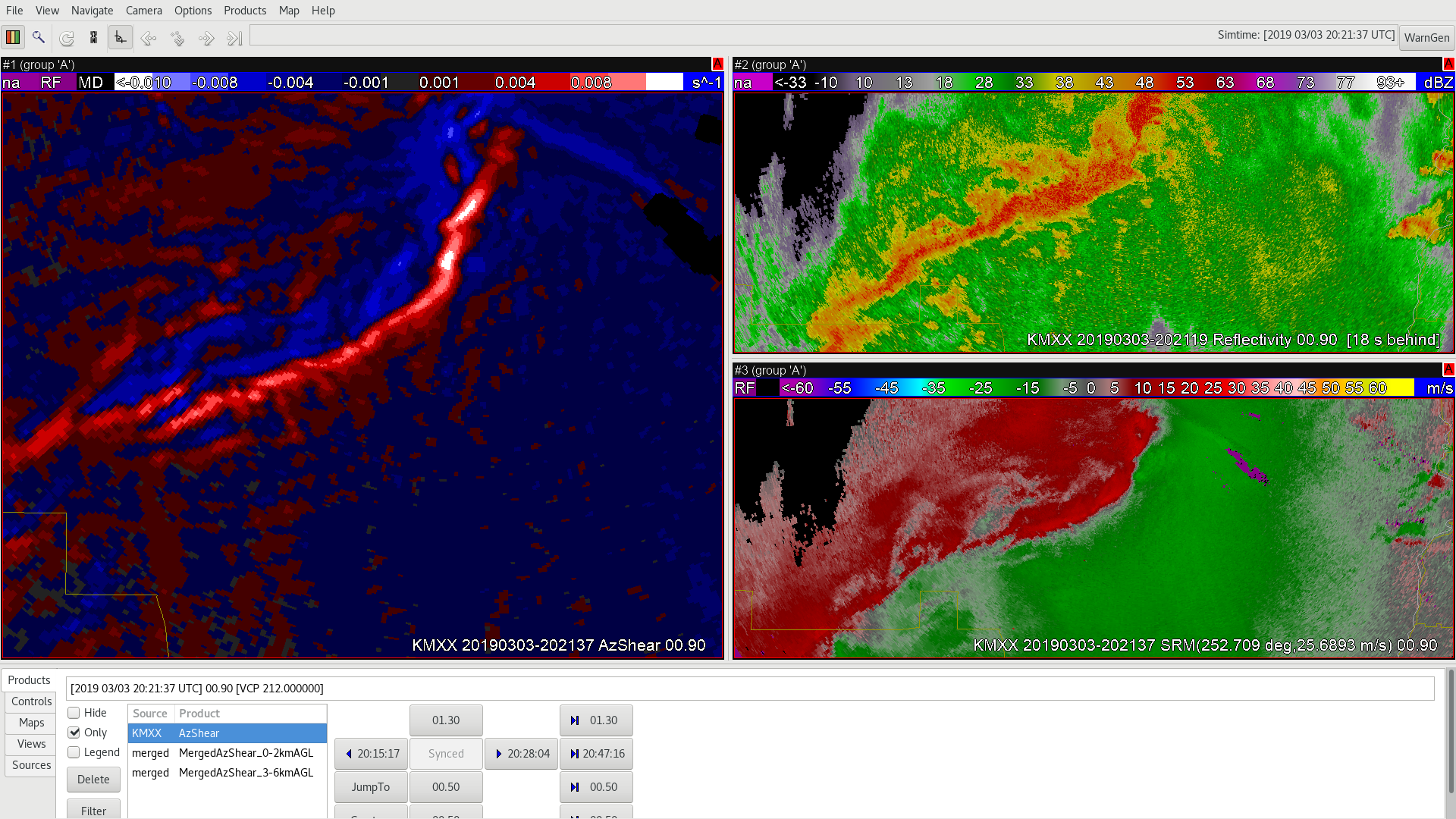
Based on a rough guestimate a warning off of the Merged AzShear data would have given an additional 2-4 minute lead time to when the tornado formed in this case. An added bonus is that the Merged AzShear product decreased in intensity as the tornado dissipated just a few minutes later (see below). Going later in time the Merged AzShear does increase again, but the KMXX velocity couple remains rather diffuse and broad. The circulation does go onto later produce a tornado so the Merged AzShear product is at least indicating this is an area to keep monitoring. It is possible other local radars like KEOX, just to the south of this storm would have a better view of the couplet/storm.
-Alexander T.
 Sandor Clegane
 Sandor Clegane
 Sandor Clegane
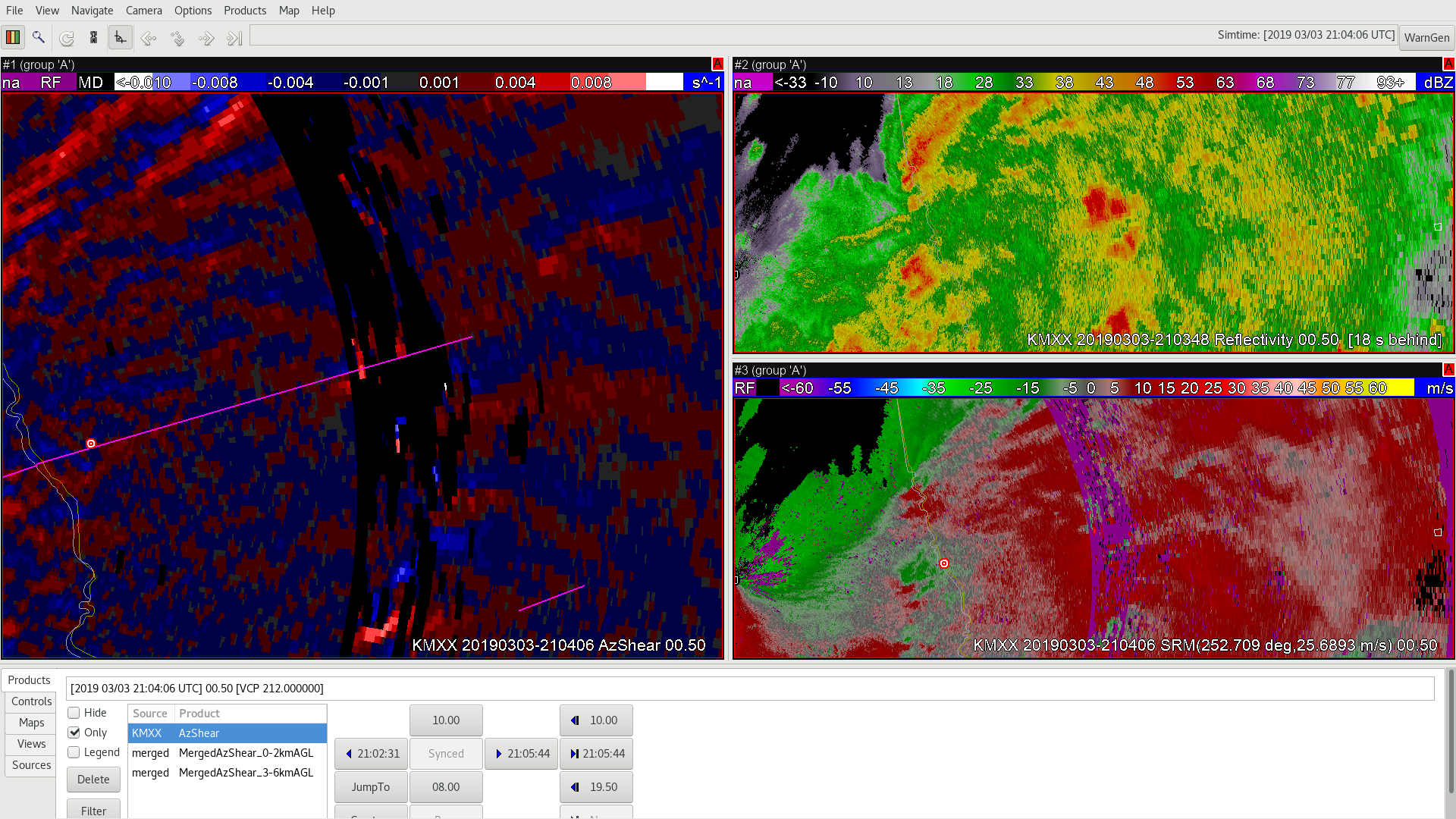
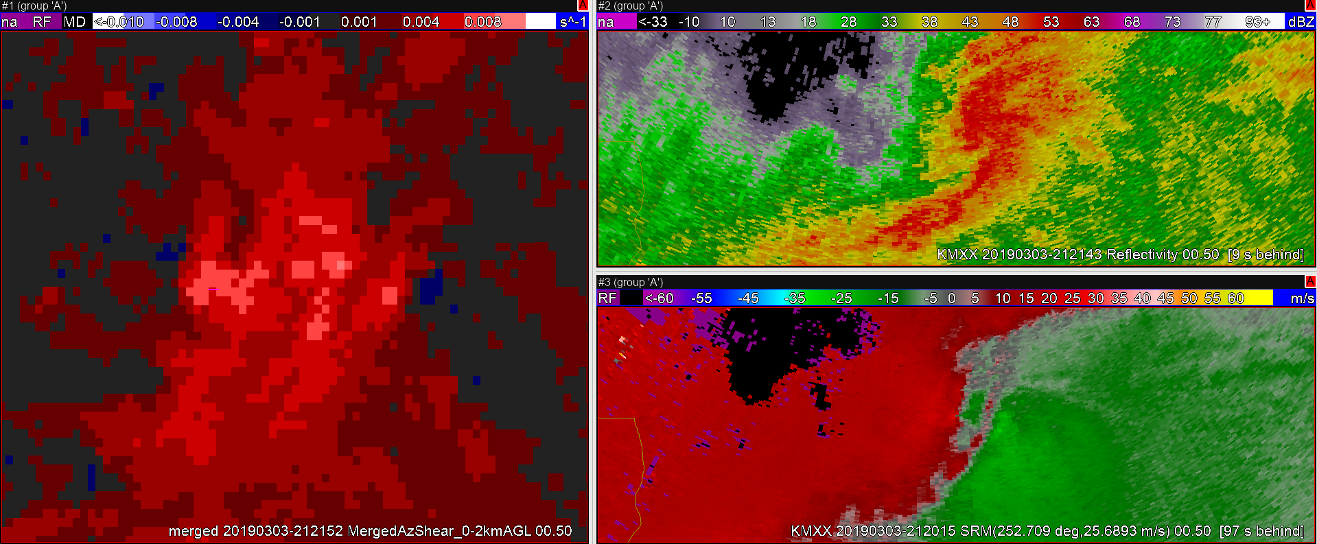
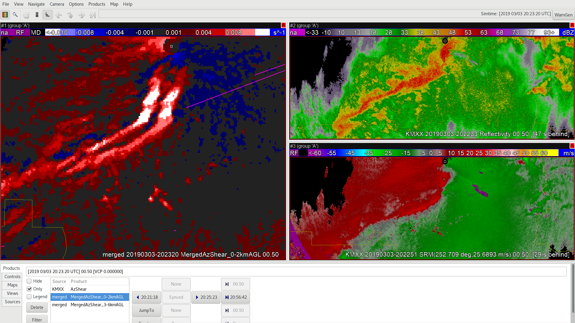
 However, toward the end of the tornado track both velocity and AzShear wash out before the tornado ceases (pink line).
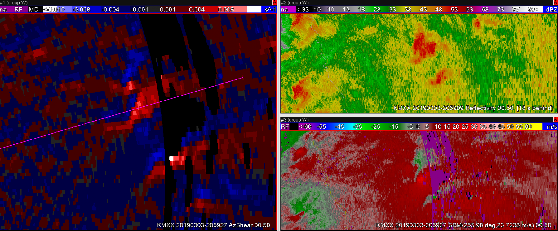 Sandor Clegane
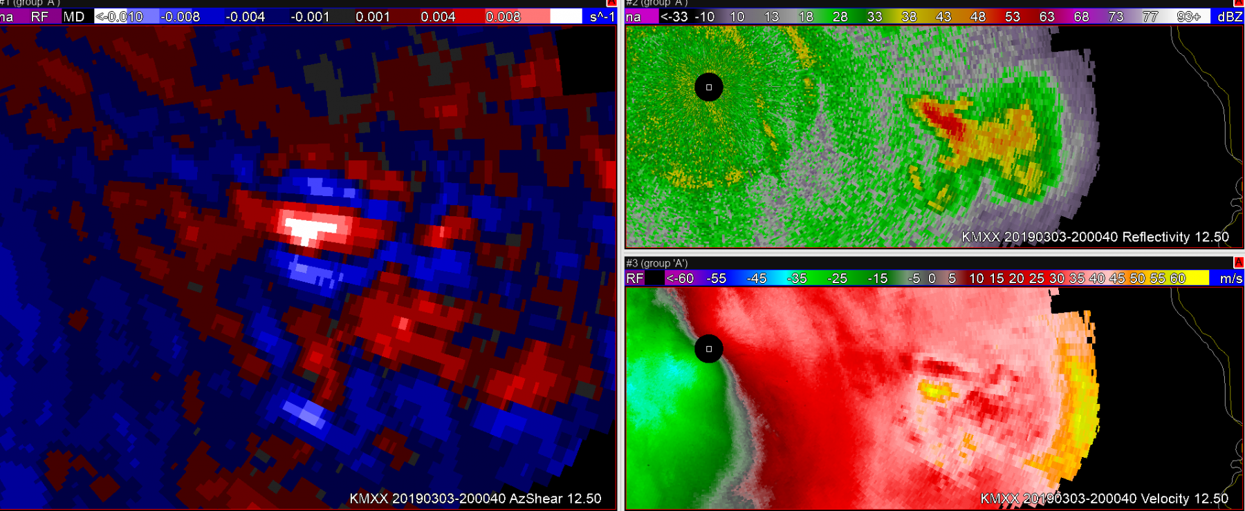 Sandor Clegane
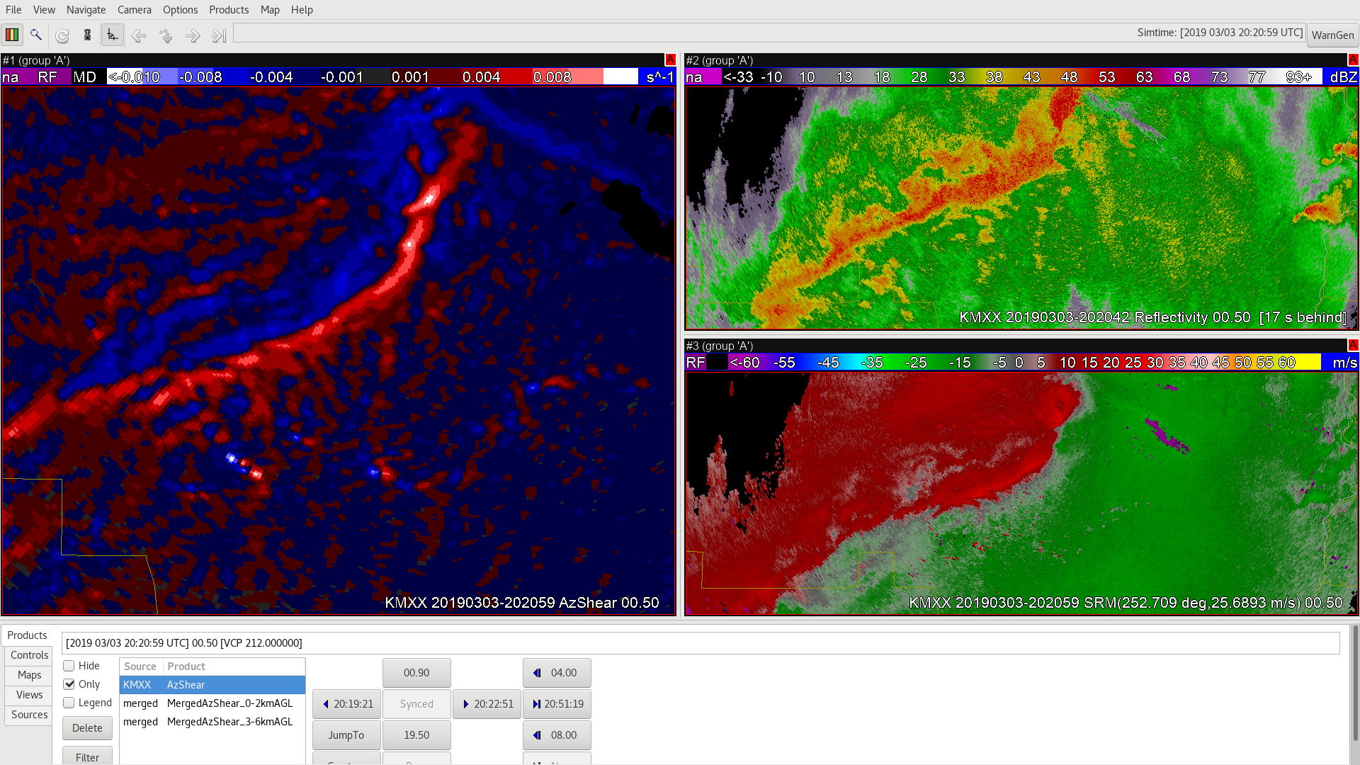
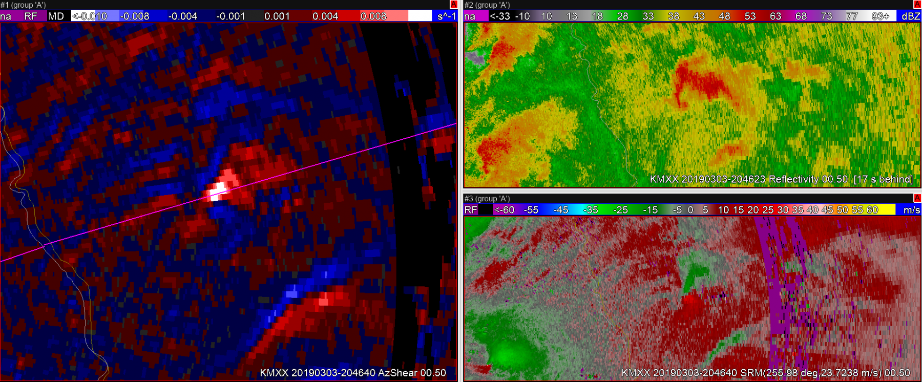
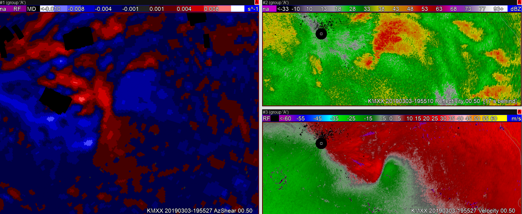 In this next image, a couple of AzShear features stand out to me. 1) Positive values of AzShear have begun spiking on the north side of the convergant zone. 2) I believe that you’ve seeing the RFD start to kick downstream.
 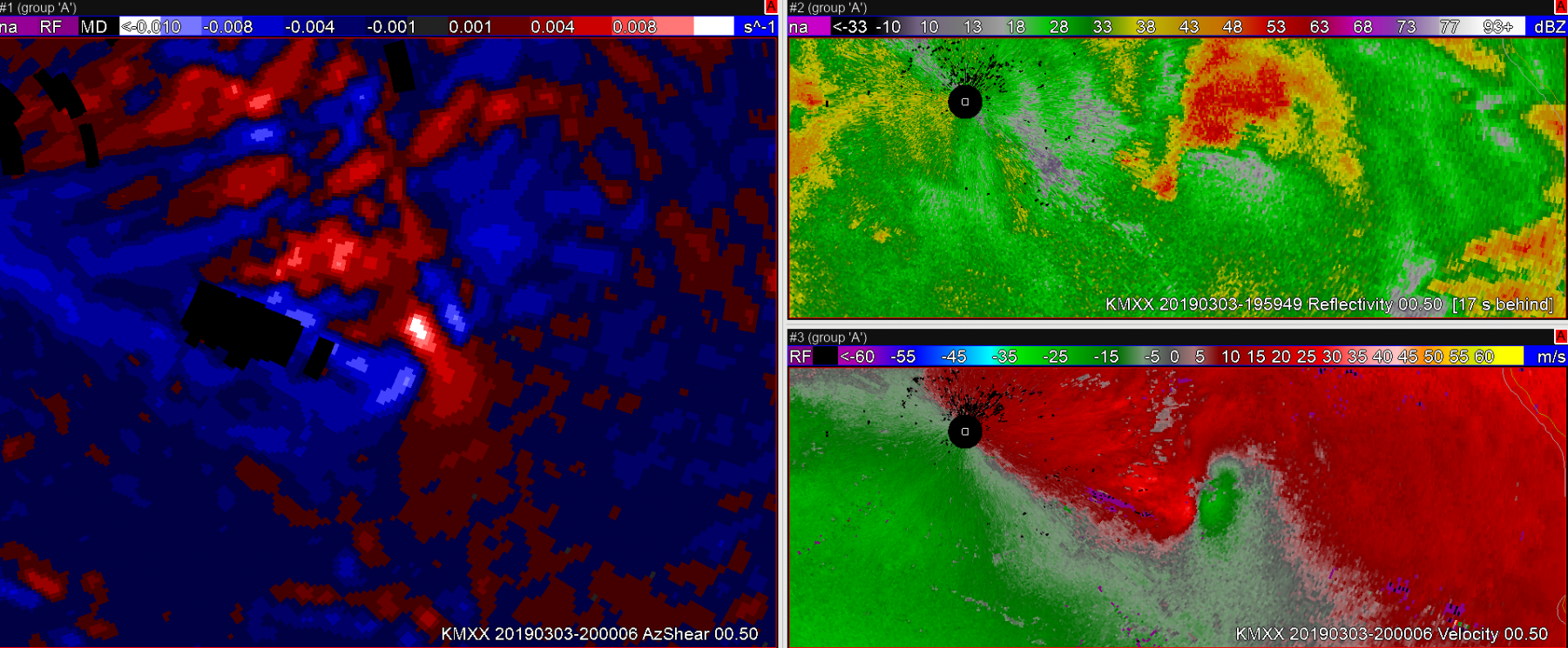 Shortly thereafter, the storm develops a very clear couplet and it is clear this storm deserves a tornado warning. The tornado survey revealed that the tornado began when the second image in this post was captured. AzShear did a nice job highlighting important features on this storm, and may have lead to additional lead time on a tornado warning.
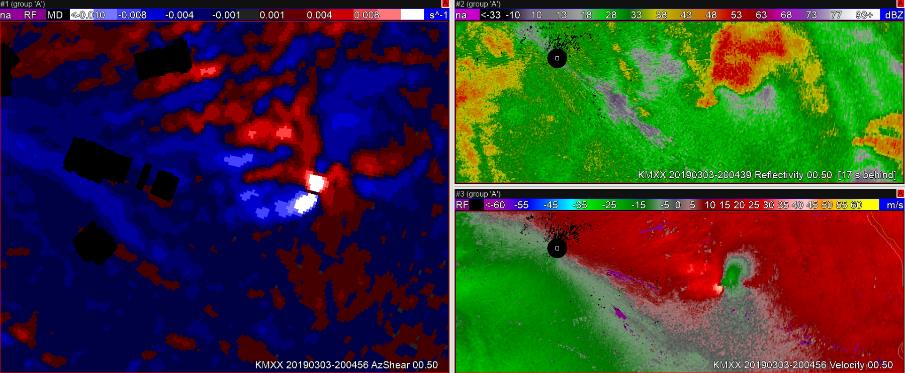 Sandor Clegane