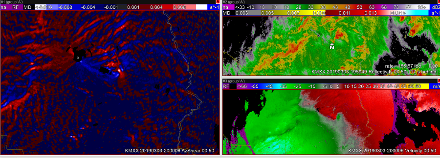
Using a combination of Z, Zdr, inst AzShear from KMXX – can see development of low level mesocyclone quicker than V/SRM alone. Can see the “white” > 0.01 s1 show up as early as 2000 UTC on the main TOR- while Z/SRM shows mainly a convergent signature.

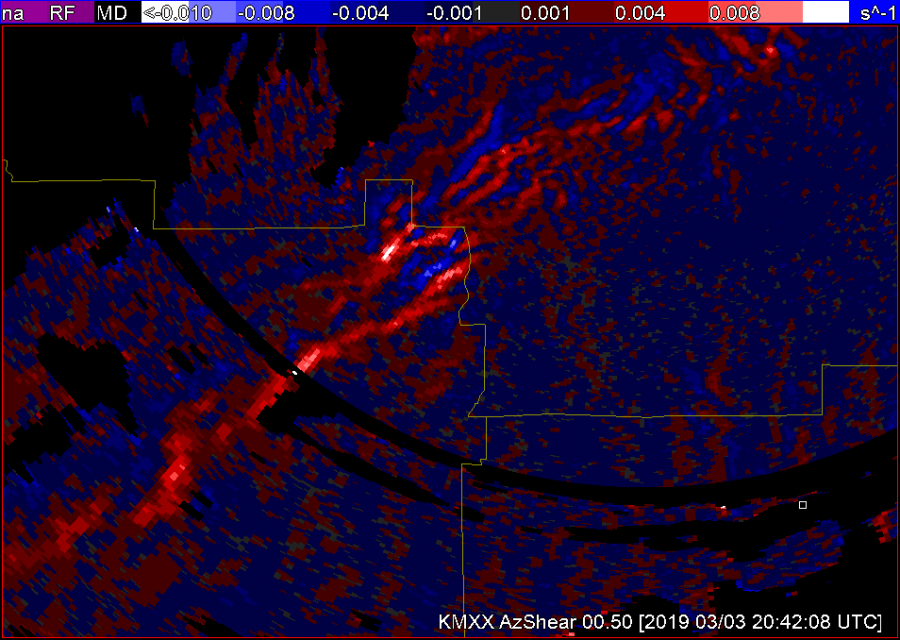
Looking down the convective line – south of KMXX – examining the Azshear around 2040 UTC. Area near the county border does trigger above 0.01 – whereas areas further south are slightly weaker (see image). Would be interesting to know which of these produced tornadoes. Reminder – plotting the tracks would be great!

