LUB Mesoscale 19Z Forecast

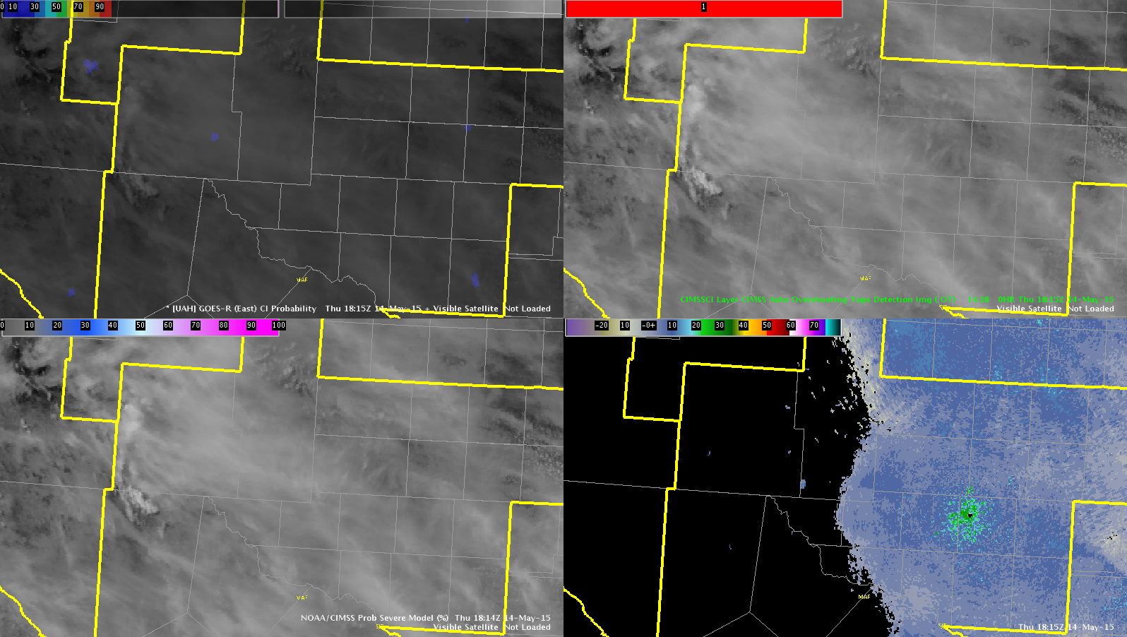
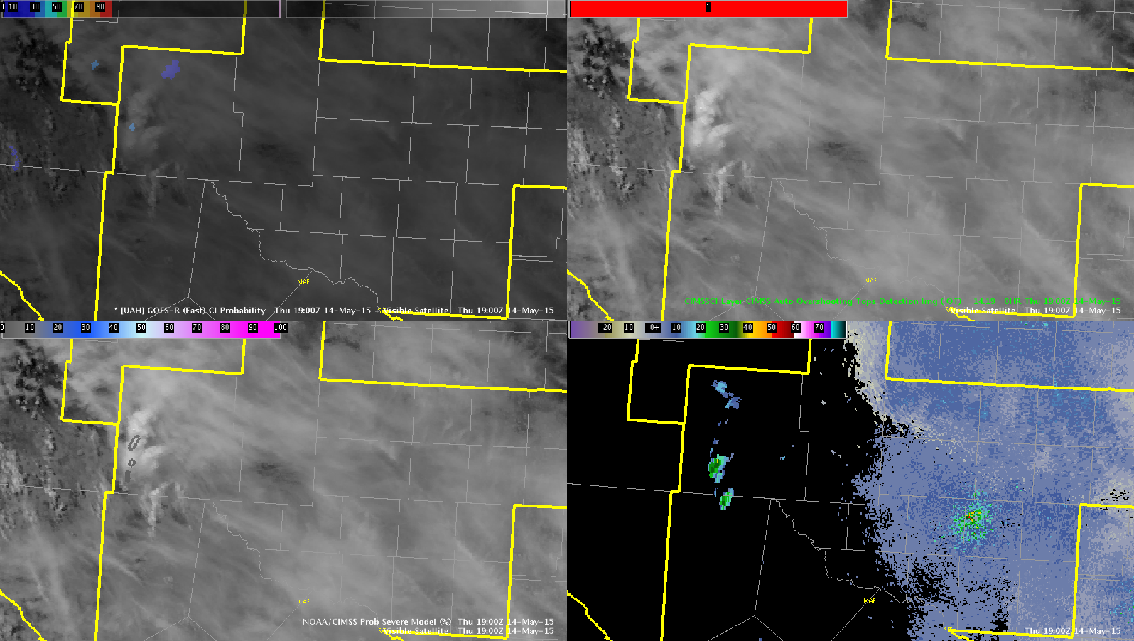
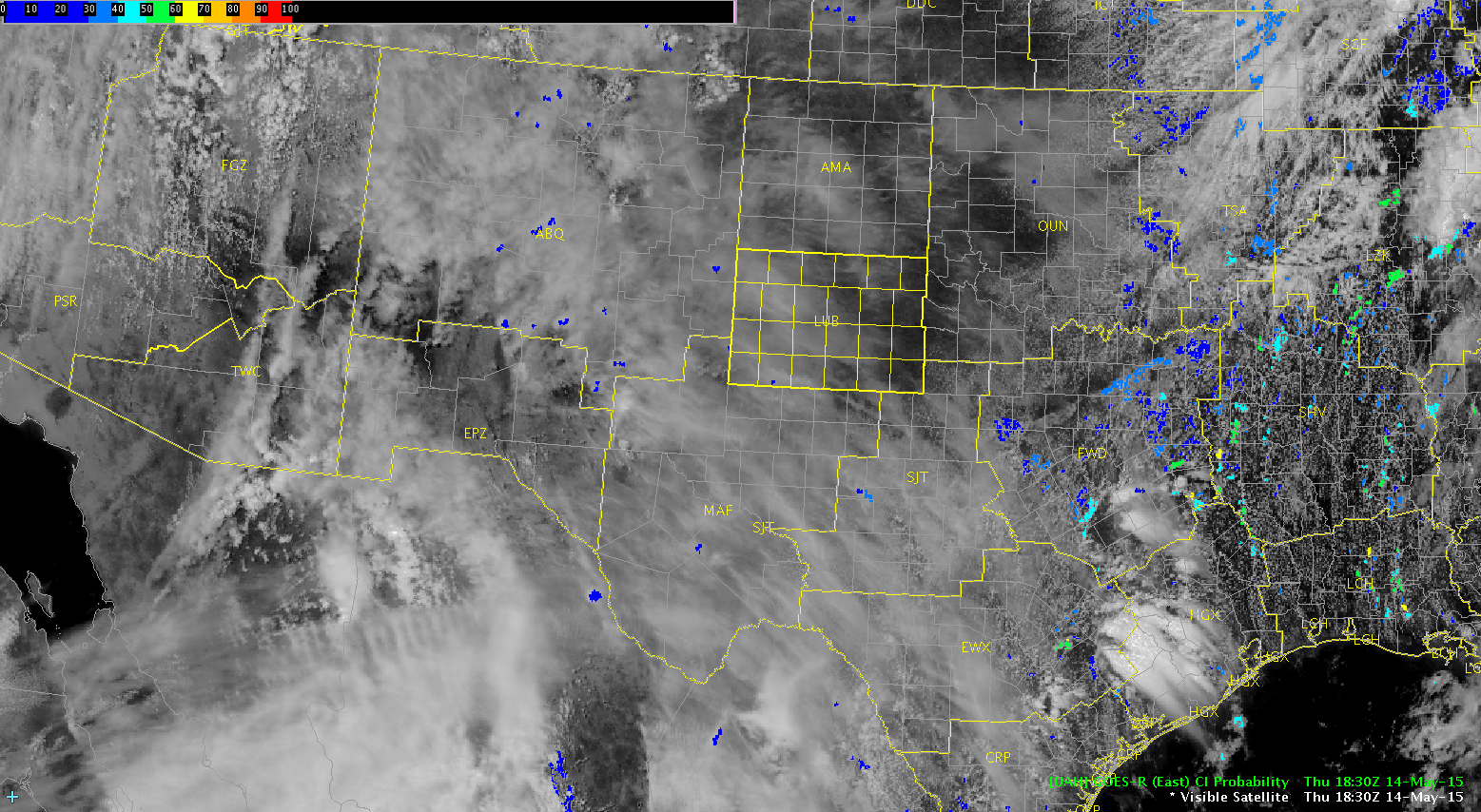
Current sfc conditions in the LUB CWA are generally characterized by temps in the M/U 70s and Tds U50s/L60s. GOES sounder information shows moisture advection to our west pooling along the Rockies in NM.

19ZPWATs
19Z GOES Total PW

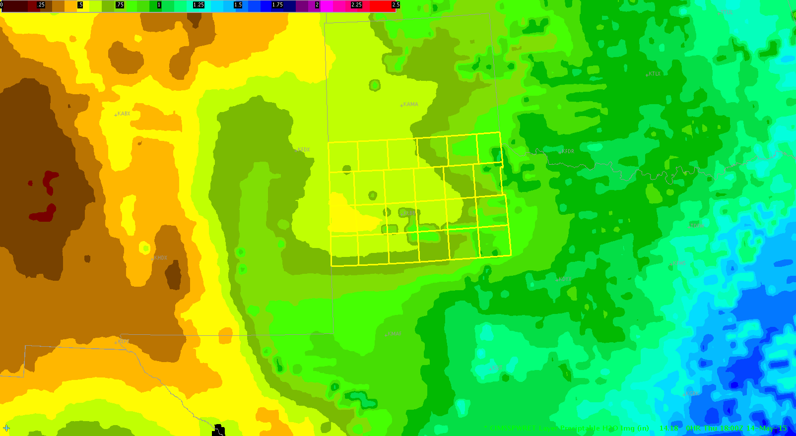
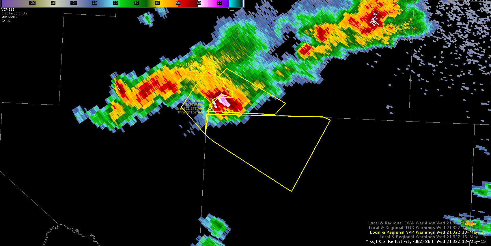
Recent satellite/radar trends show CI occurred just prior to 19Z in SE NM. CAPE values over CWA via GOES sounder are AOB 100 J/KG, but are expected to increase through the day.

19zCAPE-GOES
GOES 19Z CAPE

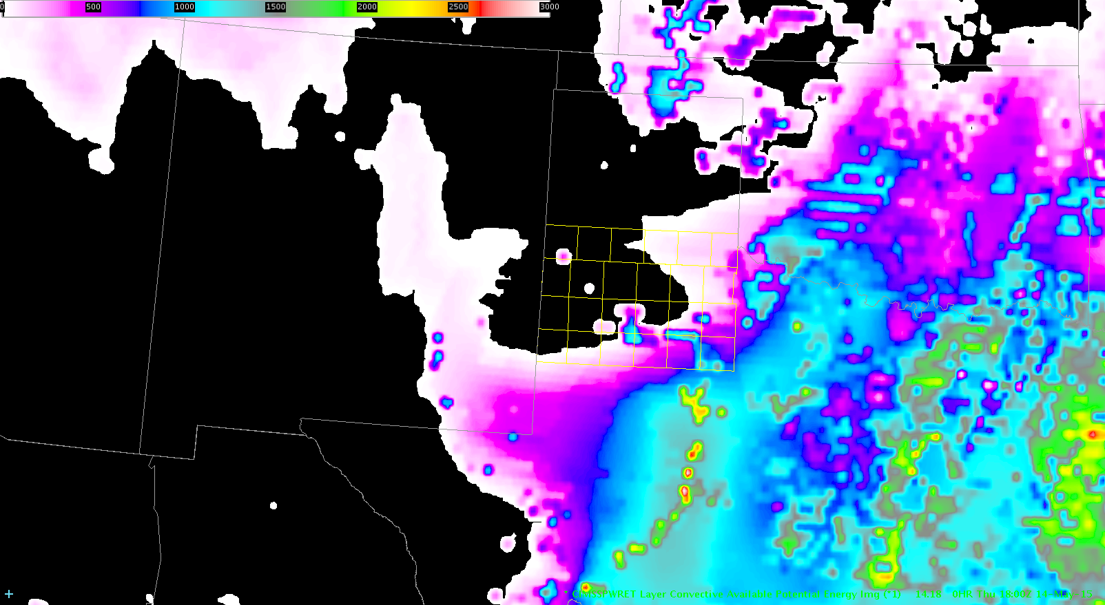
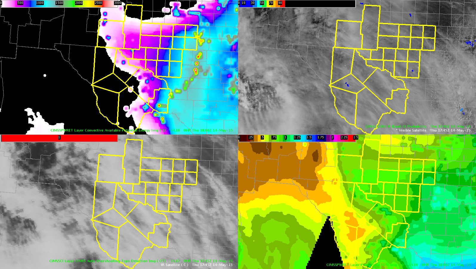
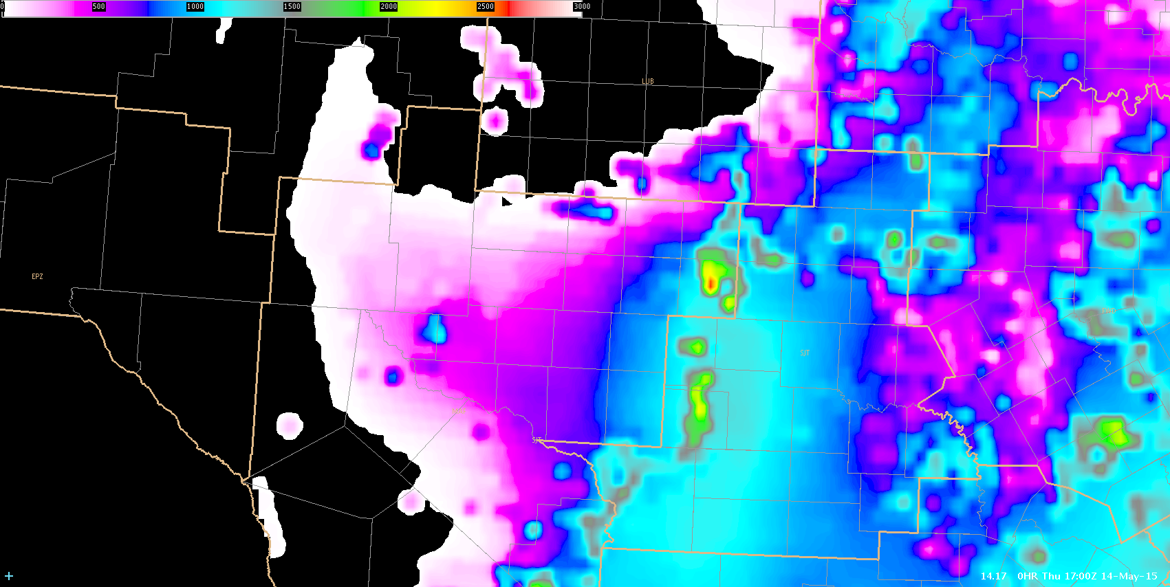
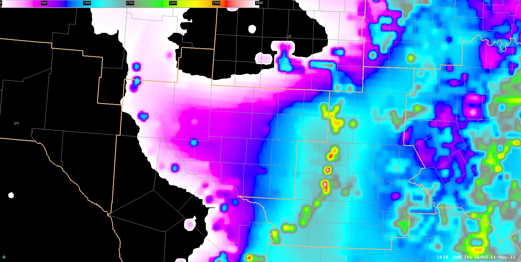
Model guidance suggests that ML CAPE values will not be very impressive (max AOB 500 J/KG), with 0-6 km bulk shear AOB 30 kts through 00Z, but shear values are expected to increase after 00Z as wind field strengthens. MU CAPE values AOA 1000 J/KG especially over our southern zones appear likely…with MU CAPE AOA 2000 J/KG also possible. Overall, expect large hail and severe wind gusts to be main threat through the early afternoon. Tornado potential appears low, especially through the early afternoon.

ERTEL


Tags: None

Cloud Layer Impacting CI Prob

Showers, thunderstorms are initiating in our western cwa. This initiation was first noticed on satellite with rising clouds tops evident. Reflectivity started showing up at approx 1815z. These showers continued their development through the course of time. Satellite easily shows instances of this. So far, CI Prob was not picked up on this developing trend at all. No probabilities with CI showed until 1900z.  These is after storms have initiated that are at or greater than 40dbz. Will continue to watch CI Prob through the afternoon as additional storms to initiate to see if pre-existing cloud contamination throws CI Prob off.

1815z CI Prob miss 1815

1900z  CI Prob miss 1900

Tags: None

Larger Scale GOES Features

As we wait for storms to develop in MAF, I am monitoring a few GOES-R products to track the impeding chance for storms and severe weather.  Higher layer CAPE values continue to move into the cwa, especially the eastern half. There is some moisture potential available in the atmosphere, demonstrated by layered PW. The PW is not necessarily high, but existent with a surge as far west as our New Mexico counties in the cwa. There is a steep decrease in CAPE and PW in the extreme western portion of the cwa.  This encourages the forecaster to focus attention in central cwa for development through the course of the afternoon. UFFSU

CIMSS Layer Cape_Layer PW

Tags: None

MAF Mesoscale Thoughts

A few interesting features setting up today in the MAF CWA. Initial CAPE values and moisture are increasing/advecting in from the S-SW from 17-18z. CAPE is also showing some “bulls-eye” like features in SJT’s area which is probably not correct but still gives us an idea for a focus of convection. It is not clearing out well with a thin layer of cirrus. Even then we are starting to destabilize. There is a dry line sitting N-S and stretching through SW Texas with dewpoints to the east in the mid 60s and in the mid 30s to the west. The shortwave aloft is still back in eastern Arizona which is where the upper support is going to come from. I think it is going to be a race between the dry line pushing through and the upper shortwave moving in. Model guidance has the line/instability pushing quickly east so if we don’t initiate in the next few hours it may end up too dry for anything to pop. There is good deep layer cape/shear so if we can start to initiate the storms will likely be strong. As of 1850z, there are a few showers showing up in the NM counties so we will see how those evolve.

17z CAPE

17zcape

18z CAPE increasing

18zcape

17z PW

17zPW

18z PW

18zPW

Lauren13/Polarimetric Researcher

Tags: None

GOES-R PW forecast for initiation

A quick glance at the GOES-R Layer PW as of 1800Z May 13 reveals a large pool of moisture with PW values around 1.8 inches in southeast Texas.

LyrPW

A curl of 0.75 inch layer PW extended up from the main pool, butting up against the mountains of eastern New Mexico.

Anticipating storm initiation within this area, with cells developing and moving into northwest Texas and the Lubbock CWA later this afternoon. Kick-off will likely be late in the afternoon due to the thick cirrus cloud layer currently over the area. CI is trying to pick up on  a couple cloud elements over eastern New Mexico as the cirrus begins to clear from that area.

vis_CI_1830

Stay tuned….

~Regina Phalange

Tags: None

Daily Summary: Week 2, Day 3

In contrast to yesterday, today our forecasters received a warm welcome to South Texas, operating close together in Houston (HGX), San Antonio (EWX), San Angelo (SJT), and Midland (MAF). Forecasters were once again exposed to an blend of ongoing convection caused by a very large precipitation shield to the East and fairly consistent developing multi-cellular/linear convection in southwest Texas ahead of the dryline and inside a narrow corridor of instability. Today we saw extensive evaluation of the ENTLN lightning trend graphs, Lightning Jump, ProbSevere, and GOES-R CI and had a fair amount of coordination between teams of adjoining CWAs.

0.5° mosaic over South Texas from 1512z - 0030z
0.5° mosaic over South Texas from 1512z – 0030z

In an EWP first, each of the three teams issued a warning covering a single storm from three different CWAs. After a round of applause, forecasters were back at work.
ThreeCWAWarning
Overall, an interesting day after a fairly pessimistic morning briefing. Here’s hoping for a strong finish tomorrow as we will most likely continue operations in West Texas.
-Darrel Kingfield, CIMMS/NSSL Research Associate & Week 2 EWP Coordinator

Tags: None

Visualizing Lightning Data

Here is an example of a display that I tried today that seemed to really help with analysis. I liked it since it kept the time series on the side and allowed for interrogation of the other data sets in a larger main editor and at the same time I could quickly glance at the lightning time series to determine the trends in lightning data. In the display, the northern cell goes with the top right time series and the southern cells goes with the bottom right time series.

LTG-TS-Grid-Display

Ertel


Tags: None