ProbSvr with Warnings

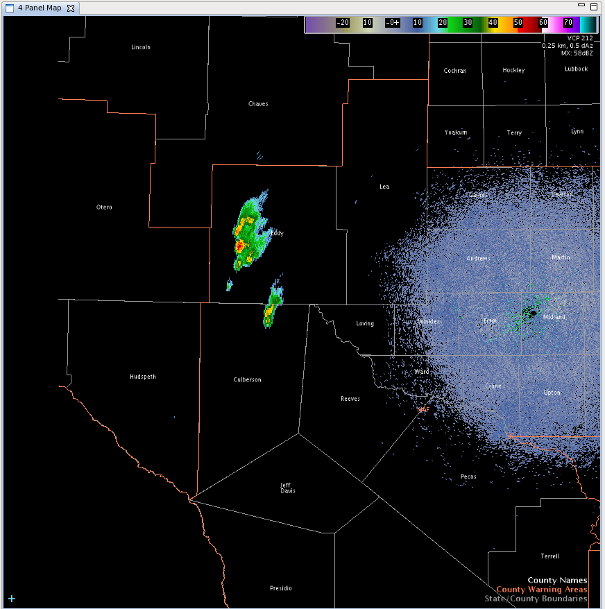
Here is an interesting example of ProbSvr ramping up while looking at 4 storms.

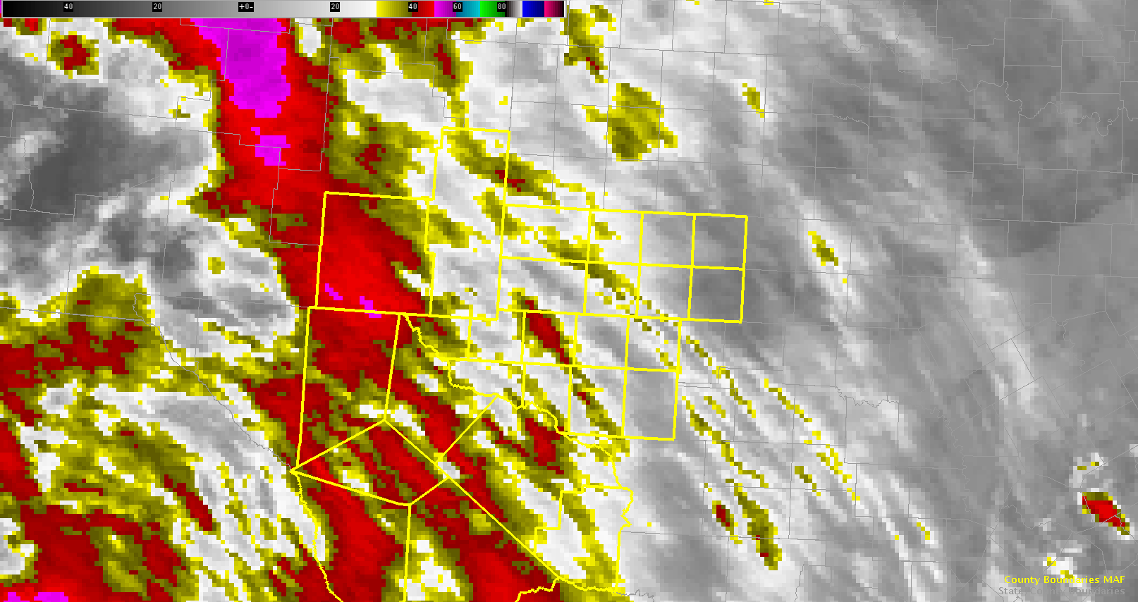
2214Z. ProbSvr is picking up four cells. This is the first scan where the two right cells have pulsed. Earlier, this could be a situation where we weren’t sure which storms would pulse back up. Seeing this helped the LUB office issue the severe you see here.

svr12214

2216 shows both right cells increasing some more.

svr2216

2220 shows them combining so it’s hard to say which storm is stronger now.

svr2220

2224 and we issued the southern severe.

At 2232 Z reported quarter size hail.

svr2224


The ProbSvr showing the difference in the cells helped us see which ones needed the focus of attention. It caught the high probs on the southern storm before the warning went out with a higher lead time for the hail. Again, it is to note that when the two storms combined, that may be why it spiked up because the northern storm was stronger at an earlier point.


Lauren13/Polarimetric Researcher


Tags: None

5 ENI alerts on one screen

Finally the storms are getting enough lightning to pull some higher ENI alerts. We have the configurable 1 set to 75 flashes/min and #2 set to 100/min. The light blue is #1 and dark blue is #2. Not really a point to it but you can see how the polygons can get a little confusing with 5 different colors. And this is without severe thunderstorm warnings overlaid.

all5ENI


Lauren13

Tags: None

Dots vs Circles on ENI Total Lightning

Just wanted to show a difference between the circles and dots. The dots are on the top image and the circles on the bottoms. Don’t know about anyone else but I like the dots a lot better even just at first glance. The circles are a little annoying and the dots make more sense to me!

points


circles


Lauren13

Tags: None

Erratic ENI Cell Tracking

Here are four frames from a cluster of storms we have been watching and *trying* to track time series on but the cell tracks keep flip flopping.

2131Z and two are being tracked

2131-2142-1

2135Z and one circle inside another in the right storm is tracked.

2131-2142-2

2140 and we have three circles

2131-2142-3

2142 and now we have one big one!

2131-2142-4

Needless to say, the ENI tracking and timeseries was NOT very useful on these storms…


Lauren13/Polarimetric Researcher

Tags: None

NUCAPS vs Observed RAOB

Today we got a special sounding at 18Z from KMAF to compare with the 19 Z NUCAPS sounding at roughly the same location. The NUCAPS sounding was able to pick up on the stable layer above 850 mb, although the NUCAPS sounding did have it a little higher. Also, after modifying the boundary layer T/Td in the NUCAPS sounding, MUCAPE values were very comparable between the two.

NUCAPS
19Z NUCAPS
KMAF18z
18Z KMAF
Tags: None

Svr Storm with ENI Thunderstorm Alert

Here is an example this morning of a clearly severe thunderstorm but with such little lightning that ENI only put a Level 1 Thunderstorm alert.

2055Z. Focusing on the southern most storm.

NoEniEx2048-2114-2

2059Z. The Thunderstorm alert has arrived but a TBSS is already evident at half degree. This is sampling about 10k ft AGL.

NoEniEx2048-2114-3

At 2105z, we issued the severe.

NoEniEx2048-2114-5

At 2111Z, the Significant Thunderstorm Alert was issued.

NoEniEx2048-2114-6


As of 2127Z, there is still not dangerous alert on the storm (or any that we have severes on…)

AllENI2127

I think it just shows why DTA’s are not the “best” thing to wait for or look at for a severe thunderstorm.

Lauren13/Polarimetric Researcher

Tags: None

ENI Lightning Jump

ENI continues to handle more isolated cells better than scattered convection. I have been following various forms of ENI data (track, plots w points, history, and current strike data). The lightning jump display is performing well right now. The storm itself does not have a very high amount of strikes, but the correlation between lightning jumps and storm intensification is holding. Increasing dbz returns can be seen in these radar images.

Here you see the lightning jump presented through ENI data on the upper right panel.  LIGHTNING JUMP

The radar reflectivity then ramps up following the 2112z spike.

Before lightning spike: lightning prejump

Post lightning jump:  lightning post jump

Tags: None

CI Sample


The images show a small break in the cirrus across Eddy County.  The CI picked up on this for one scan before the cirrus moved back in.  A storm did form there.  The 40% for this one scan was underdone due to some cirrus contamination.22

1845 Z (above)


21

19Z (above)20

1915Z (above)23

1931Z (above)

-Champion

Tags: None

Missed CI

Cirrus clouds may have impacted the CI algorithm (click to animate):

CI_failureNote that the developing convection is evident on the visible satellite.

This convection is associated with >35 dBZ echoes (click to animate):

CI_Failure2There is a possibility that the infrared satellite may be weighted too heavily during the day time because it is clear on the visible data there was convective initiation.

Here is what the infrared satellite observed (click to animate):

CI_Figure3 Note the dense cirrus across the area, which likely impacted the CI algorithm.

Polarimetric Researcher

Tags: None