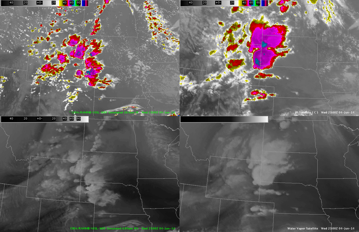
Looked at the simulated satellite imagery over the CYS domain beginning at 2300UTC. Overall – a pretty good depiction of the convective evolution in this location – although there appears to be storms too far east over the NE panhandle. Expect storms to move into that area – but the model was probably a couple hours too quick.
Sim Satellite at 2300 UTC: