Marginally Severe Storm just south of the CWA

Just before 20Z, storms have developed and the Throckmorton storm looks to be close to severe threasholds. Confidence is high that a warning will be needed for the storm. Prob severe has reached 99% with estimated hail size around an inch. Growth rate and glaciation are strong.

TstmHiProb7

The storm weakened a bit as it entered the CWA, but then strengthened quickly. Growth rate and glaciation was strong. A warning was issued.

TstmSvr7

Scott Rudge.

Tags: None

Formerly Tornadic Storm in CO moving into CYS area

Storm moving into our area out of Weld Co., CO.  Seems to have lost its rotational signature, but is already cycled a couple of times…and at the least has exhibited some signs of strong downdraft wind wrapping around.   Jared issuing SVR for wind at 2115ZCYS

of interest…total lightning has been relatively steady on this storm over the past 15 minutes.  Only some ebbs and flows…nothing notable…

ltg

db


Tags: None

Operations Update

Forecasters are hard at work examining the experimental products in both the Norman and Cheyenne CWAs.

With upper-level support in place for the first time this week, both the Colorado region and Oklahoma region are already seeing convection and (nearly) severe storms.  Severe Thunderstorm Watches have been issued for both regions of focus today with storms developing shortly after operations in the testbed began.

Colorado / Wyoming / Nebraska Watch

ww0123_radar


The pGLM lightning data is looking good over the Colorado region, but currently the OKLMA appears to be having some systematic problems.

Darrel is trouble-shooting visualization of the Lightning Jump Algorithm in AWIPS2 so that it can be viewed in either region. (currently limited to the floater domain which is only over OK)

-K. Calhoun, Week 1 Coordinator

Tags: None

Thunderstorm activity expected in western Oklahoma

Upper level analysis has ridge shifting east with trof entering the four corners region. Upper flow is west to southwest across the southern plains with 120 knot jet across central Texas.

WV7

NAM/RAP 500/700 Heights/Vorticity not showing any strong upper waves coming through this afternoon and evening.

HiteVort7

Satellite and surface data show some mid level cloudiness moving through the southwest portions of the CWA. Dry line resides across far western portions of OK. Moist southerly BL flow continues across central and eastern portions of the area.

SatSurf7

Nearcast moisture fields indicate increased PW’s and higher Theta E moving into the area by late afternoon and early evening.

Nearcast7

Convection has initiated just south of the forecast area and just east of the dry line.

CI_05_07

Scott Rudge.


Tags: None

Initial Thoughts…Cheyenne and Points Southeast

Some thunderstorms have already developed this morning and this trend should continue through this afternoon. Moisture is shallow now, but the column continues to moisten as we progress through the day. The main focus, I believe, will be just east of the region. Temperatures are currently in the 60s and 70s in Northeastern Colorado and Western Nebraska with a little better moisture content. The main low is hanging back over Southwestern Wyoming, but we will begin to see some energy rotate in and around this low later this afternoon. There should be better support for storms as the jet become better established over the region, as well. The tornado threat is on the lower end, while the hail and wind threat would be greater. Low freezing levels would suggest easy formation of hail, especially if we can get some better updrafts (especially outside the meager 40 and 50 degree temperatures we see in Wyoming/Colorado).

Jared Maples

Tags: None

Prob Svr Trend

7May14 Cheyenne Radar Prob Svr7May14 Cheyenne Radar Prob Svr 2

I was focused on a storm south of Cheyenne that was developing just west of I-25. The first few scans showed some potential with the storm. The Prob Svr was indicating smaller values (~30% range) around 1930Z. I utilized the all-tilts and dual pol products to see the extent of the storm height and magnitude of the reflectivity. It was apparent that 60+ dbz were up to around 19,000 AGL at the time. A freezing level of around 4,000 AGL gave confidence that some type of hail was falling. It was only about ten minutes later than the Prob Svr jumped from the 30% range to the 70% range. This would have had a decent influence on any warning that was issued. Soundings depicted plenty of dry air aloft, which would have supported some wind associated with this storm. Approximately 15 minutes time passed before velocity returns showed interest features that may have signified some decent wind gusts.

Jared Maples


Tags: None

Early Afternoon Set-Up for WY, CO, NE

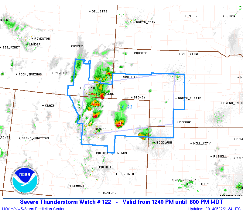
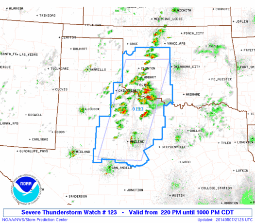
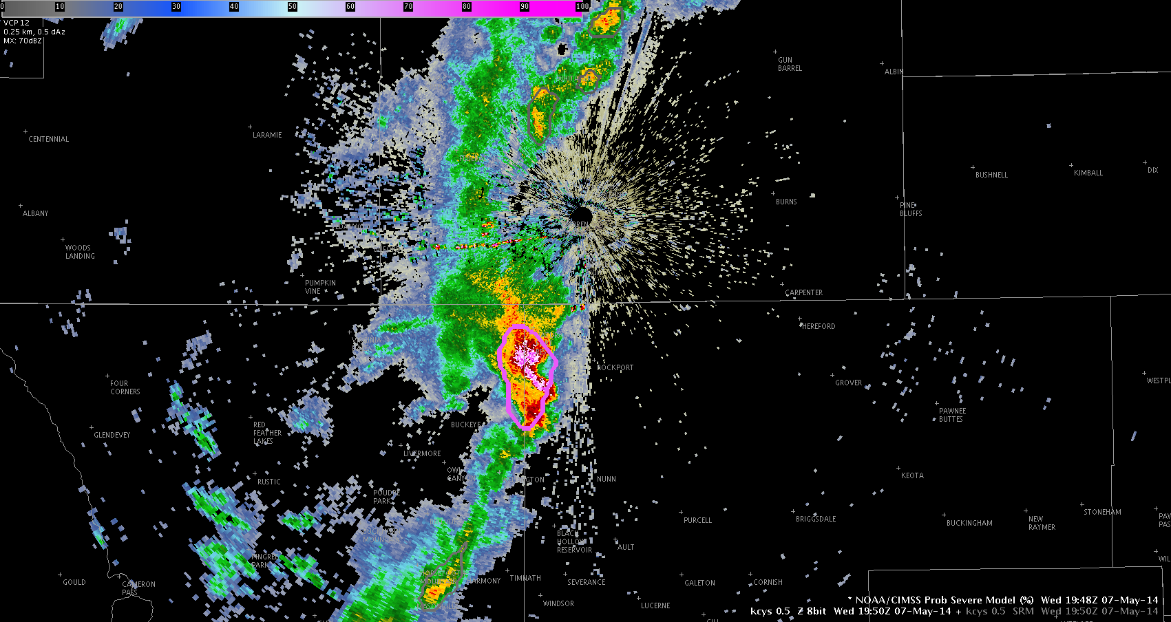
Severe t-storms are a possibility through the afternoon in the High Plains around WY, CO, NE.

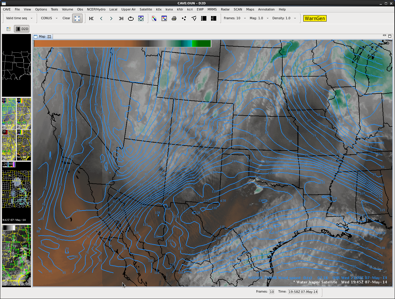
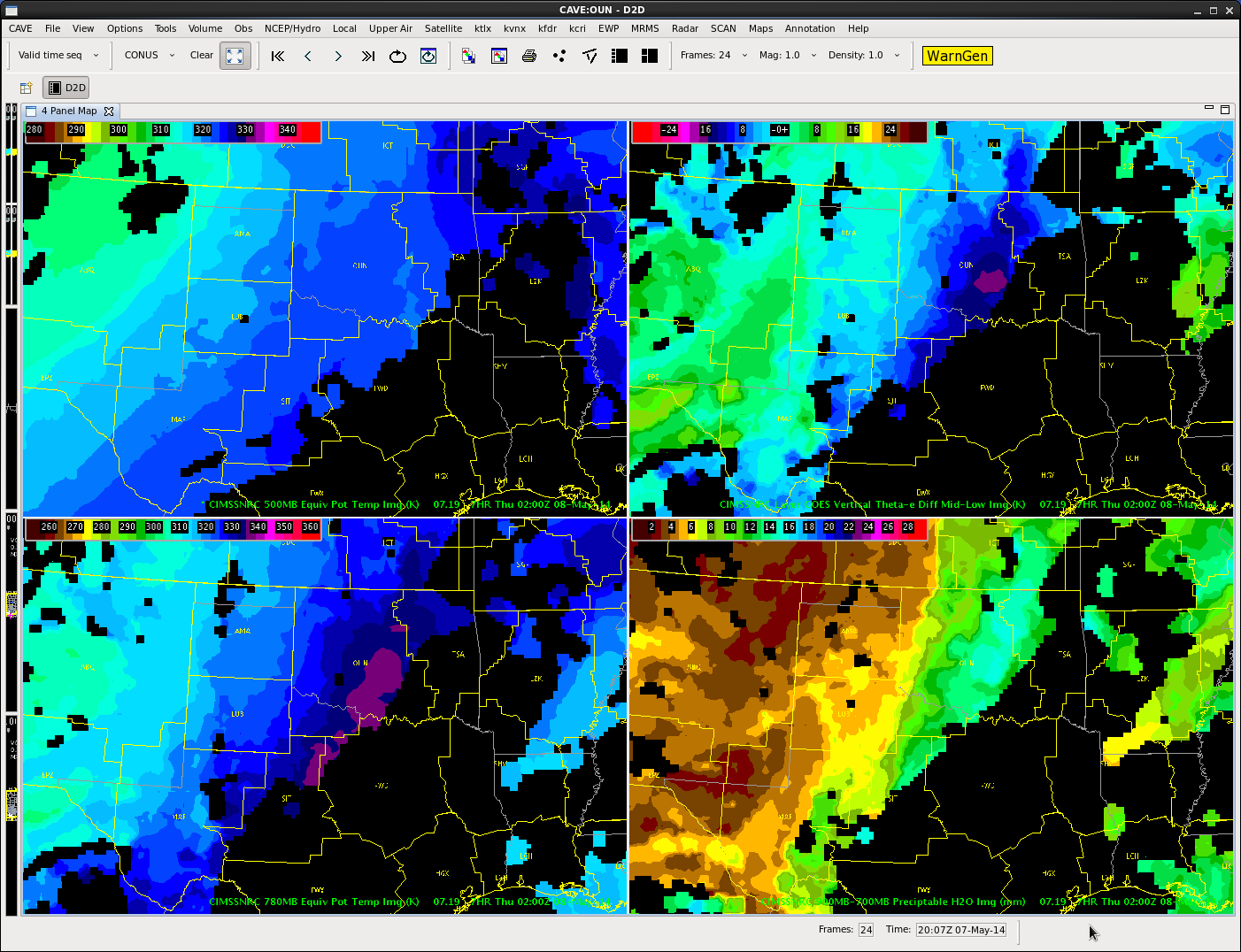
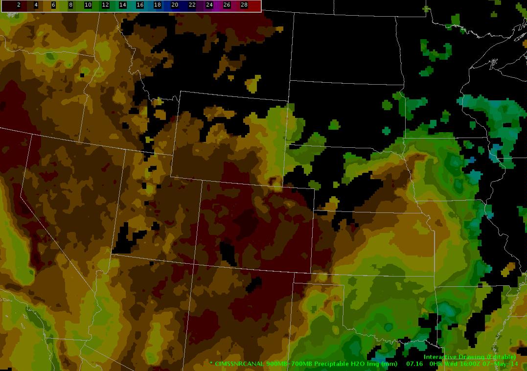
NAM, GFS agree on a low on the E. Colorado/W. Kansas area strengthening some through the afternoon, increasing the easterly, upslope flow into the area.  This will also serve to advect higher moisture content from the east…something we see in the Nearcast precip. H2O analysis

CAVEDrawing


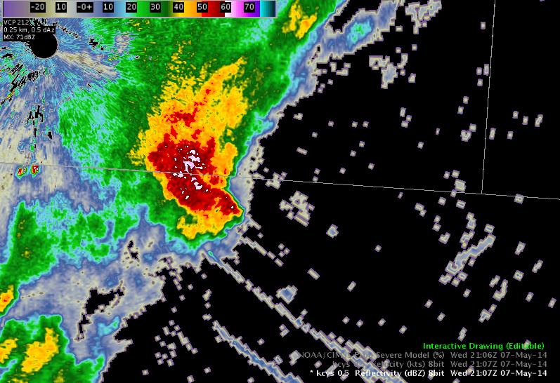
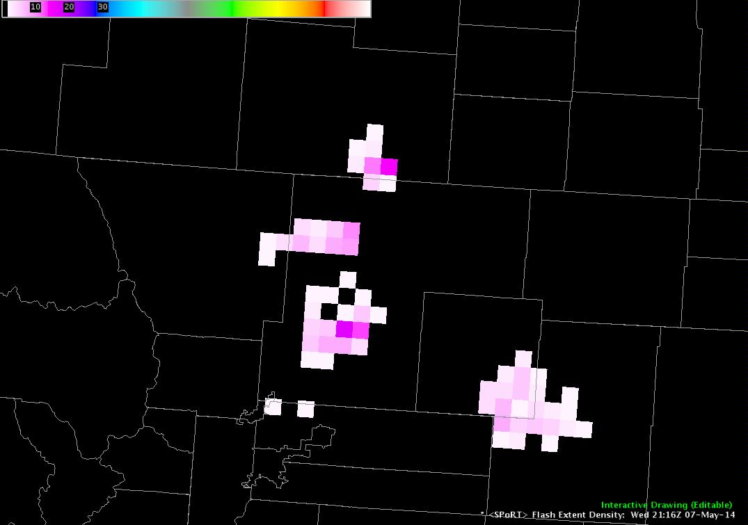
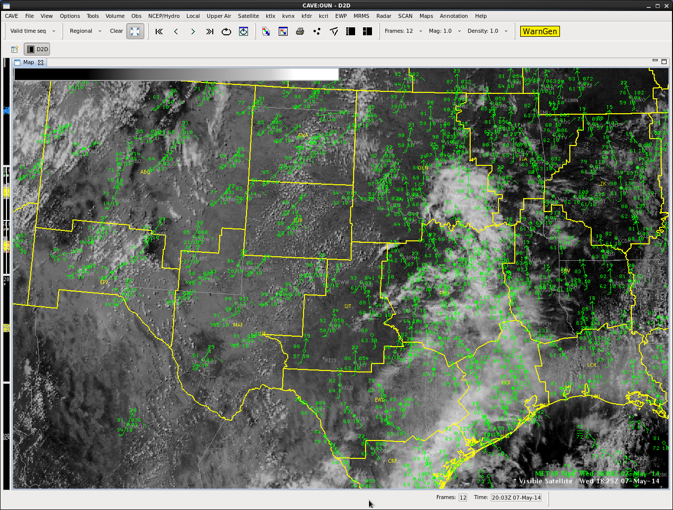
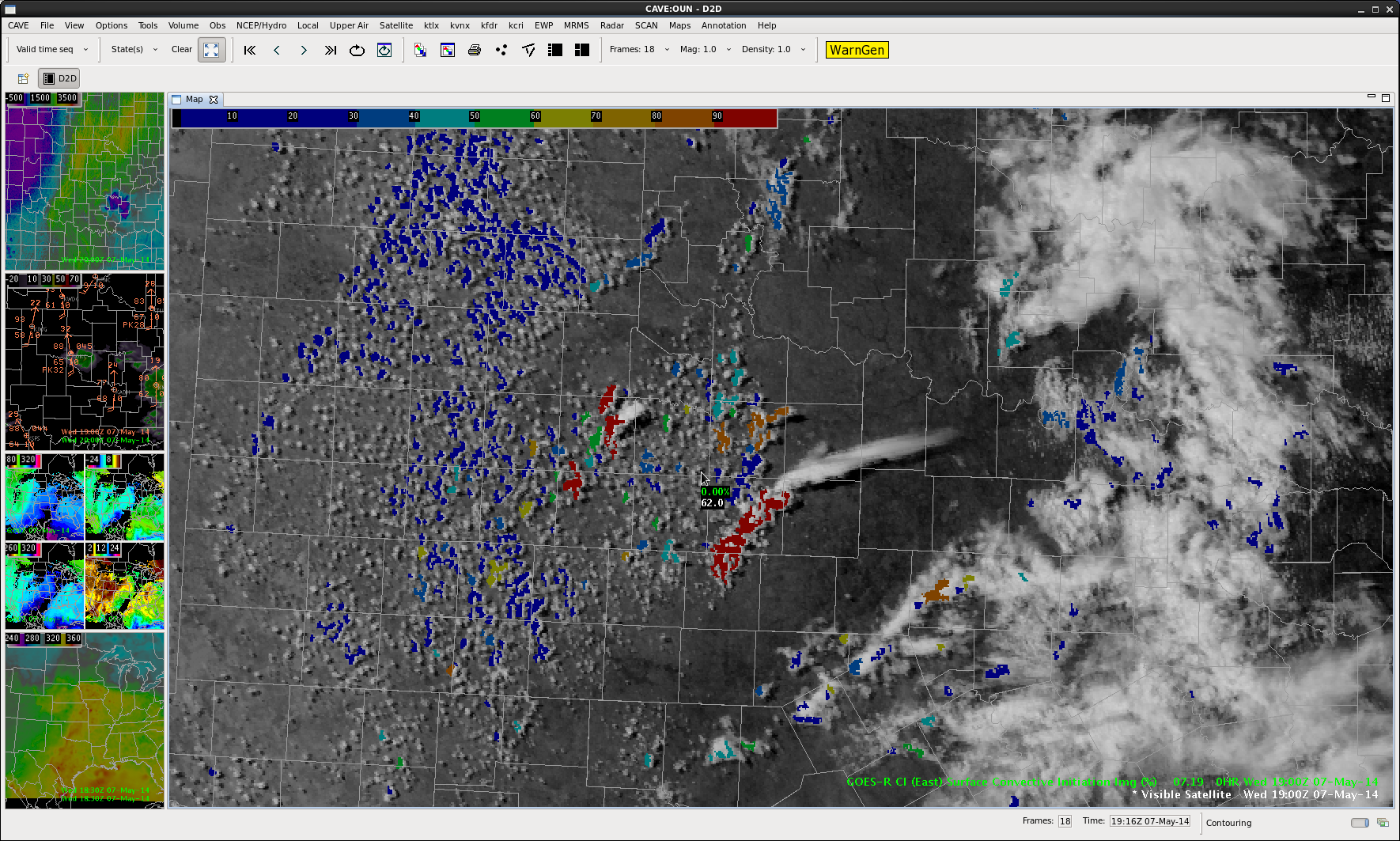
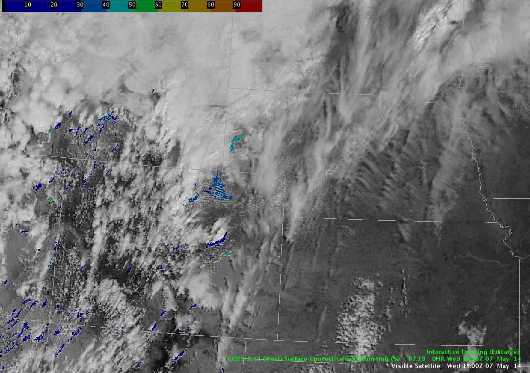
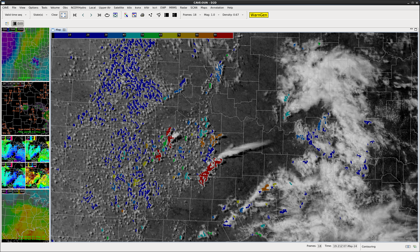
Ongoing convection in WY in combination with plenty of cirrus over the area of concern has limited for now the use of the CI product.  Plenty of clearer air farther southeast in KS outside of the area of immediate concern.

CAVEDrawing1

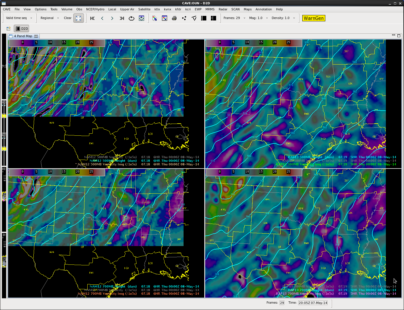
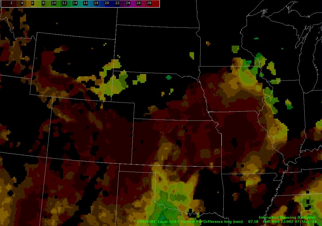
The Nearcast vertical theta-e difference product shows a band if instability along the WY, CO border and on into western NE.  The model forecast shows a maximum in instability near the WY, NE border at 22Z.

CAVEDrawing2

As ongoing convection in WY emerges into warmer, ore unstable air to the east, there is an expectation that storms will intensify.  Also need to be on the lookout for any thinning in the cirrus shield over the next few hours in NE as we could see more development out here.

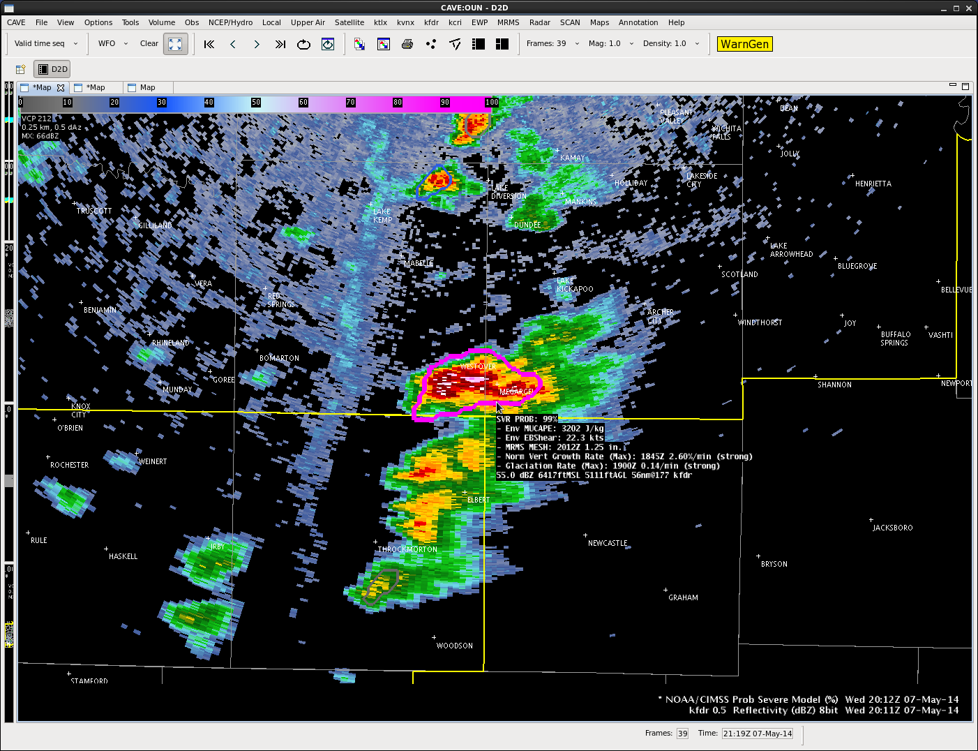
Storm motion should be to the northeast.  Low freezing levels may lead to very large hail.  Looking at the 22Z Nearcast forecast difference in PW between the low and mid-levels, higher values are seen in the area of concern…drier air aloft could assist in downdrafts and damaging wind production.

CAVEDrawing3

Will monitor impulses rounding the upper trough to the west for increased vertical motion through the afternoon/evening.-db


Tags: None

Cu field in NW Texas

CI_05_07

CI tagging cu field in western north Texas with 90 percent development. A few storms have already formed with strongest storm approaching Knox county with 27% on
prob severe model.

BT

Tags: None

Daily Summary: EWP Day 2

Tuesday of our first operational week was a bit quiet, but still allowed for testing of many of the operational products.  We chose to operate in the Cheyenne and Norman County Warning Areas.  The nearcast, CI, and ProbWarn products were heavily utilized during our operations.

SPC Storm Reports for 6 May 2014.

-K. Calhoun, Week 1 Coordinator

Tags: None

EWP Status for 7 May 2014: 12:30-8:30 pm Shift

EWP Status for 7 May 2014: 12:30-8:30 pm Shift

We will begin the day in the DevLab with a debrief of Tuesdays operations in Wyoming and Oklahoma before moving to the HWT at 1pm to join the EFP map discussion.

Severe convection looks a bit more likely over the southern and central plains on Wed. Currently the plan is to operate in the Norman and possibly San Angelo CWAs.  The schedule should allow us to examine the pre-CI environment with multiple GOESR products before transitioning to warning operations.  The Norman  (and Lubbock? — depending on the dryline location) CWAs will be given first priority due to the presence of the Lightning Mapping Arrays.  Hail / wind will likely be the primary threat with these storms.

A region farther north east (Iowa / MN / WI) also currently appears to be a possibility for operations, but CI is likely to occur much later in the day and may not be the best fit for our shift.

Tags: None