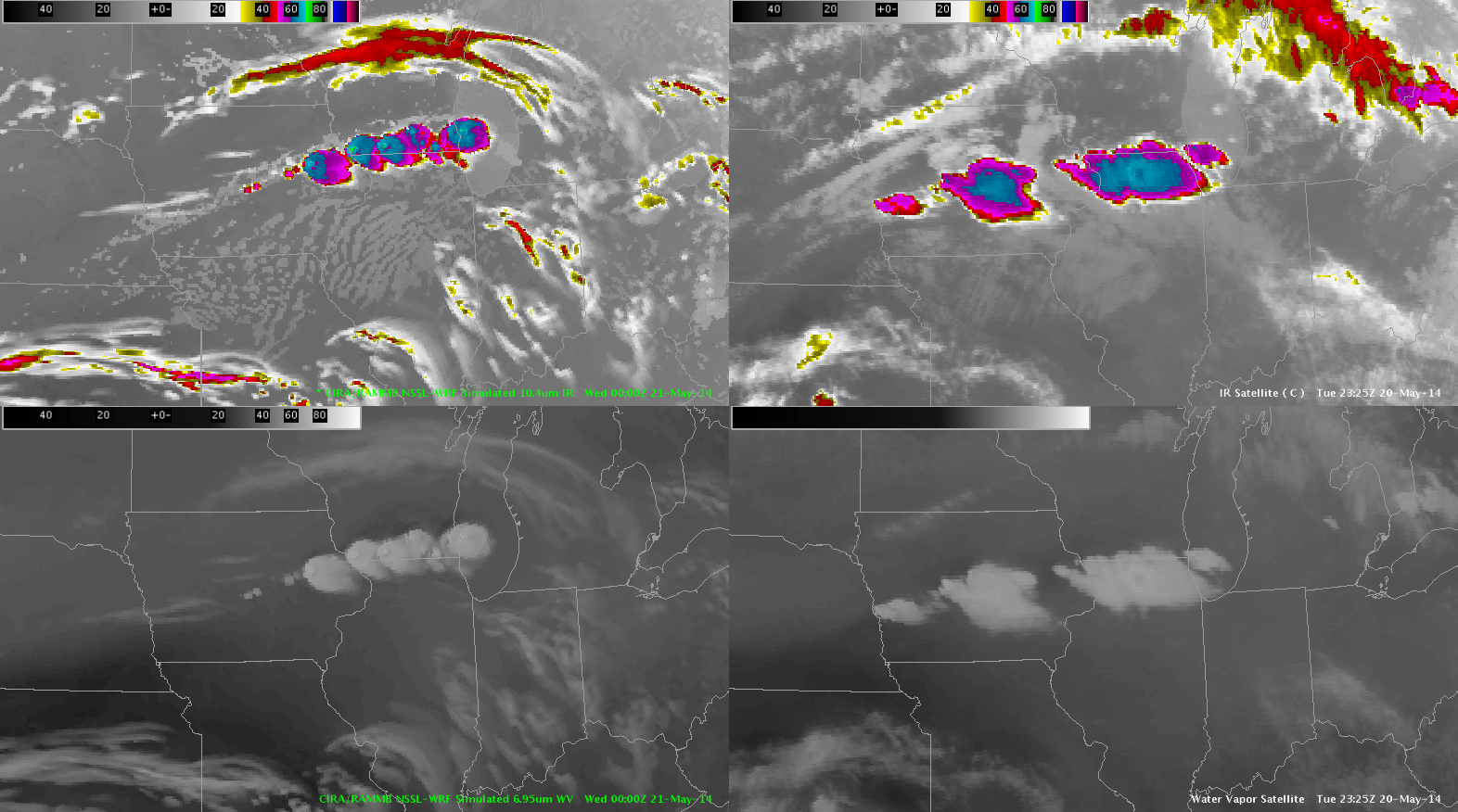
Building on the previous post the simulated IR/WV imagery did very well capturing the orientation/timing of the convection later in the day across eastern IA and into northern IL. In reality it did under-forecast the degree of convection over western IA.
-JB

