

The line of storms heading toward the DC area is showing up on the vLAPS model 800×800 grid. This is the forecast for max reflectivity at 19Z: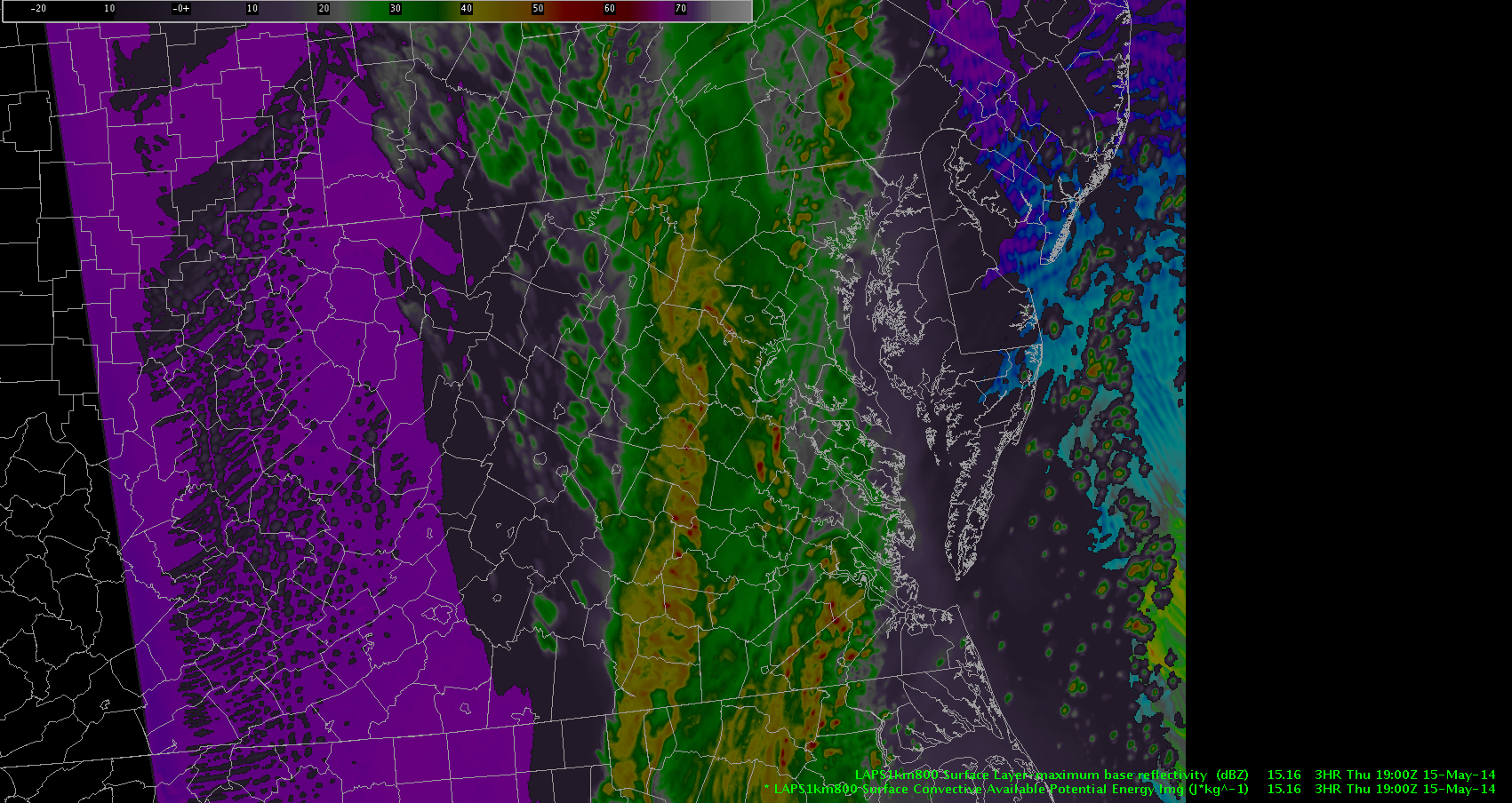
It shows moderate rainfall over DC itself, with heavy rainfall to the west. Max values on vLAPS (in red) were between 50-55 dBZ. At the time, the line of rain and storms was further to the west, and it was not raining in DC yet. However, some small convective showers were starting to show up in front of the longer LCS line.
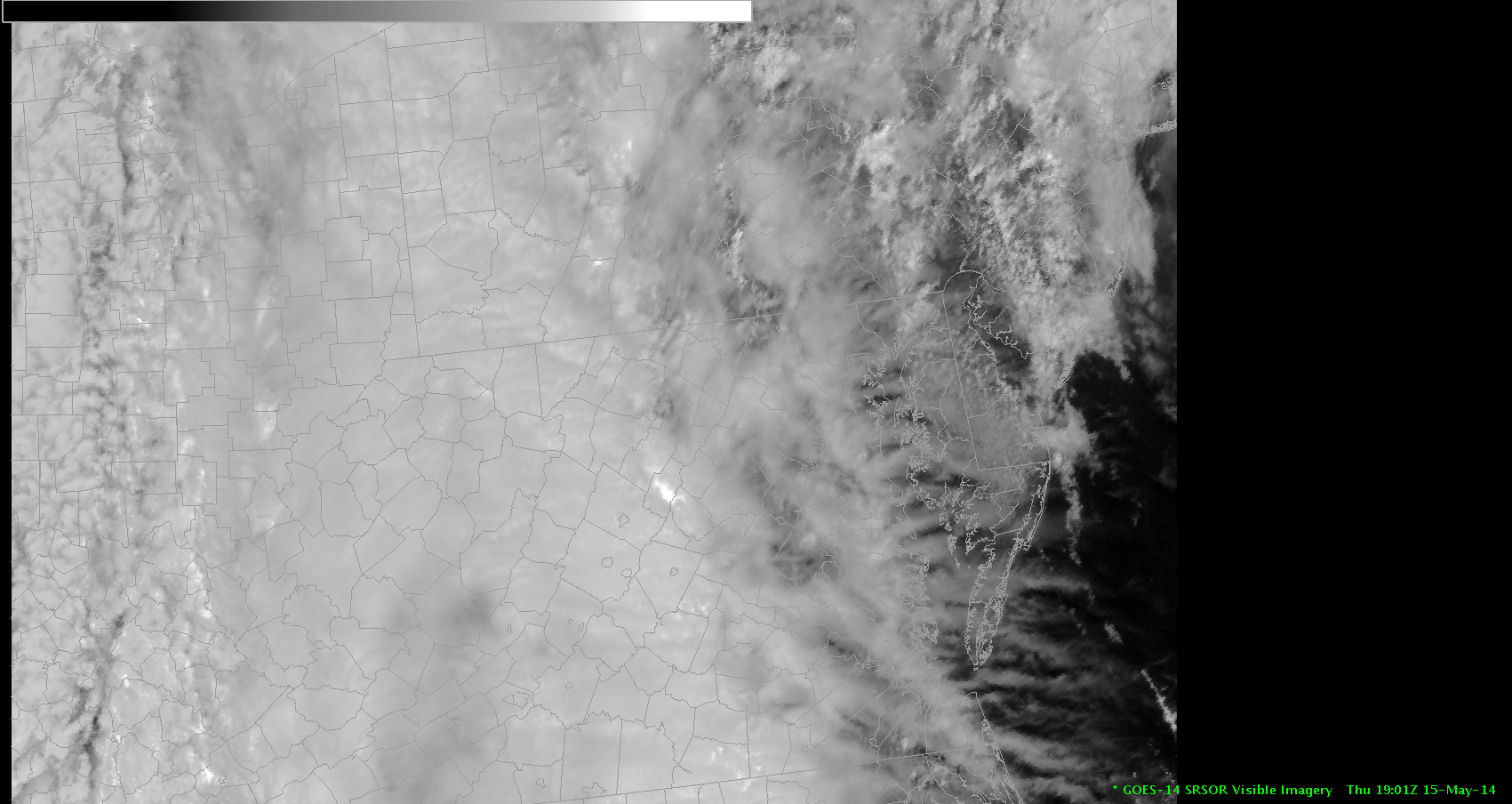
 As you can see, the spatial coverage of the rain is way overdone on vLAPS at this point, and the line of convection is too far to the east as well. It might be the cloud cover that’s causing a problem for LAPS. You can see how heavy the cloud deck is on the rapid scan GOES visible imagery:
 At some point, I’m not sure exactly when because I was on this side blogging :-)… but the model re-initialized and looked much better. This is the 20Z forecast for max reflectivity on vLAPS:
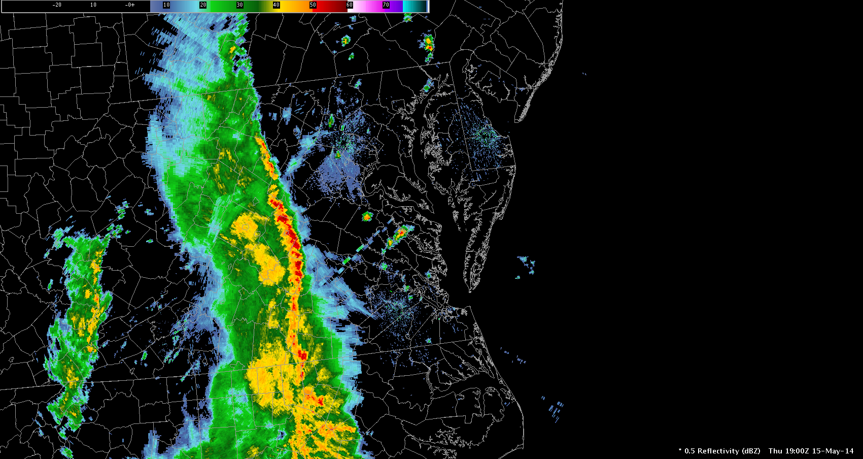
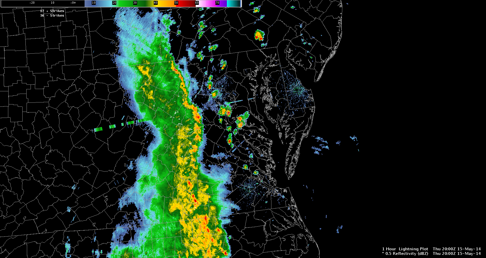
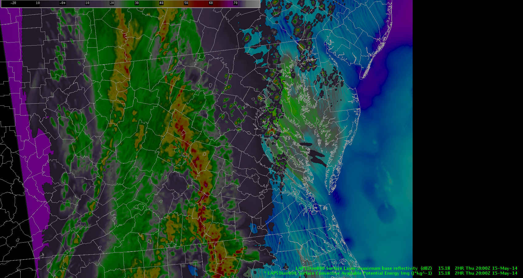 Notice how much further west the line of storms is in the frame above. It compares better with the actual base reflectivity:
 … but now, it seems that the model has over-corrected. The storm line is now too far west by about 50 miles. Unfortunately, it looks like the vLAPS is not going to be initialized well enough to aid in severe forecasting today.
At our meeting earlier this afternoon, vLAPS developer Hong Le mentioned that it takes an hour or two for the model to completely switch over to its new environment once its coordinates have been moved. Was there still some bad data lingering in the system that caused the speedy FROPA earlier in the afternoon? Or, did the model need time to “catch up” to the new initial conditions in this 800x800km region? Or was there another reason altogether?