
On Wednesday afternoon, a line of severe storms developed and began moving through western Pennsylvania. The LAPS 800×800 surface CAPE output was showing an interesting feature- relatively high CAPE levels (around 2000 J/kg; not bad for western PA).
 30 minutes later, and the values in this area are progged to be very erratic, with strong gradients in CAPE developing along this same line.
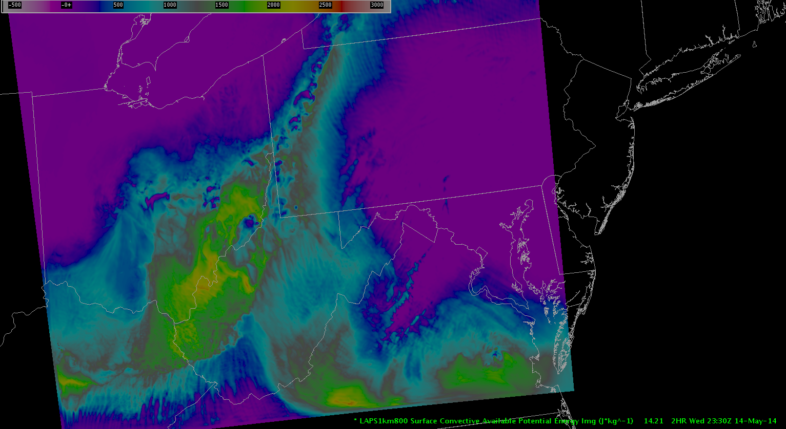 The model output seems to produce a sort of streamline look, heading toward the center of this line. It sort of looks like a convergence zone. This is precisely the area that manifested as a line of severe thunderstorms. The first SVR for this line was issued at 22:54Z. This is what the radar looked like at about 23:30Z.
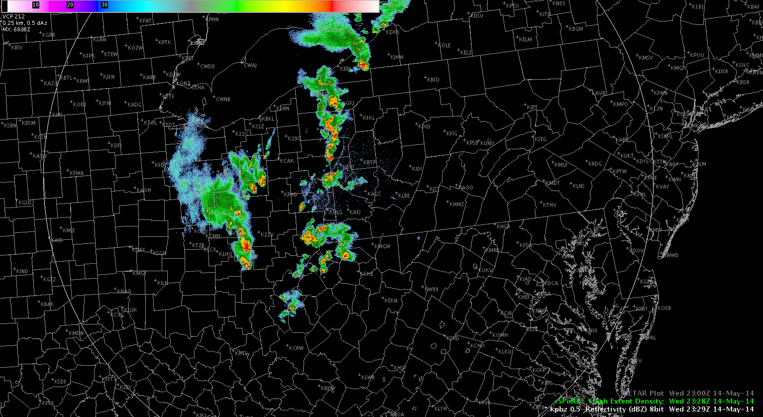 A whole bunch of convective cells, but oftentimes, you’ll get a line like this and it won’t turn severe. So it’s helpful to have guidance in the short term so see if these storms have true severe potential.
I also want to point out the storm cells along the PA/WV border, which had spawned severe warnings at the same time as the line to the north. The LAPS was showing high CAPE values (above 2000) in the vicinity of the developing cells, but the values were also high back behind the storm. So, the spatial coverage of the high CAPE values was too large to determine exactly where a strong thunderstorm would develop. But, you could see it on the super rapid scan GOES IR imagery:
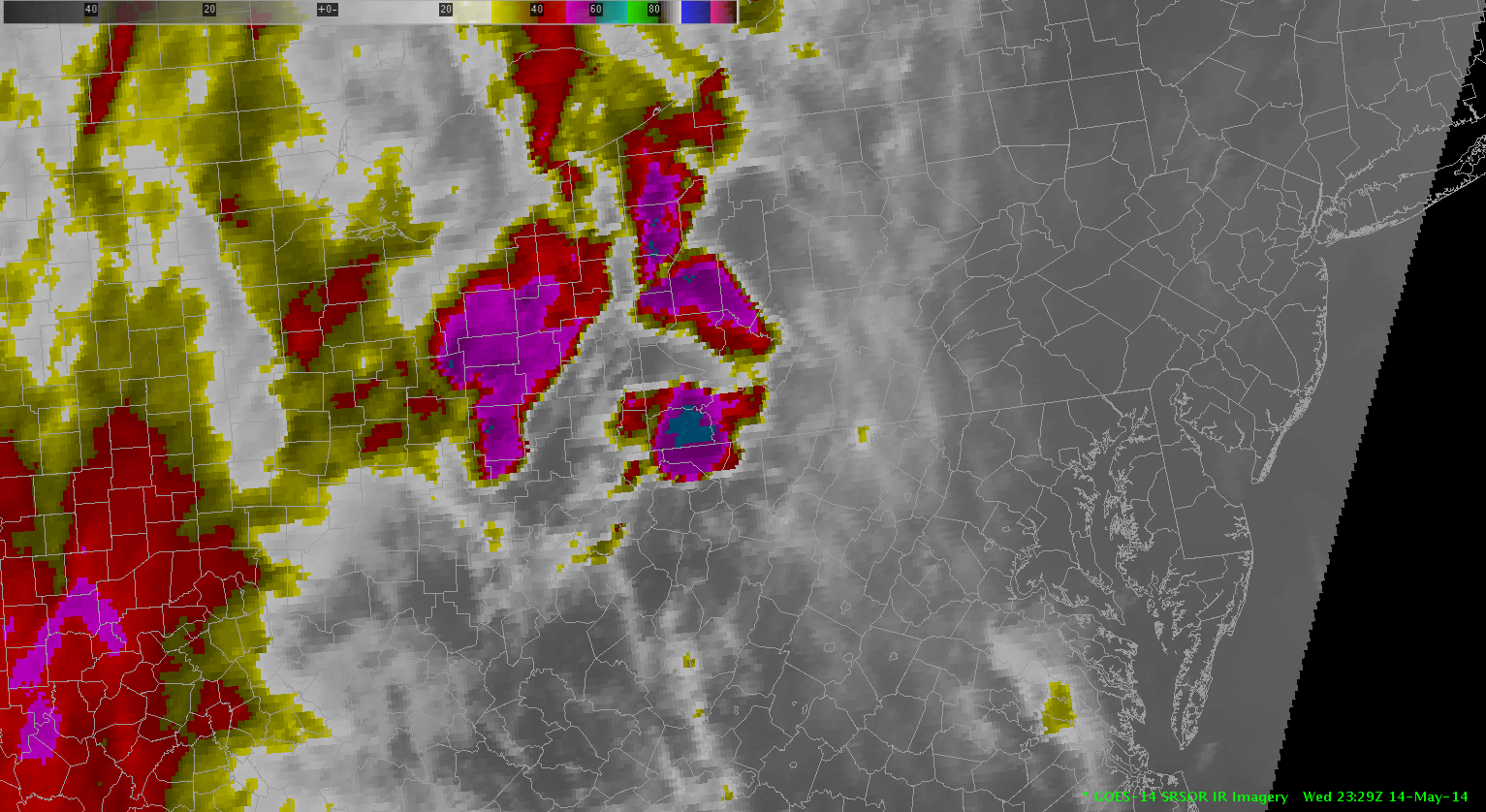 The southern cell had a SVR issued about 10 minutes prior to the SVR for the northern line of storms. I noticed in later images of GOES IR (which I failed to capture… sorry) that the cloud tops had cooled significantly in the northern cell and a broad area of -60C cloud tops had developed.