

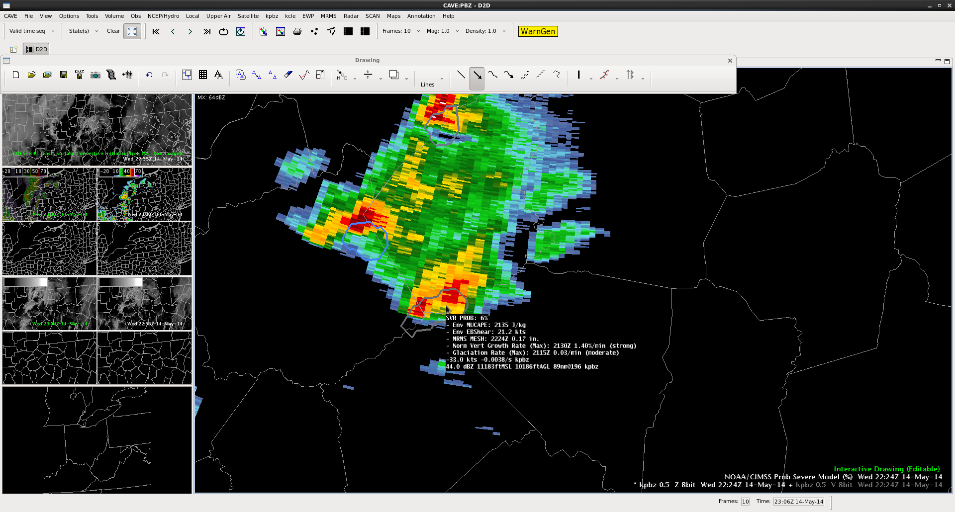
The following three images follow a cell northward across north-central WV using the ProbSevere Model overlaid on KPIT 0.5 degree radar reflectivity. The first image below is from 2224z where the sampling box shows the ProbSevere model with a 6% probability of a severe storm. The Multi-Radar Multi-Sensor MESH size was 0.17 inch within an environment of 2135 J/kg MUCAPE and 21.2kts EBShear. There was strong vertical cloud growth rate and a moderate glaciation rate calculated from satellite imagery.
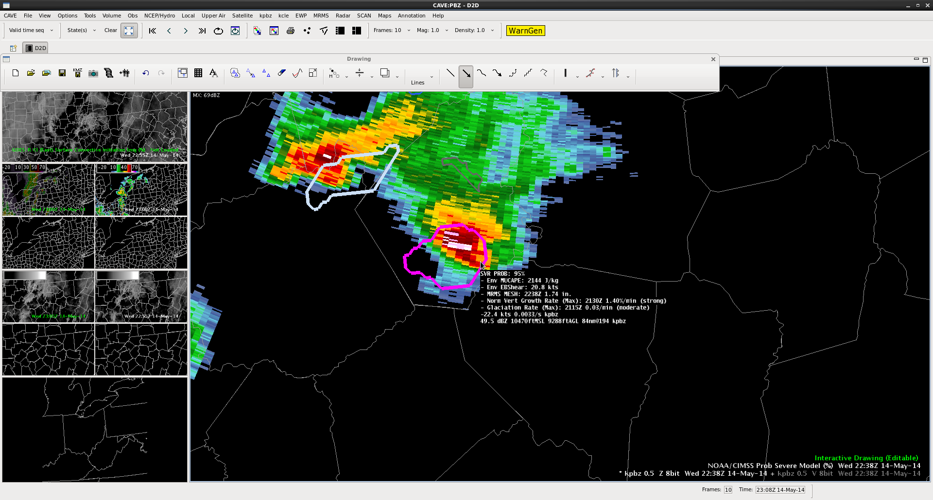
 14 minutes later at 22:38z the ProbSevere Model severe probs jumped to 95% with the only change in the predictors being an increase in MRMS MESH to 1.74inch.
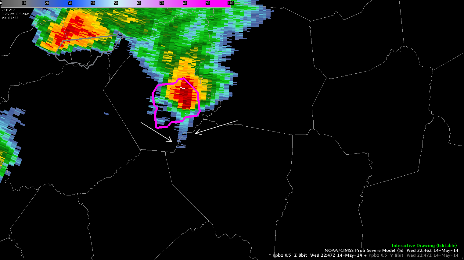
 9 minutes later at 2247z a three-body scatter signature (between the annotated arrows) shows up on the KPIT radar to the south of the storm core. At 2254z golf ball sized hail was reported in Salem, WV.
 Shawn Smith