

 The image above is a screen capture of radar and lightning data centered over the OHX (Nashville) CWA at 21:54z. Today we evaluated the Lightning Jump Detection Algorithm since the OHX CWA was within coverage of the Northern AL Psudo-Geostationary Lighting Mapper.
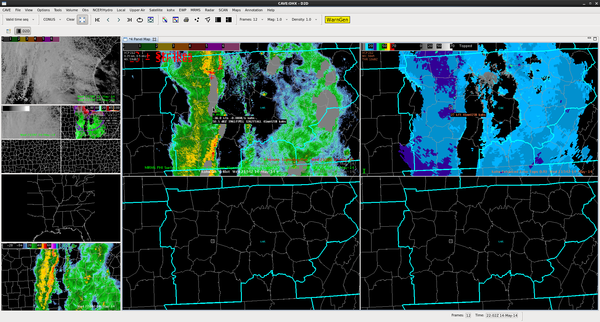
In the four panel above focus on the top two panes where the top left has 0.5 reflectivity from OHX radar overlaid with the Lightning Jump Detection Algorithm (Grey) and 5 minute NLDN Cloud-to-ground lightning data (+ and – in red). The grey of color of the Lightning Jump Detection Algorithm only indicates 0-1 sigma or 0-1 standard deviations of the previous 10-minute change in flash rate. Significant jumps (increases in sigma) in lightning activity are correlated with severe weather. The top right pane shows OHX Enhanced Echo Tops. The convection observed in the top right pane was a low-topped QLCS as indicated by Enhanced Echo Tops of only 20-25kft. During the evaluation period of 20-22z no significant lightning jumps were detected due to the low-topped nature of the QLCS. Had the storm updrafts and tops been taller (upwards of 40-50kft) then lightning activity including jumps may have had a better chance of occurring.
Shawn Smith