
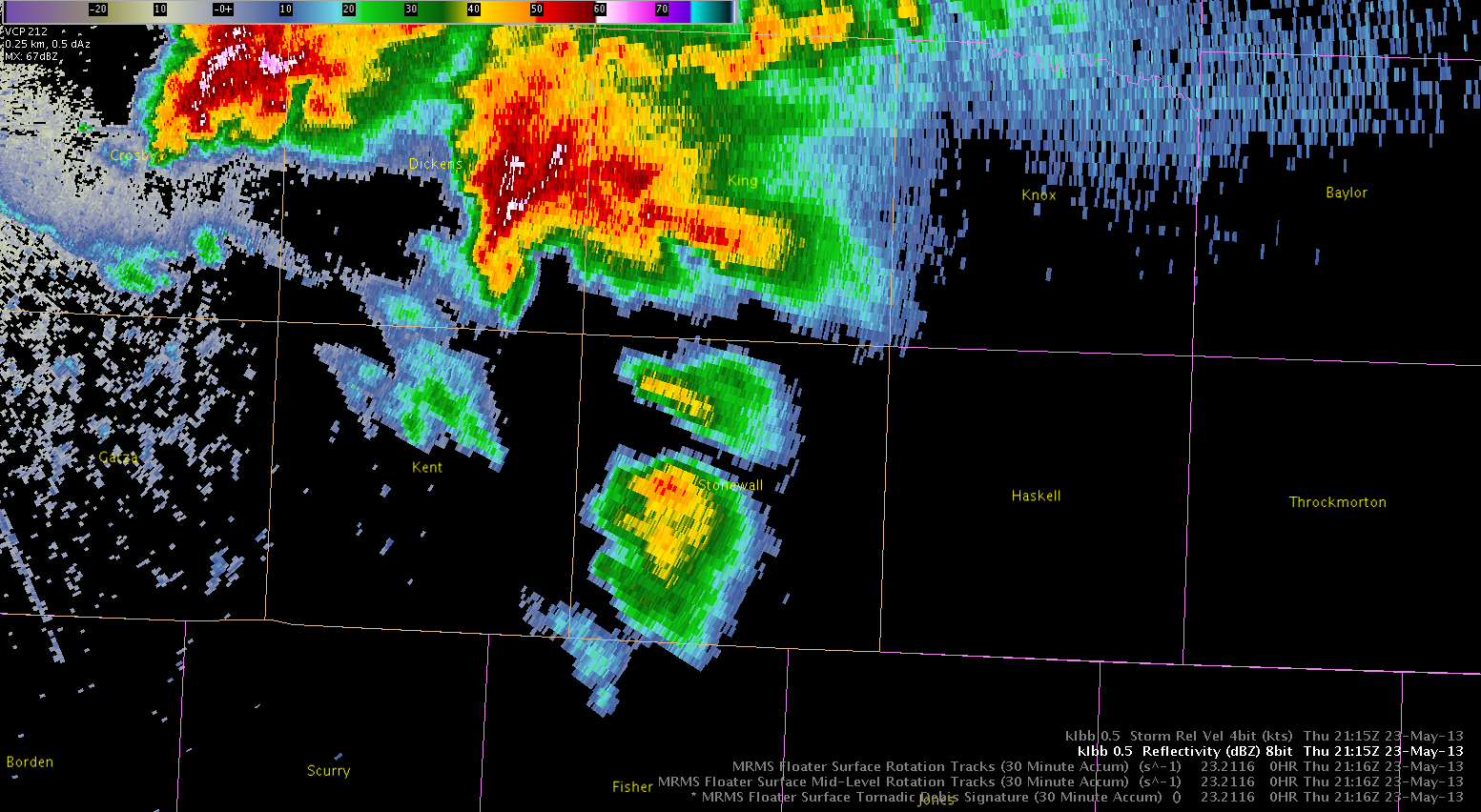
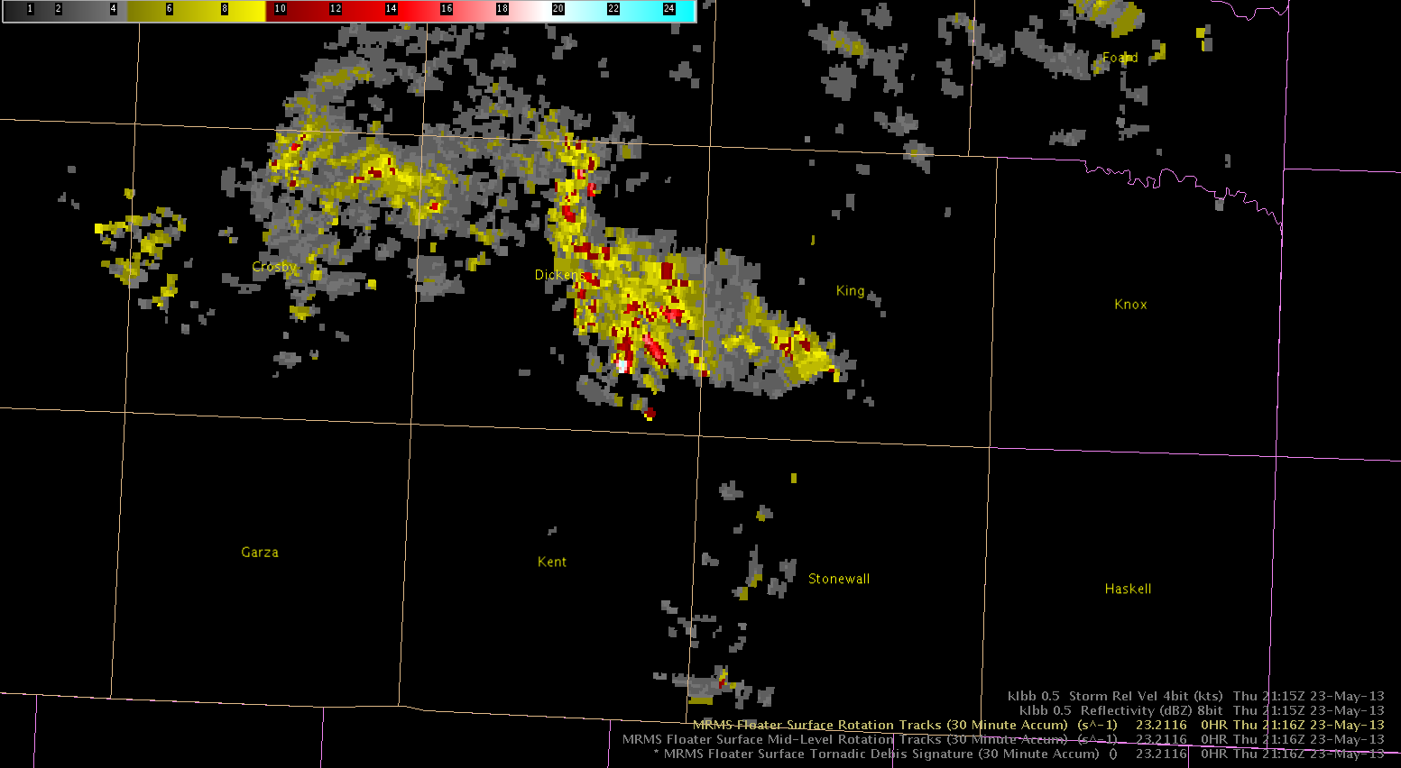
KLBB radar reflectivity really ramped up 2115Z and MRMS Low-Lvl Rotation Track also indicated increasing in intensity of the low level mesocyclone. See images below. Low-Lvl Rotation Track Prog was used for the TOR warning.
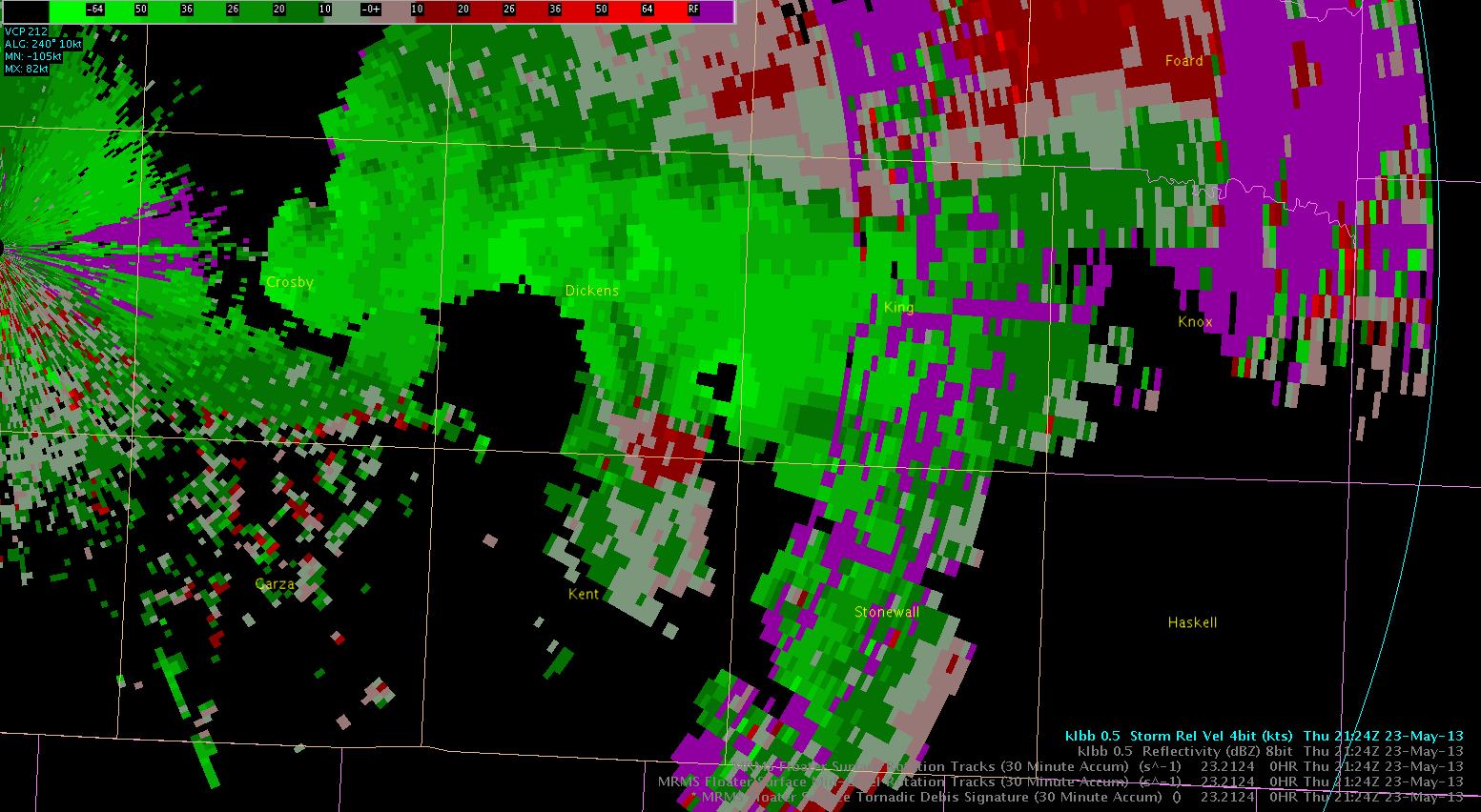
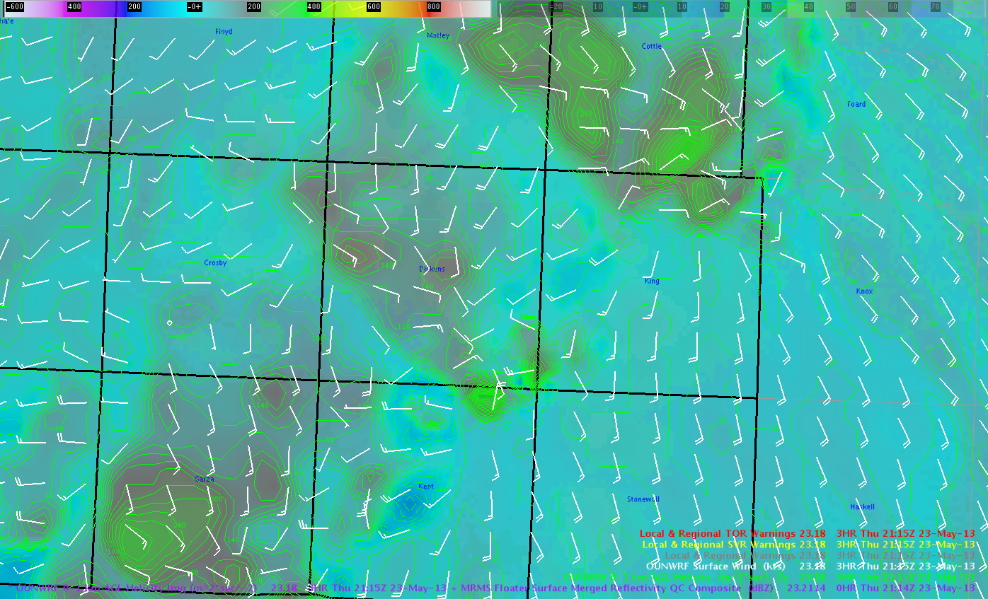
Though the low-level circulation was increasing and ramping up, it wasn’t “gate-to-gate” on the SRM just yet at 2115Z on KLBB. Nevertheless, OUN_WRF indicated high 0-1KM SRH forecast values in the next hour on the order of 300-400 m2/s2 where the dangerous part of the storm was headed, thus went straight to a tornado warning due to the conducive environment. (See below images).
We still continue to watch our northern counties below the old MCS outflow boundary, as the air is only slightly cooler, shallow, and remains conditionally unstable with extremely backed easterly surface winds.
Wow, what a day. My favorite (due to being more comfortable and the type of storms) ALL WEEK!!
Martello/Zimmerman