
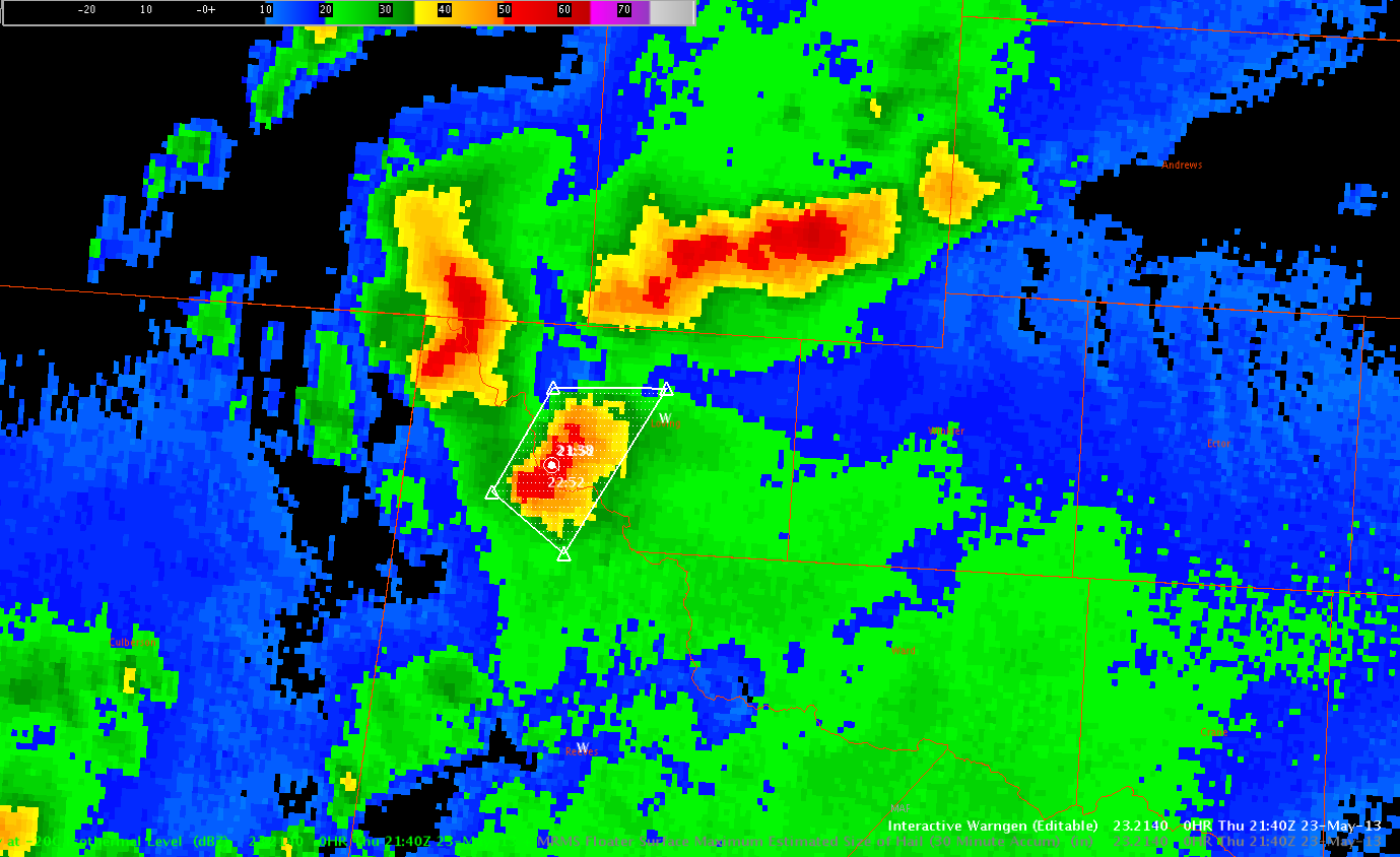
So, with ongoing and potentially severe thunderstorms in the Midland area, I decided to move to Midland! Well, not really, but virtually. =) So, we’ll see how well the MRMS, HSDA and other products work here, and if the pattern recognition I developed on the previous two days will work well here. Now, I am expecting a dearth of reports way out here in west Texas, unless they have some cameras strapped to a rattlesnake or a jackrabbit. Anyway, after transferring over, and getting products set up as quick as I could, I quickly issued my first warning based mostly on the MESH and 60 dBZ reflectivity values at -20C. This warning was issued for the affecting the western portions of Loving and the far northern portions of Reeves Counties.
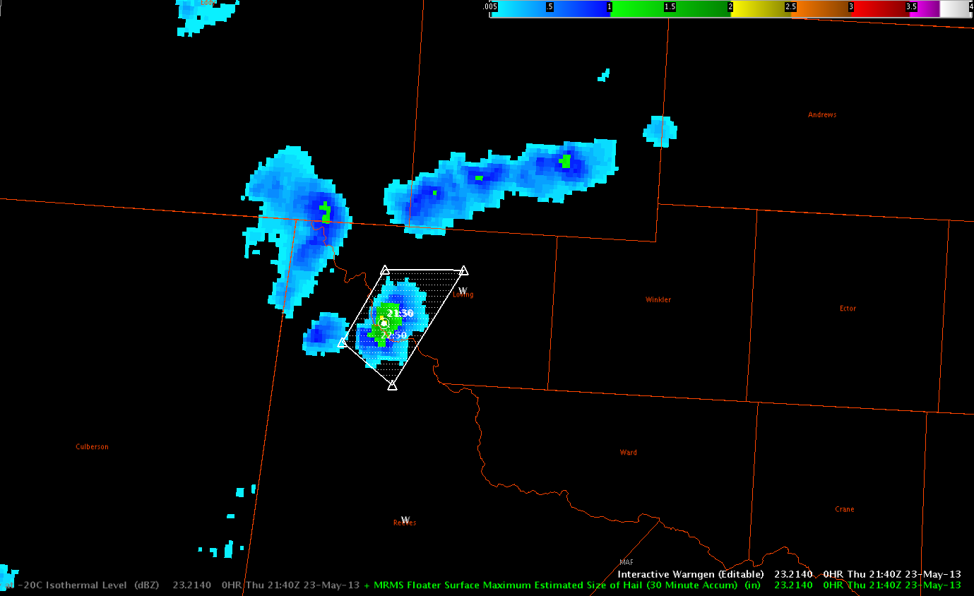
Following is a four panel of various MRMS parameters and the 0.5 degree HC.
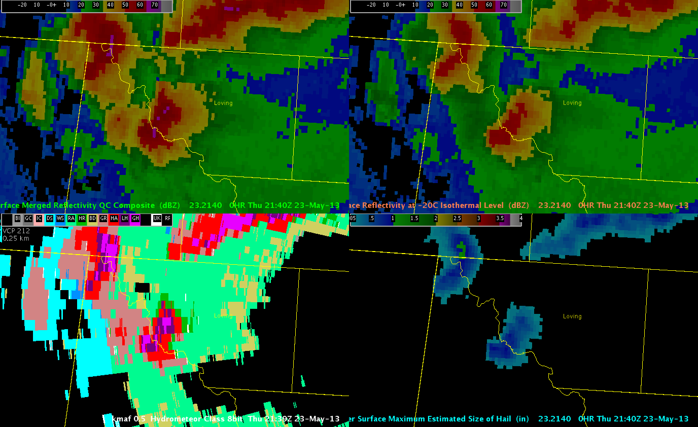
Notice that the MESH product in the lower left no longer indicates sever hail, however, the 0.5 degree HC algorithm clearly shows some giant hail signals. This storm had undergone recent weakening and the MESH 30 minute accumulation had indicated severe size hail within the previous 30 minutes. The severe hail still may had been reaching the ground by the time I was able to load up the data. So, I went ahead and issued the warning. We’ll see if we get any reports from this storm…but I’m not too positive.
Kris