
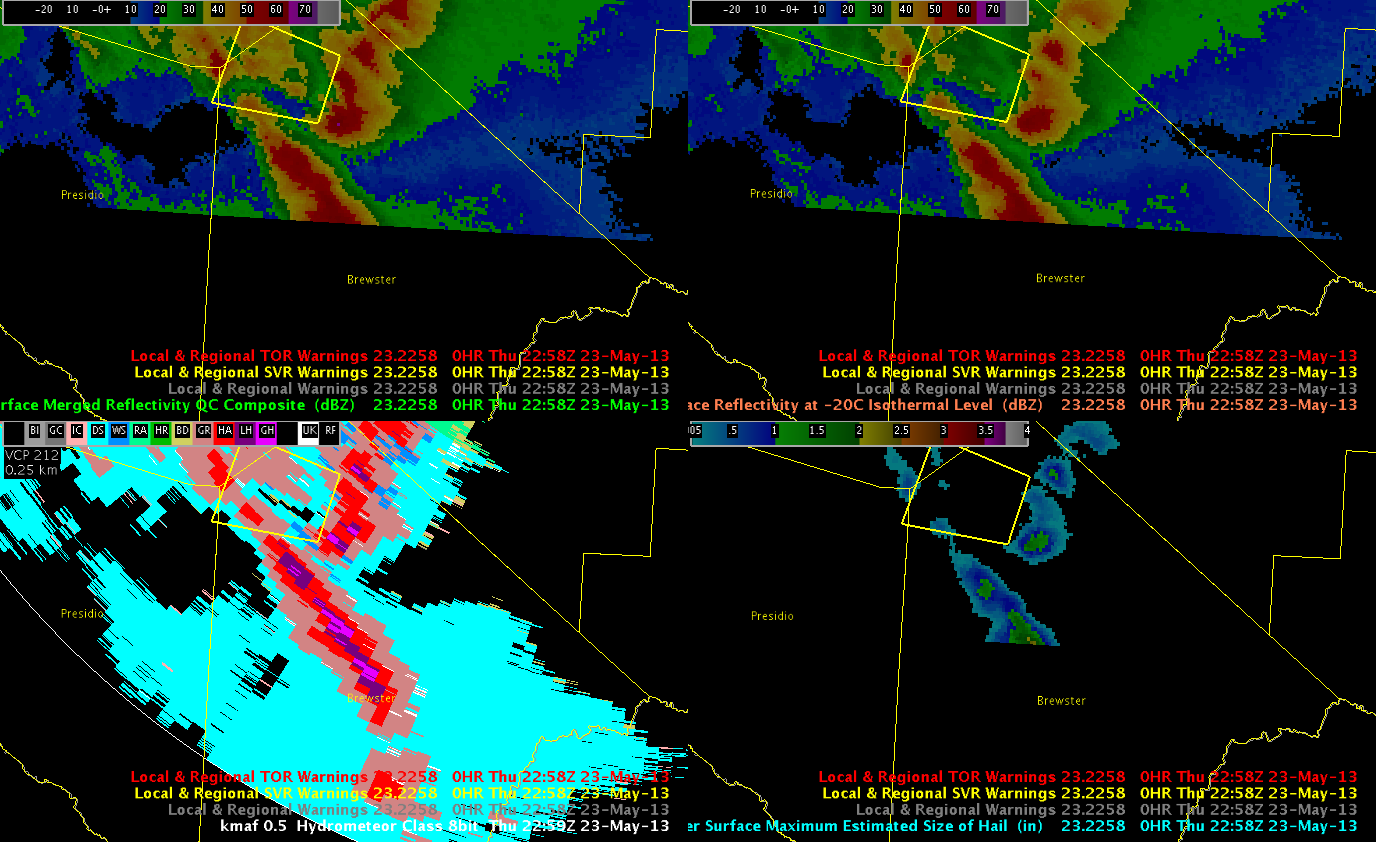
A few more warnings have resulted in the Midland CWA since I switched over. I’ll blog about the most recent. By 2300 UTC I noticed a line of deep convection moving northward through Brewster County, TX. Unfortunately, this area was on the far southern end of our domain today, so I didn’t get HWT specific products until some of the potentially severe portions of these cells may have already been ongoing. Anyway, as you’ll notice, MRMS MESH and HSDA data were indicating potentially severe hail with this line of storms between 2250-2258 UTC. I had to use the KMAF reflectivity data to produce the warning (to see the extent of the line of convection). Nevertheless, you’ll notice that the MESH was as high as about 2 inches in the extreme southern portion of the image. HSDA data at the time was showing a line of categorical giant and large hail.
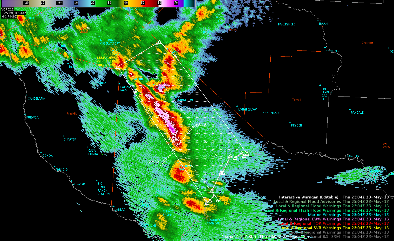
These data prompted me to issue a warning, which went out at 2304 UTC. The following image shows the resulting polygon.
Any reports so far? No…I’m not real sure to expect any either, but we’ll see.
Kris