

Another warning earlier was successfully made in the south end of the FDW area. The MESH and reflectivity values at the -20C isotherm were used once again, in addition to other standard all-tilts base data. The first image below is the 8.7 degree slice of the all-tilts base data, which showed a relatively high reflectivity ~55 dBZ, which was at about 38 kft AGL at this location.

The next image shows a >1 inch MESH value north of the town of Calvert in Robertson County and corresponding high reflectivity values ~57 dBZ in the same location at 2338 UTC. Earlier reports indicated severe hail was common near these thresholds, so the decision to warn was made. In the first image, notice the MESH (lower right) and the high dBZ at -20C (lower left).

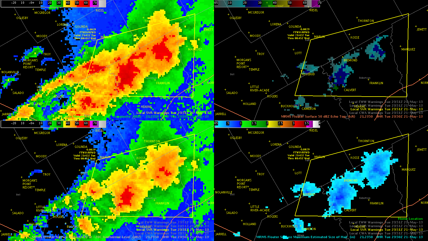
In the next image, the eventual warning box can be seen. This warning was issued shortly after observing the earlier data. Notice that the box was drawn trying to incorporate the areas with reflectivity at the -20C level greater than 55 dBZ. However, notice that the MESH values had decreased a little by the time this image was taken at 2351 UTC.
This storm did eventually produce severe hail with the a report of 1.75 inch hail in the southeast corner of the warning box at 0041 UTC.