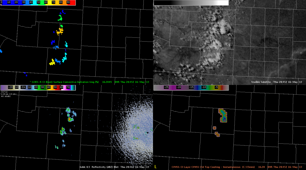
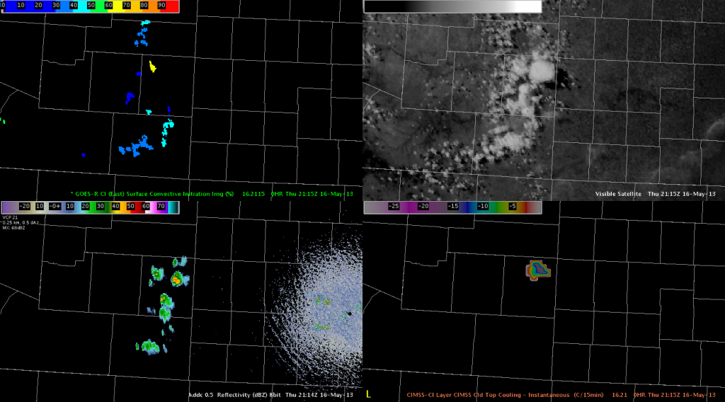
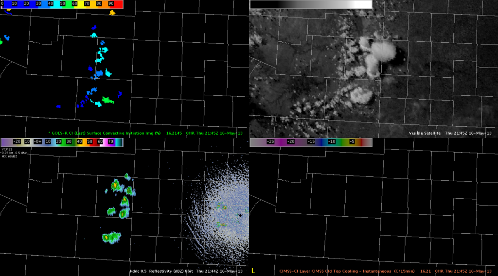
A few high based storms have been struggling to develop across southeast Colorado due to abundant dry air and SBCAPE 500-1000 J/kg.
 The first image was at 2045 UTC on May 16 where the GOESR UAH CI suggested some potential for convection with a few locations 61-78%, and the CIMSS CTC depicted a maximum of -18C/15 min. This appeared promising for deep convection.
 The next image was at 2115 UTC and continued to depict a few areas 20-62% for CI as well as -16C/15 min along with a few weak cells. At this point, there still remained hope for some deep convection.
 The last image was at 2145 UTC respectively with lower CI and CTC values as well as a few non-severe/rather weak cells. So far, these cells have failed to intensify or become severe. Weak forcing aloft in conjunction with the lack of low level moisture may be the main culprits for the poor development of storms.

