
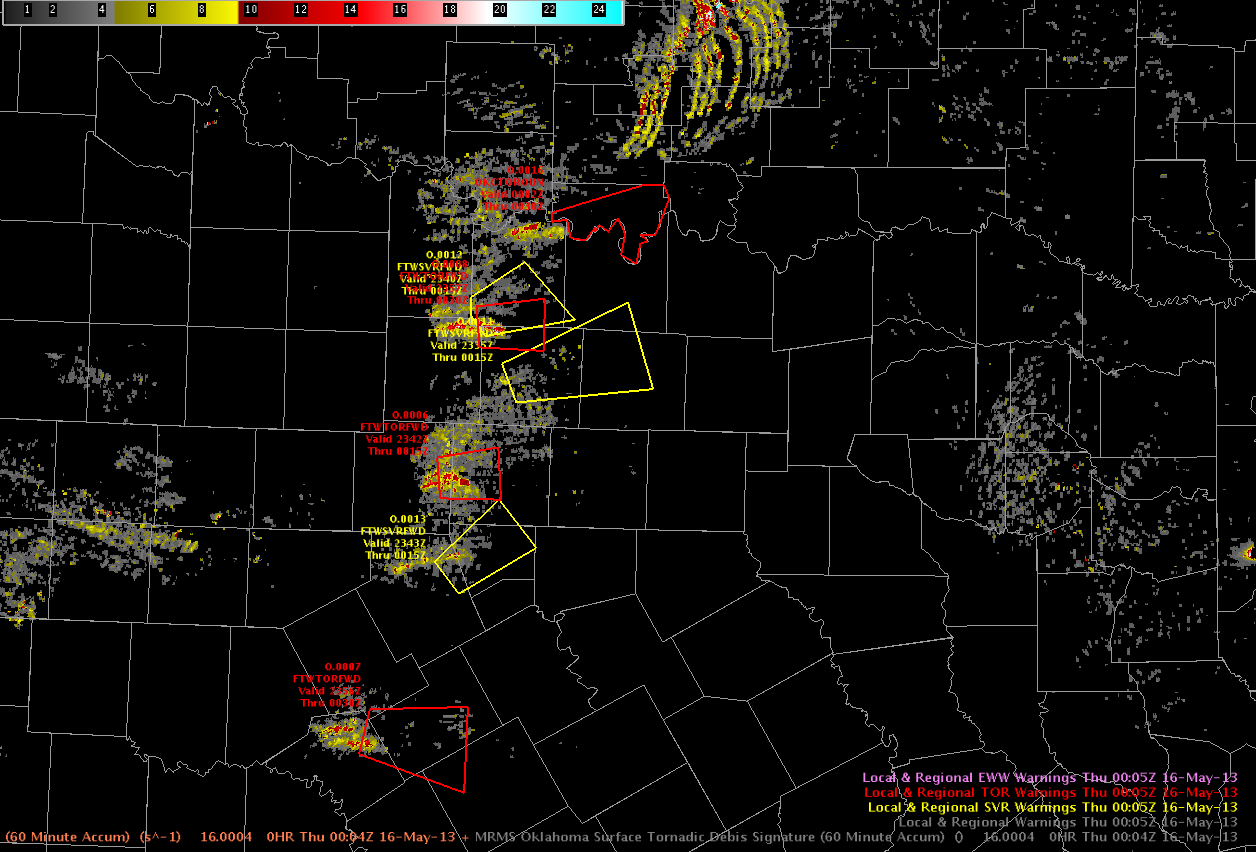
Yesterday was the busiest day of the week 2, if not our entire experiment. We localized to the OUN and FWD county warning areas. Mazur/Ostuno handled to the OUN domain, taking time to examine pGLM lightning data from the OKLMA and work with the NASA-SPoRT moving trace tool. Along the way they issued a number of severe warnings and a few tornado warnings on radar circulations. Scotten/Helge managed the mesoscale desk across the region, providing some detailed updates on the LAPS/OUN-WRF and GOESR CI products. Picca/Leonardi managed the warnings over the FWD CWA. Though activity across this region began slowly, the evening finished with multiple tornadoes still on the ground. They
A bit of the feedback from the debrief:
–The HSDA performed better than previous days this week, however, it may be nice to add an area or volume criteria (compared to individual pixels) to increase forecaster confidence.
–The MESH and lightning flash rates had comparable trends in the OK region, with the flash rates typically preceding MESH by ~1-2 min and reports on the ground by ~15 min.
–The forecasters found manually adjusting the moving trace for every frame to be a bit tedious and would prefer an “apply to all” option. As it stands now, the tool is difficult to use in realtime, but still could be useful for post-analysis and shows great promise for future operations. Forecasters are particularly interested in the capability of displaying trends from multiple fields on the same graph (e.g., flash rates and hail size).
–The LAPS instability field was quite useful when combined with a radar mosaic. Particularly early on in the FWD domain, this field provided clues to when storms would decrease or increase in intensity with time.
–The LAPS 22 UTC 1-km forecast was incredibly accurate 2 hrs out. The updraft helicity product was useful in visualizing the location/strength of the activity.
–MRMS rotation tracks were commonly utilized by the warning forecasters. They found that they helped draw polygon size / shape and reduced FAR area. The rotation tracks / AzShear product was a time saver particularly for situational awareness (calling attention to storms /locations).
-Kristin Calhoun, Week 2 Coordinator