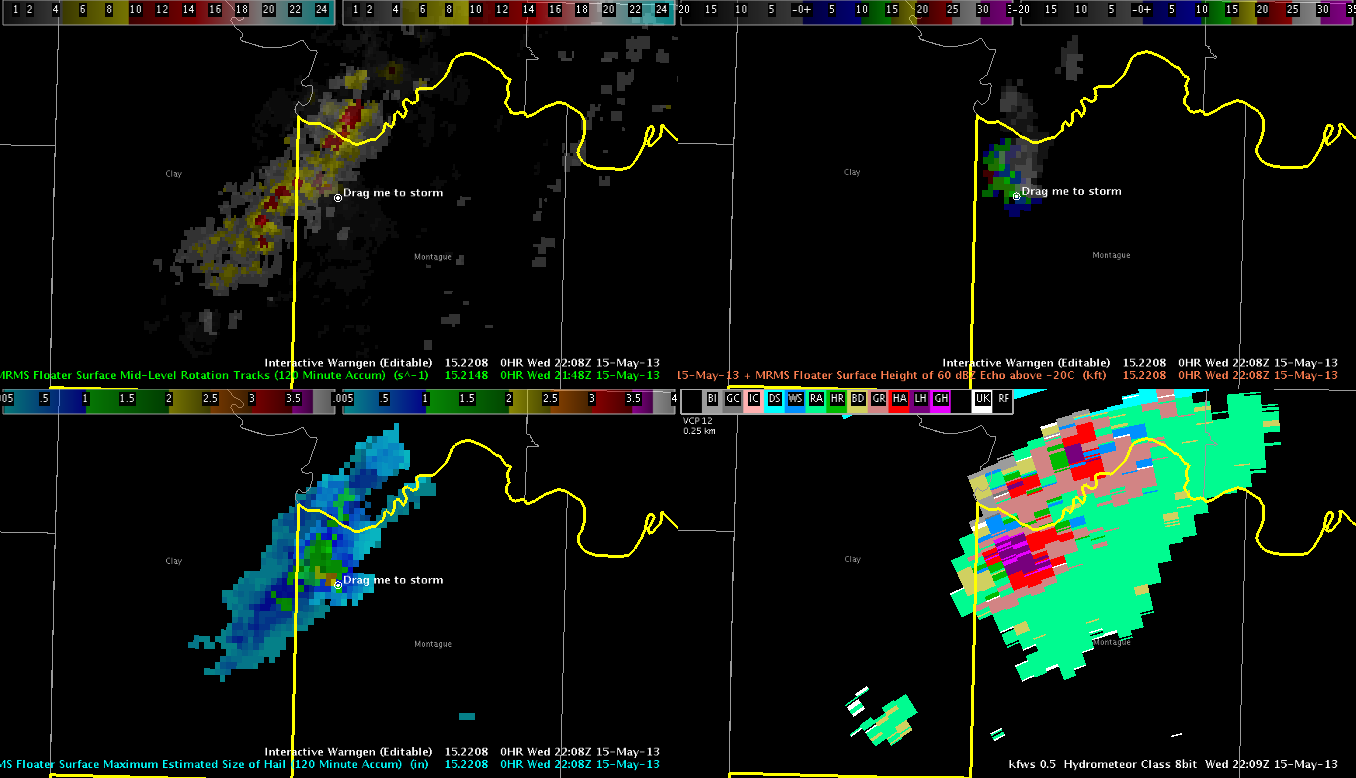
Got a tall and strong storm in Montague County in the northwest corner of the FWD CWA. It built up very quickly, and we almost were too slow with the warning. Below is a four panel of various MRMS fields: upper left=mid level rotation tracks, upper right=height of 60 dBZ echo above -20C level, lower left=MESH, lower right=hydrometeor class with HSDA. Note the orange MESH pixels, showing 2.5″+ hail, as well as the area of large/giant hail on the HSDA product. The warning went out at 2205Z, and we got the first reports of golfball/baseball sized hail at 2208Z. Just in time!
CL