

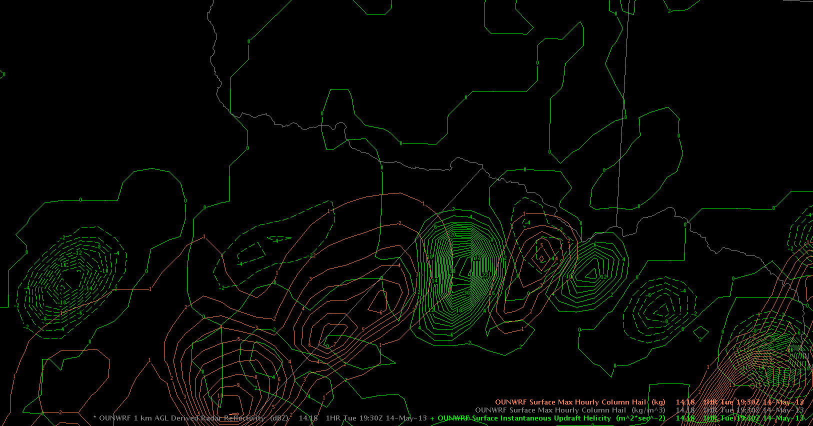
Referring to the reflectivity/MESH post a few minutes ago, OUN WRF showed some signals of an increase in the severe risk just as storms achieved 60 + dBz cores. Attached below one can see an overlap of instantaneous updraft helicity (green) and surface max hourly column hail (brown). For most of the period until now, both parameters were persistently separated, which is shown below in the first image. Those storms had a pulsating character with relatively weak cores.
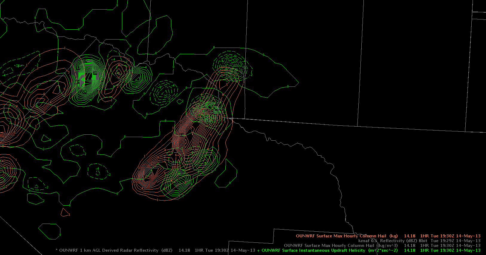
It was interesting to see that betimes, OUNWRF produced stronger signals with a a better overlap of both parameters. Eventually storms began to intensify just in this area, finally producing our strong thunderstorms. OUNWRF gave some lead timing and increased confidence to the forecaster that an increase of thunderstorm’s strength could be expected.
Helge