

The CTC algorithm missed a developing storm that went on to become a robust storm and prompted an experimental severe thunderstorm warning. The storm in question is highlighted below within the red hatching at 2114Z when visually it was very apparent the storm was rapidly intensifying.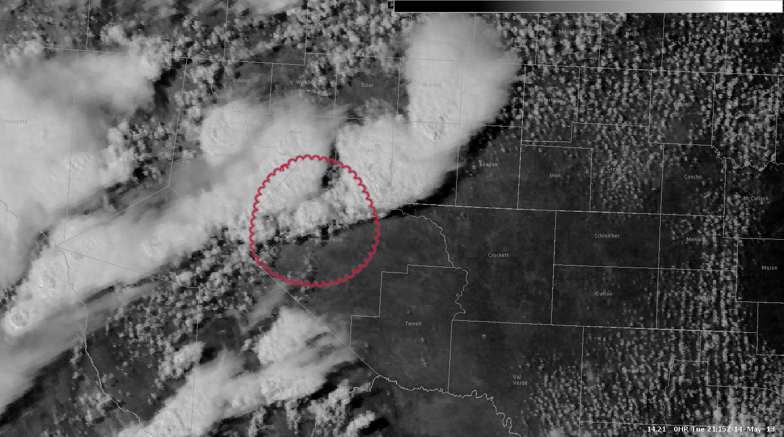
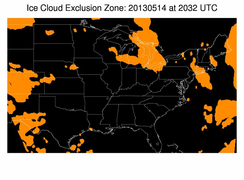
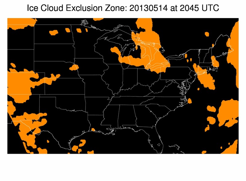
The algorithm “missed” this developing storm mainly due to the algorithm defining the cloud type in the vicinity of the developing storm as thick ice and cirrus at 2032Z and 2045Z. This storm was likely within the thick ice and cirrus definition…and therefore was included in the ice cloud exclusion zone and not given a CTC rate.


This example merely illustrates that not all developing storms will be captured by the algorithm even if visually it looks to be clearly intensifying. This is especially the case in a situation where multiple storms are in one area.
RJM